TopoQuest Logo
Do you find TopoQuest useful?
Help keep TopoQuest running and adding new maps/features by donating!
Bitcoin:  19c7KJd3qBynnjoSw5npx9KScwjBe4ifkT
Litecoin:  LXs6TkuXGGXo1vDsWCkWVdjQX94eUKd6ui
Home View Maps Find Maps Find Places Resources & Links


Corinth, New York Topographic Map

USGS Map Title: Corinth, NY
USGS Map MRC: 43073B7
DRG (GeoTIFF) Download: o43073b7.tif


Neighboring USGS Topographic Map Quads:


  Conklingville, NY  
43073C8
 

  Lake Luzerne, NY  
43073C7
 

  Glens Falls, NY  
43073C6
 

  Porter Corners, NY  
43073B8
 

  Corinth, NY  
43073B7
 

  Gansevoort, NY  
43073B6
 

  Middle Grove, NY  
43073A8
 

  Saratoga Springs, NY  
43073A7
 

  Quaker Springs, NY  
43073A6


Map MRC Location:

N44°
W74°
N44°
W73°
H8 H7 H6 H5 H4 H3 H2 H1
G8 G7 G6 G5 G4 G3 G2 G1
F8 F7 F6 F5 F4 F3 F2 F1
E8 E7 E6 E5 E4 E3 E2 E1
D8 D7 D6 D5 D4 D3 D2 D1
C8 C7 C6 C5 C4 C3 C2 C1
B8 B7 B6 B5 B4 B3 B2 B1
A8 A7 A6 A5 A4 A3 A2 A1
N43°
W74°
N43°
W73°

Corinth, NY USGS 1:24K Topographic Map Preview:
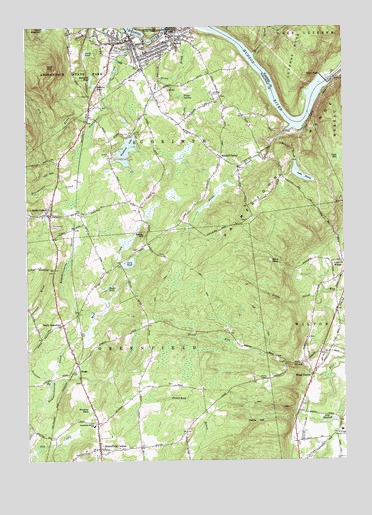
Corinth, NY USGS Topographic Map
Click on map above to begin viewing in our Map Viewer.

This topographic map contains these locations and features:
Feature Name Type Latitude Longitude GNIS ID View Map
Adirondack Christian Fellowship ChurchChurchN43.1312°W73.7668°2615503View Map
Allen CemeteryCemeteryN43.1477°W73.8540°2424849View Map
Angell CemeteryCemeteryN43.1969°W73.8316°2424858View Map
Arnold CemeteryCemeteryN43.1530°W73.7741°2424860View Map
Bailey CemeteryCemeteryN43.1858°W73.8310°2424851View Map
Bailey HillSummitN43.1898°W73.8290°942782View Map
Bald MountainSummitN43.2384°W73.8665°942868View Map
Beaver BrookStreamN43.2190°W73.7740°943352View Map
Bennie BrookStreamN43.2420°W73.7846°943690View Map
Black PondLakeN43.1826°W73.7788°944164View Map
Bullhead PondLakeN43.2351°W73.8489°945149View Map
Carp PondLakeN43.1817°W73.8347°945883View Map
Clothier CemeteryCemeteryN43.2301°W73.7981°2426221View Map
Clothier HollowValleyN43.2193°W73.7742°946912View Map
CorinthPopulated PlaceN43.2445°W73.8323°974277View Map
Corinth Elementary SchoolSchoolN43.2378°W73.8331°2438487View Map
Corinth Emergency SquadBuildingN43.2474°W73.8312°2720148View Map
Corinth Free LibraryBuildingN43.2480°W73.8339°2617253View Map
Corinth Free Methodist ChurchChurchN43.2468°W73.8379°2426211View Map
Corinth Middle-High SchoolSchoolN43.2423°W73.8272°2426215View Map
Corinth Post OfficePost OfficeN43.2477°W73.8335°2617876View Map
Corinth Rural CemeteryCemeteryN43.2418°W73.8399°2426220View Map
Corinth Town HallBuildingN43.2461°W73.8153°2617601View Map
Corinth Town HallBuildingN43.2470°W73.8383°2426219View Map
Corinth Village HallBuildingN43.2449°W73.8324°2426210View Map
Corinth Volunteer Fire DepartmentBuildingN43.2442°W73.8407°2718279View Map
Corinth Wesleyan ChurchChurchN43.2441°W73.8285°2426214View Map
Davis - Bedell - Young CemeteryCemeteryN43.2136°W73.7821°2426222View Map
Devils DenSummitN43.1359°W73.7865°948364View Map
Devils PondLakeN43.2424°W73.8513°948372View Map
Dry BrookStreamN43.2220°W73.8482°948685View Map
Eddy CemeteryCemeteryN43.1943°W73.7884°2424857View Map
Edwards CemeteryCemeteryN43.1794°W73.8643°2424852View Map
First Baptist ChurchChurchN43.2440°W73.8313°2426213View Map
First Presbyterian ChurchChurchN43.2440°W73.8257°2426218View Map
First United Methodist ChurchChurchN43.2457°W73.8321°2426212View Map
Full Gospel Assembly ChurchChurchN43.2296°W73.8270°2616053View Map
Fuller SwampSwampN43.2301°W73.8132°950789View Map
Greenfield CemeteryCemeteryN43.1289°W73.8345°2424850View Map
Greenfield CenterPopulated PlaceN43.1284°W73.8465°951743View Map
Greenfield Center Baptist ChurchChurchN43.1471°W73.7800°2616440View Map
Greenfield Center Post OfficePost OfficeN43.1287°W73.8458°2617947View Map
Greenfield Center Volunteer Fire Company 1BuildingN43.1287°W73.8488°2718560View Map
Greenfield Elementary SchoolSchoolN43.1354°W73.8490°951744View Map
Heath BrookStreamN43.2481°W73.8010°952491View Map
Hodges CemeteryCemeteryN43.1842°W73.8208°2424853View Map
John Eggleston CemeteryCemeteryN43.2251°W73.8195°2426224View Map
KingsPopulated PlaceN43.1509°W73.8543°972689View Map
Kings StationPopulated PlaceN43.1492°W73.7629°954675View Map
Kings Station CemeteryCemeteryN43.1604°W73.7639°2424859View Map
Lake AnnLakeN43.2124°W73.7516°942488View Map
Lake BonitaReservoirN43.2075°W73.7663°944428View Map
Lake ElizabethLakeN43.1362°W73.7562°949482View Map
Main Street School (historical)SchoolN43.2423°W73.8303°2426216View Map
Maplewood CemeteryCemeteryN43.1923°W73.8651°956480View Map
McGregor Country ClubLocaleN43.1337°W73.7512°974748View Map
Mud CreekStreamN43.1590°W73.8582°957998View Map
Nathan Carpenter CemeteryCemeteryN43.2023°W73.8254°2424856View Map
North GreenfieldPopulated PlaceN43.1642°W73.8610°958797View Map
PalmerPopulated PlaceN43.2454°W73.8173°959778View Map
Palmer Avenue School (historical)SchoolN43.2465°W73.8139°2426217View Map
Palmertown RangeRangeN43.2173°W73.7643°959802View Map
Paper Dragon FarmsLocaleN43.2114°W73.8622°2519119View Map
Pickerel PondLakeN43.2331°W73.8478°960330View Map
Quaker CemeteryCemeteryN43.1813°W73.8378°2424854View Map
Randall CornerPopulated PlaceN43.2123°W73.7982°962171View Map
Roman Catholic Church of the Immaculate ConceptionChurchN43.2453°W73.8210°2426209View Map
Saint Joseph's Roman Catholic ChurchChurchN43.1329°W73.8467°2616950View Map
Saint Mary's CemeteryCemeteryN43.2420°W73.8421°2426223View Map
Sand BrookStreamN43.2351°W73.8173°964365View Map
Sessions BrookStreamN43.1473°W73.8657°964847View Map
Sexton CemeteryCemeteryN43.1968°W73.8568°2424855View Map
South CorinthPopulated PlaceN43.1965°W73.8673°965726View Map
Spier FallsFallsN43.2348°W73.7568°966005View Map
Stony BrookStreamN43.2201°W73.7721°966530View Map
Sturdevant CreekStreamN43.2487°W73.8351°966663View Map
Taylor PondLakeN43.1751°W73.8435°967098View Map
Victory Bible Baptist ChurchChurchN43.1925°W73.8662°2617157View Map
Village of CorinthCivilN43.2456°W73.8310°2391625View Map
Wilton Baptist ChurchChurchN43.1468°W73.7655°2617097View Map
Winslow PondLakeN43.1398°W73.8505°971506View Map
Woodland LakeLakeN43.2152°W73.8348°971655View Map
WSCG-FM (Corinth)TowerN43.2445°W73.7712°978509View Map

Note: Coordinates in the location and feature list above are referenced to NAD83 datum.


Copyright (C) 2008-2024 Ryan Niemi / Sunset Dynamics ... All Rights Reserved