TopoQuest Logo
Do you find TopoQuest useful?
Help keep TopoQuest running and adding new maps/features by donating!
Bitcoin:  19c7KJd3qBynnjoSw5npx9KScwjBe4ifkT
Litecoin:  LXs6TkuXGGXo1vDsWCkWVdjQX94eUKd6ui
Home View Maps Find Maps Find Places Resources & Links


Corwith, Iowa Topographic Map

USGS Map Title: Corwith, IA
USGS Map MRC: 42093H8
DRG (GeoTIFF) Download: o42093h8.tif


Neighboring USGS Topographic Map Quads:


  Sexton, IA  
43094A1
 

  Wesley, IA  
43093A8
 

  Britt, IA  
43093A7
 

  Lu Verne, IA  
42094H1
 

  Corwith, IA  
42093H8
 

  Kanawha, IA  
42093H7
 

  Hardy, IA  
42094G1
 

  Renwick, IA  
42093G8
 

  Kanawha SE, IA  
42093G7


Map MRC Location:

N43°
W94°
N43°
W93°
H8 H7 H6 H5 H4 H3 H2 H1
G8 G7 G6 G5 G4 G3 G2 G1
F8 F7 F6 F5 F4 F3 F2 F1
E8 E7 E6 E5 E4 E3 E2 E1
D8 D7 D6 D5 D4 D3 D2 D1
C8 C7 C6 C5 C4 C3 C2 C1
B8 B7 B6 B5 B4 B3 B2 B1
A8 A7 A6 A5 A4 A3 A2 A1
N42°
W94°
N42°
W93°

Corwith, IA USGS 1:24K Topographic Map Preview:
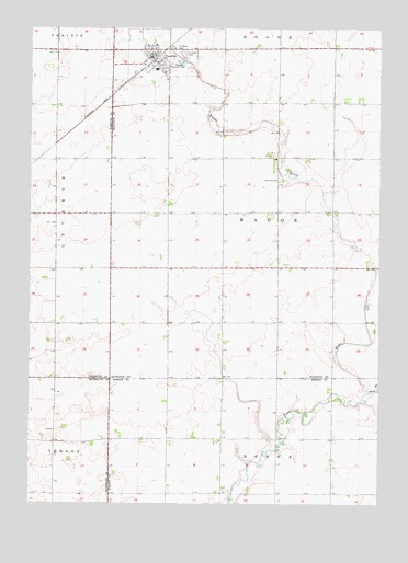
Corwith, IA USGS Topographic Map
Click on map above to begin viewing in our Map Viewer.

This topographic map contains these locations and features:
Feature Name Type Latitude Longitude GNIS ID View Map
AldrichLocaleN42.9077°W93.9308°466282View Map
City of CorwithCivilN42.9890°W93.9581°2393641View Map
CorwithPopulated PlaceN42.9927°W93.9575°455640View Map
Corwith - Wesley High SchoolSchoolN42.9892°W93.9555°1926038View Map
Corwith (historical)LocaleN42.9916°W93.9563°1926034View Map
Corwith CemeteryCemeteryN42.9936°W93.9458°455641View Map
Corwith Emergency Medical TechniciansBuildingN42.9928°W93.9563°2599829View Map
Corwith Post OfficePost OfficeN42.9927°W93.9575°1926033View Map
Corwith Public LibraryBuildingN42.9927°W93.9575°1926030View Map
Corwith Town HallBuildingN42.9927°W93.9575°1926031View Map
Corwith Volunteer Fire DepartmentBuildingN42.9927°W93.9562°2577291View Map
East Branch Boone RiverStreamN42.9044°W93.8786°456121View Map
Gold-Eagle Cooperative ElevatorLocaleN42.9927°W93.9575°1926032View Map
Grace Baptist ChurchChurchN42.9955°W93.9555°1926037View Map
Magor Township CemeteryCemeteryN42.9602°W93.9108°1926039View Map
Saint Johns Lutheran ChurchChurchN42.9883°W93.9522°1926036View Map
Saint Mary's CemeteryCemeteryN42.9940°W93.9469°461184View Map
Township of MagorCivilN42.9515°W93.9119°468331View Map
United Methodist ChurchChurchN42.9911°W93.9550°1926035View Map

Note: Coordinates in the location and feature list above are referenced to NAD83 datum.


Copyright (C) 2008-2024 Ryan Niemi / Sunset Dynamics ... All Rights Reserved