TopoQuest Logo
Do you find TopoQuest useful?
Help keep TopoQuest running and adding new maps/features by donating!
Bitcoin:  19c7KJd3qBynnjoSw5npx9KScwjBe4ifkT
Litecoin:  LXs6TkuXGGXo1vDsWCkWVdjQX94eUKd6ui
Home View Maps Find Maps Find Places Resources & Links


Danville Mountain, Arkansas Topographic Map

USGS Map Title: Danville Mountain, AR
USGS Map MRC: 35093A3
DRG (GeoTIFF) Download: o35093a3.tif


Neighboring USGS Topographic Map Quads:


  Chickalah Mountain West, AR  
35093B4
 

  Chickalah Mountain East, AR  
35093B3
 

  Dardanelle, AR  
35093B2
 

  Danville, AR  
35093A4
 

  Danville Mountain, AR  
35093A3
 

  Ola, AR  
35093A2
 

  Rover, AR  
34093H4
 

  Plainview, AR  
34093H3
 

  Nimrod Dam, AR  
34093H2


Map MRC Location:

N36°
W94°
N36°
W93°
H8 H7 H6 H5 H4 H3 H2 H1
G8 G7 G6 G5 G4 G3 G2 G1
F8 F7 F6 F5 F4 F3 F2 F1
E8 E7 E6 E5 E4 E3 E2 E1
D8 D7 D6 D5 D4 D3 D2 D1
C8 C7 C6 C5 C4 C3 C2 C1
B8 B7 B6 B5 B4 B3 B2 B1
A8 A7 A6 A5 A4 A3 A2 A1
N35°
W94°
N35°
W93°

Danville Mountain, AR USGS 1:24K Topographic Map Preview:
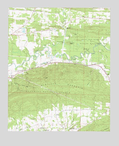
Danville Mountain, AR USGS Topographic Map
Click on map above to begin viewing in our Map Viewer.

This topographic map contains these locations and features:
Feature Name Type Latitude Longitude GNIS ID View Map
Achmun CreekStreamN35.0693°W93.2613°70407View Map
Achmun Creek BridgeBridgeN35.0643°W93.2713°67852View Map
AlphaPopulated PlaceN35.1156°W93.2807°70435View Map
Booze HollowValleyN35.0531°W93.3696°70767View Map
Bunker HillSummitN35.0543°W93.3291°70925View Map
Cane IslandFlatN35.0740°W93.2516°70988View Map
Cane Island SloughGutN35.0637°W93.2546°70989View Map
Cape SloughStreamN35.0884°W93.3052°71007View Map
Chickalah CreekStreamN35.0795°W93.2749°71131View Map
Danville MountainRidgeN35.0445°W93.3021°71333View Map
Elm Root SloughStreamN35.0765°W93.3107°71558View Map
Harris Fish Farm DamDamN35.1001°W93.3552°80418View Map
Harris Fish Farm ReservoirReservoirN35.1018°W93.3561°80419View Map
Jake CreekStreamN35.1240°W93.3021°77361View Map
KingstonPopulated PlaceN35.0168°W93.3152°72264View Map
Lone PinePopulated PlaceN35.1040°W93.3218°72457View Map
Lone Pine School (historical)SchoolN35.1034°W93.3243°67902View Map
Melchor CreekStreamN35.0673°W93.3577°72624View Map
MicklesPopulated PlaceN35.0690°W93.2902°72632View Map
New Bethel CemeteryCemeteryN35.0023°W93.3596°2033640View Map
New Bethel ChurchChurchN35.0026°W93.3594°72850View Map
Nimrod State Wildlife Management AreaParkN35.0023°W93.3321°70396View Map
Peeler GapGapN35.0459°W93.3505°73036View Map
Peeler LakeLakeN35.0691°W93.3310°75073View Map
Peter George LakeLakeN35.1040°W93.3039°75075View Map
Prairie CreekStreamN35.0765°W93.3463°73193View Map
Prairie Creek School (historical)SchoolN35.0895°W93.3655°67940View Map
RangerPopulated PlaceN35.1220°W93.3432°73236View Map
Ridge Church (historical)ChurchN35.1220°W93.2593°67942View Map
Salem ChurchChurchN35.0034°W93.3068°73461View Map
Social Circle School (historical)SchoolN35.0062°W93.3402°67953View Map
Surrounded RidgesSummitN35.0898°W93.3007°73789View Map
Surrounded Ridges LakeLakeN35.0889°W93.3058°75153View Map
Township of PrairieCivilN35.1102°W93.3410°69886View Map
Union Grove School (historical)SchoolN35.0229°W93.2821°67959View Map

Note: Coordinates in the location and feature list above are referenced to NAD83 datum.


Copyright (C) 2008-2024 Ryan Niemi / Sunset Dynamics ... All Rights Reserved