TopoQuest Logo
Do you find TopoQuest useful?
Help keep TopoQuest running and adding new maps/features by donating!
Bitcoin:  19c7KJd3qBynnjoSw5npx9KScwjBe4ifkT
Litecoin:  LXs6TkuXGGXo1vDsWCkWVdjQX94eUKd6ui
Home View Maps Find Maps Find Places Resources & Links


Defeat Butte, Oregon Topographic Map

USGS Map Title: Defeat Butte, OR
USGS Map MRC: 42117B1
DRG (GeoTIFF) Download: o42117b1.tif


Neighboring USGS Topographic Map Quads:


  Rawhide Pocket, OR  
42117C2
 

  Beaver Charlie Breaks, OR  
42117C1
 

  Bull Basin Camp, ID  
42116C8
 

  Stoney Corral, OR  
42117B2
 

  Defeat Butte, OR  
42117B1
 

  Spring Creek Basin, ID  
42116B8
 

  Lookout Lake, OR  
42117A2
 

  Star Valley Knoll, OR  
42117A1
 

  Star Valley, ID  
42116A8


Map MRC Location:

N43°
W118°
N43°
W117°
H8 H7 H6 H5 H4 H3 H2 H1
G8 G7 G6 G5 G4 G3 G2 G1
F8 F7 F6 F5 F4 F3 F2 F1
E8 E7 E6 E5 E4 E3 E2 E1
D8 D7 D6 D5 D4 D3 D2 D1
C8 C7 C6 C5 C4 C3 C2 C1
B8 B7 B6 B5 B4 B3 B2 B1
A8 A7 A6 A5 A4 A3 A2 A1
N42°
W118°
N42°
W117°

Defeat Butte, OR USGS 1:24K Topographic Map Preview:
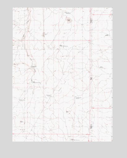
Defeat Butte, OR USGS Topographic Map
Click on map above to begin viewing in our Map Viewer.

This topographic map contains these locations and features:
Feature Name Type Latitude Longitude GNIS ID View Map
Black Snake ReservoirReservoirN42.1950°W117.1017°1157325View Map
Butch ReservoirReservoirN42.2241°W117.0038°395153View Map
Defeat ButteSummitN42.1535°W117.0546°1159099View Map
Defeat Butte ReservoirReservoirN42.1670°W117.0459°1157320View Map
Defeat Lake ReservoirReservoirN42.1673°W117.0764°1157321View Map
Defeat RidgeRidgeN42.1789°W117.0652°1157324View Map
East Hoodoo Butte ReservoirReservoirN42.1268°W117.0515°1157319View Map
East Toppin Creek ReservoirReservoirN42.2146°W117.0659°1157326View Map
Hoodoo ButteSummitN42.1435°W117.1121°1133207View Map
Hoodoo Butte ReservoirReservoirN42.1646°W117.1166°1157322View Map
Inside ReservoirReservoirN42.1938°W117.0161°395511View Map
Little LakeReservoirN42.2240°W117.0863°1157327View Map
Mustang LakeFlatN42.2388°W117.0551°1157329View Map
Mustang Lake reservoirReservoirN42.2443°W117.0534°1157328View Map
North Hoodoo Butte ReservoirReservoirN42.1801°W117.1007°1157323View Map
South Fork Toppin CreekStreamN42.2188°W117.1137°1157330View Map

Note: Coordinates in the location and feature list above are referenced to NAD83 datum.


Copyright (C) 2008-2024 Ryan Niemi / Sunset Dynamics ... All Rights Reserved