TopoQuest Logo
Do you find TopoQuest useful?
Help keep TopoQuest running and adding new maps/features by donating!
Bitcoin:  19c7KJd3qBynnjoSw5npx9KScwjBe4ifkT
Litecoin:  LXs6TkuXGGXo1vDsWCkWVdjQX94eUKd6ui
Home View Maps Find Maps Find Places Resources & Links


Devils Tower, Wyoming Topographic Map

USGS Map Title: Devils Tower, WY
USGS Map MRC: 44104E6
DRG (GeoTIFF) Download: o44104e6.tif


Neighboring USGS Topographic Map Quads:


  New Haven, WY  
44104F7
 

  Moore Hill, WY  
44104F6
 

  Hulett, WY  
44104F5
 

  Missouri Buttes, WY  
44104E7
 

  Devils Tower, WY  
44104E6
 

  Sherrard Hill, WY  
44104E5
 

  Carlile, WY  
44104D7
 

  Wonder View, WY  
44104D6
 

  The Rocks, WY  
44104D5


Map MRC Location:

N45°
W105°
N45°
W104°
H8 H7 H6 H5 H4 H3 H2 H1
G8 G7 G6 G5 G4 G3 G2 G1
F8 F7 F6 F5 F4 F3 F2 F1
E8 E7 E6 E5 E4 E3 E2 E1
D8 D7 D6 D5 D4 D3 D2 D1
C8 C7 C6 C5 C4 C3 C2 C1
B8 B7 B6 B5 B4 B3 B2 B1
A8 A7 A6 A5 A4 A3 A2 A1
N44°
W105°
N44°
W104°

Devils Tower, WY USGS 1:24K Topographic Map Preview:
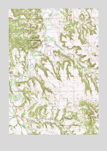
Devils Tower, WY USGS Topographic Map
Click on map above to begin viewing in our Map Viewer.

This topographic map contains these locations and features:
Feature Name Type Latitude Longitude GNIS ID View Map
Belle Fourche River Number Two MineMineN44.5939°W104.6889°1704265View Map
Bitter Springs SchoolSchoolN44.5025°W104.6441°1585576View Map
Brimmer SchoolSchoolN44.5908°W104.6361°1585928View Map
Campstool DrawValleyN44.5822°W104.6922°1586327View Map
Campstool Eleven MineMineN44.5492°W104.7464°1726356View Map
Campstool Nine MineMineN44.5492°W104.7464°1726355View Map
Campstool RanchLocaleN44.5914°W104.6869°1586328View Map
Campstool SchoolSchoolN44.5875°W104.6977°1586329View Map
Carlile JunctionPopulated PlaceN44.5022°W104.6883°1597251View Map
Claudie DamDamN44.5017°W104.6689°1607530View Map
Claudie ReservoirReservoirN44.5017°W104.6689°1607531View Map
Devils TowerSummitN44.5906°W104.7152°1609083View Map
Devils TowerPopulated PlaceN44.5892°W104.6966°1604684View Map
Devils Tower National MonumentParkN44.5906°W104.7156°2733421View Map
Devils Tower Post OfficePost OfficeN44.5894°W104.6983°1608731View Map
Left CreekStreamN44.5530°W104.7411°1590630View Map
Lytle CreekStreamN44.5930°W104.6908°1601206View Map
Miller CreekStreamN44.5083°W104.7305°1601465View Map
Nubeth Joint Venture MineMineN44.5050°W104.7050°1704266View Map
PIC RanchLocaleN44.5144°W104.7219°1592525View Map
PIC SchoolSchoolN44.5042°W104.7236°1592526View Map
Tower DivideRidgeN44.5314°W104.6991°1595648View Map
Tower Divide CemeteryCemeteryN44.5651°W104.6603°2774545View Map
Tower Divide SchoolSchoolN44.5280°W104.6805°1595649View Map

Note: Coordinates in the location and feature list above are referenced to NAD83 datum.


Copyright (C) 2008-2024 Ryan Niemi / Sunset Dynamics ... All Rights Reserved