TopoQuest Logo
Do you find TopoQuest useful?
Help keep TopoQuest running and adding new maps/features by donating!
Bitcoin:  19c7KJd3qBynnjoSw5npx9KScwjBe4ifkT
Litecoin:  LXs6TkuXGGXo1vDsWCkWVdjQX94eUKd6ui
Home View Maps Find Maps Find Places Resources & Links


Dougherty, Iowa Topographic Map

USGS Map Title: Dougherty, IA
USGS Map MRC: 42093H1
DRG (GeoTIFF) Download: o42093h1.tif


Neighboring USGS Topographic Map Quads:


  Hanford, IA  
43093A2
 

  Mason City SE, IA  
43093A1
 

  Rockford, IA  
43092A8
 

  Sheffield, IA  
42093H2
 

  Dougherty, IA  
42093H1
 

  Aureola, IA  
42092H8
 

  Hampton North, IA  
42093G2
 

  Hansell, IA  
42093G1
 

  Dumont North, IA  
42092G8


Map MRC Location:

N43°
W94°
N43°
W93°
H8 H7 H6 H5 H4 H3 H2 H1
G8 G7 G6 G5 G4 G3 G2 G1
F8 F7 F6 F5 F4 F3 F2 F1
E8 E7 E6 E5 E4 E3 E2 E1
D8 D7 D6 D5 D4 D3 D2 D1
C8 C7 C6 C5 C4 C3 C2 C1
B8 B7 B6 B5 B4 B3 B2 B1
A8 A7 A6 A5 A4 A3 A2 A1
N42°
W94°
N42°
W93°

Dougherty, IA USGS 1:24K Topographic Map Preview:
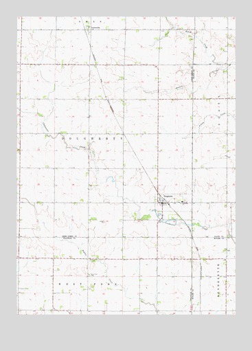
Dougherty, IA USGS Topographic Map
Click on map above to begin viewing in our Map Viewer.

This topographic map contains these locations and features:
Feature Name Type Latitude Longitude GNIS ID View Map
CartersvillePopulated PlaceN42.9944°W93.0830°455193View Map
Cartersville (historical)LocaleN42.9944°W93.0869°1940992View Map
Cartersville Elevator Incorporated ElevatorLocaleN42.9944°W93.0830°1941149View Map
Cartersville Post Office (historical)Post OfficeN42.9944°W93.0830°1940993View Map
City of DoughertyCivilN42.9220°W93.0359°2394551View Map
Coldwater Post Office (historical)Post OfficeN42.9361°W93.0452°1940991View Map
Coldwater Post Office (historical)Post OfficeN42.8916°W93.0502°466453View Map
DoughertyPopulated PlaceN42.9222°W93.0421°455961View Map
Dougherty (historical)LocaleN42.9227°W93.0405°1941244View Map
Dougherty First RespondersBuildingN42.9217°W93.0412°2599903View Map
Dougherty Post OfficePost OfficeN42.9222°W93.0421°1941246View Map
Dougherty Town HallBuildingN42.9222°W93.0421°1941245View Map
Hackberry Post Office (historical)Post OfficeN42.9861°W93.0063°1945236View Map
Ingham Post Office (historical)Post OfficeN42.8916°W93.0502°466454View Map
Rapid CreekStreamN42.9783°W93.0083°460527View Map
Saint Patricks Catholic CemeteryCemeteryN42.9227°W93.0296°1941248View Map
Saint Patricks ChurchChurchN42.9225°W93.0305°461265View Map
Saint Patricks SchoolSchoolN42.9222°W93.0308°1941247View Map
Township of DoughertyCivilN42.9510°W93.0838°467721View Map
West Fork CemeteryCemeteryN42.8917°W93.0838°462847View Map

Note: Coordinates in the location and feature list above are referenced to NAD83 datum.


Copyright (C) 2008-2024 Ryan Niemi / Sunset Dynamics ... All Rights Reserved