TopoQuest Logo
Do you find TopoQuest useful?
Help keep TopoQuest running and adding new maps/features by donating!
Bitcoin:  19c7KJd3qBynnjoSw5npx9KScwjBe4ifkT
Litecoin:  LXs6TkuXGGXo1vDsWCkWVdjQX94eUKd6ui
Home View Maps Find Maps Find Places Resources & Links


Ellisville, Florida Topographic Map

USGS Map Title: Ellisville, FL
USGS Map MRC: 30082A5
DRG (GeoTIFF) Download: o30082a5.tif


Neighboring USGS Topographic Map Quads:


  Lake City West, FL  
30082B6
 

  Lake City East, FL  
30082B5
 

  Olustee, FL  
30082B4
 

  Columbia, FL  
30082A6
 

  Ellisville, FL  
30082A5
 

  Lulu, FL  
30082A4
 

  Fort White, FL  
29082H6
 

  Mikesville, FL  
29082H5
 

  Worthington Springs, FL  
29082H4


Map MRC Location:

N31°
W83°
N31°
W82°
H8 H7 H6 H5 H4 H3 H2 H1
G8 G7 G6 G5 G4 G3 G2 G1
F8 F7 F6 F5 F4 F3 F2 F1
E8 E7 E6 E5 E4 E3 E2 E1
D8 D7 D6 D5 D4 D3 D2 D1
C8 C7 C6 C5 C4 C3 C2 C1
B8 B7 B6 B5 B4 B3 B2 B1
A8 A7 A6 A5 A4 A3 A2 A1
N30°
W83°
N30°
W82°

Ellisville, FL USGS 1:24K Topographic Map Preview:
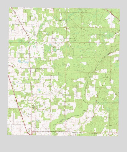
Ellisville, FL USGS Topographic Map
Click on map above to begin viewing in our Map Viewer.

This topographic map contains these locations and features:
Feature Name Type Latitude Longitude GNIS ID View Map
Bethlehem Lutheran ChurchChurchN30.0277°W82.5957°278569View Map
Bethlehem Lutheran Church CemeteryCemeteryN30.0400°W82.5961°2547975View Map
Camp O the SuwanneeLocaleN30.0005°W82.5151°301608View Map
Central Church of ChristChurchN30.1103°W82.6125°2548038View Map
Church of the Living GodChurchN30.1186°W82.6237°308489View Map
EbenezerPopulated PlaceN30.0961°W82.5707°301072View Map
Ebenezer CemeteryCemeteryN30.0930°W82.5518°282059View Map
EllisvillePopulated PlaceN30.0038°W82.5973°294755View Map
Ellisville Volunteer Fire Department Station 45BuildingN30.0188°W82.5971°2548058View Map
Farnell CemeteryCemeteryN30.0080°W82.5929°282389View Map
Hawthorne CemeteryCemeteryN30.0655°W82.5887°283830View Map
Hopeful Baptist ChurchChurchN30.0986°W82.5790°284251View Map
Hopeful Baptist ChurchChurchN30.0987°W82.5789°2450148View Map
Hopeful Church CemeteryCemeteryN30.0983°W82.5794°2548037View Map
Kerce CemeteryCemeteryN30.1022°W82.5059°285065View Map
Lake City AirparkAirportN30.0438°W82.6040°309585View Map
MasonPopulated PlaceN30.0400°W82.5979°295433View Map
Mason City Community CenterBuildingN30.0400°W82.5997°2547976View Map
Mount Tabor African Methodist Episcopal CemeteryCemeteryN30.0517°W82.6058°2547977View Map
Mount Tabor African Methodist Episcopal ChurchChurchN30.0530°W82.6051°287328View Map
Mount Tabor CemeteryCemeteryN30.0478°W82.5797°2547972View Map
Mount Tabor CemeteryCemeteryN30.0269°W82.5828°2547974View Map
Mount Tabor Church (historical)ChurchN30.0481°W82.5800°287327View Map
MyrtisPopulated PlaceN30.0655°W82.6001°294862View Map
New Zion ChurchChurchN30.0744°W82.5001°287702View Map
Old Providence Baptist ChurchChurchN30.0141°W82.5585°288108View Map
ProvidencePopulated PlaceN30.0041°W82.5473°289341View Map
Providence CemeteryCemeteryN30.0142°W82.5592°2547971View Map
Providence Village Baptist ChurchChurchN30.0036°W82.5467°2547970View Map
Ramona Park ChurchChurchN30.0833°W82.6019°301071View Map
Rose CreekStreamN30.0916°W82.6037°306306View Map
Rose Creek Lookout TowerTowerN30.1036°W82.6079°289961View Map
Rose Creek Mobile Home ParkPopulated PlaceN30.0928°W82.6014°2548057View Map
Swift CreekStreamN30.0308°W82.5342°277655View Map
The Church of Jesus Christ of Latter Day SaintsChurchN30.0043°W82.5660°2450112View Map
Victory Assembly of God-Everybodys TabernacleChurchN30.0113°W82.5990°282321View Map

Note: Coordinates in the location and feature list above are referenced to NAD83 datum.


Copyright (C) 2008-2024 Ryan Niemi / Sunset Dynamics ... All Rights Reserved