TopoQuest Logo
Do you find TopoQuest useful?
Help keep TopoQuest running and adding new maps/features by donating!
Bitcoin:  19c7KJd3qBynnjoSw5npx9KScwjBe4ifkT
Litecoin:  LXs6TkuXGGXo1vDsWCkWVdjQX94eUKd6ui
Home View Maps Find Maps Find Places Resources & Links


Arlington, Ohio Topographic Map

USGS Map Title: Arlington, OH
USGS Map MRC: 40083H6
DRG (GeoTIFF) Download: o40083h6.tif


Neighboring USGS Topographic Map Quads:


  McComb, OH  
41083A7
 

  Findlay, OH  
41083A6
 

  Arcadia, OH  
41083A5
 

  Rawson, OH  
40083H7
 

  Arlington, OH  
40083H6
 

  Mount Blanchard, OH  
40083H5
 

  Ada, OH  
40083G7
 

  Dunkirk, OH  
40083G6
 

  Forest, OH  
40083G5


Map MRC Location:

N41°
W84°
N41°
W83°
H8 H7 H6 H5 H4 H3 H2 H1
G8 G7 G6 G5 G4 G3 G2 G1
F8 F7 F6 F5 F4 F3 F2 F1
E8 E7 E6 E5 E4 E3 E2 E1
D8 D7 D6 D5 D4 D3 D2 D1
C8 C7 C6 C5 C4 C3 C2 C1
B8 B7 B6 B5 B4 B3 B2 B1
A8 A7 A6 A5 A4 A3 A2 A1
N40°
W84°
N40°
W83°

Arlington, OH USGS 1:24K Topographic Map Preview:
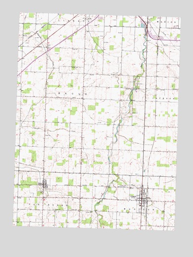
Arlington, OH USGS Topographic Map
Click on map above to begin viewing in our Map Viewer.

This topographic map contains these locations and features:
Feature Name Type Latitude Longitude GNIS ID View Map
Alge Airport (historical)AirportN40.9051°W83.6448°1082464View Map
Appleseed Joint Ambulance DistrictBuildingN40.8993°W83.6514°2550943View Map
ArlingtonPopulated PlaceN40.8937°W83.6502°1064342View Map
Arlington Branch LibraryBuildingN40.8959°W83.6513°1071950View Map
Arlington CemeteryCemeteryN40.9000°W83.6610°1037474View Map
Arlington Elementary SchoolSchoolN40.8895°W83.6519°1071951View Map
Arlington High SchoolSchoolN40.8892°W83.6519°1054419View Map
Arlington Post Office (historical)Post OfficeN40.8931°W83.6499°1990229View Map
Arlington United Methodist ChurchChurchN40.8956°W83.6513°1071952View Map
Arlington Volunteer Fire DepartmentBuildingN40.8947°W83.6513°2549603View Map
Beagle (historical)Populated PlaceN40.9356°W83.6424°1054420View Map
Beagle Post Office (historical)Post OfficeN40.9362°W83.6430°1990243View Map
Bishop CemeteryCemeteryN40.9434°W83.6602°1038060View Map
Bishop School (historical)SchoolN40.9501°W83.6697°1054424View Map
Boehm Dairy FarmLocaleN40.9264°W83.7403°2705621View Map
Brinkman Turkey FarmsLocaleN40.9306°W83.6528°2548174View Map
Buck RunStreamN40.9051°W83.6683°1038467View Map
Camp BerryLocaleN40.9606°W83.6566°1038662View Map
Eagle Center Church (historical)ChurchN40.9509°W83.7072°1054431View Map
Ellis CemeteryCemeteryN40.9578°W83.6252°1040146View Map
Ferrell AirportAirportN40.9727°W83.6419°1082683View Map
Good Hope Lutheran ChurchChurchN40.8903°W83.6516°1071955View Map
Hartman CemeteryCemeteryN40.9690°W83.7085°1041378View Map
JeneraPopulated PlaceN40.8998°W83.7269°1042073View Map
Jenera Post OfficePost OfficeN40.9001°W83.7263°1990232View Map
Jenera Volunteer Fire DepartmentBuildingN40.8991°W83.7266°2549602View Map
Keller CemeteryCemeteryN40.9284°W83.7267°1042202View Map
Line CemeteryCemeteryN40.9431°W83.6697°1730687View Map
Lucas School (historical)SchoolN40.9506°W83.7463°1054444View Map
Martinstown (historical)Populated PlaceN40.9064°W83.6510°1063598View Map
Plain View DairyLocaleN40.8931°W83.6972°2703618View Map
Powell CemeteryCemeteryN40.9800°W83.7266°1044733View Map
Saint Pauls CemeteryCemeteryN40.8848°W83.6888°1045751View Map
Saint Pauls ChurchChurchN40.8856°W83.7008°1072254View Map
Salem ChurchChurchN40.9801°W83.7349°1058002View Map
Schaller AirportAirportN40.9499°W83.6815°2442502View Map
Sycamore Springs Golf CourseLocaleN40.9228°W83.6624°1054451View Map
Township of EagleCivilN40.9502°W83.7081°1086244View Map
Trinity CemeteryCemeteryN40.8853°W83.7183°1047149View Map
Trinity Evangelical Lutheran ChurchChurchN40.9014°W83.7266°1063616View Map
Trinity Lutheran SchoolSchoolN40.9020°W83.7258°1063617View Map
Village of ArlingtonCivilN40.8939°W83.6530°2397983View Map
Village of JeneraCivilN40.8995°W83.7271°2398296View Map

Note: Coordinates in the location and feature list above are referenced to NAD83 datum.


Copyright (C) 2008-2024 Ryan Niemi / Sunset Dynamics ... All Rights Reserved