TopoQuest Logo
Do you find TopoQuest useful?
Help keep TopoQuest running and adding new maps/features by donating!
Bitcoin:  19c7KJd3qBynnjoSw5npx9KScwjBe4ifkT
Litecoin:  LXs6TkuXGGXo1vDsWCkWVdjQX94eUKd6ui
Home View Maps Find Maps Find Places Resources & Links


Eunice, New Mexico Topographic Map

USGS Map Title: Eunice, NM
USGS Map MRC: 32103D2
DRG (GeoTIFF) Download: o32103d2.tif


Neighboring USGS Topographic Map Quads:


  Monument South, NM  
32103E3
 

  Hobbs SW, NM  
32103E2
 

  Hobbs SE, TX  
32103E1
 

  Oil Center, NM  
32103D3
 

  Eunice, NM  
32103D2
 

  Eunice NE, TX  
32103D1
 

  East Lake, NM  
32103C3
 

  Rattlesnake Canyon, NM  
32103C2
 

  Eunice SE, TX  
32103C1


Map MRC Location:

N33°
W104°
N33°
W103°
H8 H7 H6 H5 H4 H3 H2 H1
G8 G7 G6 G5 G4 G3 G2 G1
F8 F7 F6 F5 F4 F3 F2 F1
E8 E7 E6 E5 E4 E3 E2 E1
D8 D7 D6 D5 D4 D3 D2 D1
C8 C7 C6 C5 C4 C3 C2 C1
B8 B7 B6 B5 B4 B3 B2 B1
A8 A7 A6 A5 A4 A3 A2 A1
N32°
W104°
N32°
W103°

Eunice, NM USGS 1:24K Topographic Map Preview:
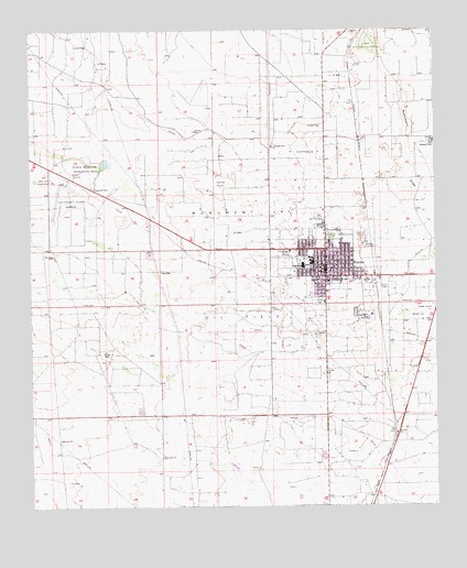
Eunice, NM USGS Topographic Map
Click on map above to begin viewing in our Map Viewer.

This topographic map contains these locations and features:
Feature Name Type Latitude Longitude GNIS ID View Map
Armstrong and ArmstrongMineN32.4621°W103.2449°915418View Map
Calvary Baptist ChurchChurchN32.4373°W103.1591°920120View Map
Caton Junior High SchoolSchoolN32.4373°W103.1591°933875View Map
Church of ChristChurchN32.4373°W103.1591°920417View Map
City of EuniceCivilN32.4425°W103.1914°2410462View Map
Cobb WellWellN32.4157°W103.2282°887718View Map
EunicePopulated PlaceN32.4373°W103.1591°899630View Map
Eunice Airport (historical)AirportN32.4568°W103.2405°936949View Map
Eunice DivisionCivilN32.4574°W103.2255°1937530View Map
Eunice Fire and Rescue DepartmentBuildingN32.4371°W103.1578°2657588View Map
Eunice High SchoolSchoolN32.4373°W103.1591°934097View Map
Eunice Holiness AcademySchoolN32.4390°W103.1591°901438View Map
Eunice LibraryBuildingN32.4373°W103.1591°929371View Map
Eunice Municipal Recreation AreaParkN32.4643°W103.2335°888933View Map
Eunice Police DepartmentBuildingN32.4418°W103.1713°2722577View Map
Eunice Post OfficePost OfficeN32.4380°W103.1585°2781527View Map
Eunice Post Office (historical)Post OfficeN32.4373°W103.1591°938265View Map
Eunice Public LibraryBuildingN32.4373°W103.1591°931597View Map
First Baptist ChurchChurchN32.4373°W103.1591°920405View Map
Hardy FlatsFlatN32.4598°W103.1913°889773View Map
Highland Baptist ChurchChurchN32.4373°W103.1591°920121View Map
Jones CityPopulated PlaceN32.4707°W103.1257°899690View Map
KPCE-FM (Eunice)TowerN32.4315°W103.1527°938648View Map
Lea County Sheriff's Office EuniceBuildingN32.4419°W103.1715°2722569View Map
Mettie Jordan Elementary SchoolSchoolN32.4373°W103.1591°933863View Map
Trinity Lutheran ChurchChurchN32.4197°W103.2250°902495View Map

Note: Coordinates in the location and feature list above are referenced to NAD83 datum.


Copyright (C) 2008-2024 Ryan Niemi / Sunset Dynamics ... All Rights Reserved