TopoQuest Logo
Do you find TopoQuest useful?
Help keep TopoQuest running and adding new maps/features by donating!
Bitcoin:  19c7KJd3qBynnjoSw5npx9KScwjBe4ifkT
Litecoin:  LXs6TkuXGGXo1vDsWCkWVdjQX94eUKd6ui
Home View Maps Find Maps Find Places Resources & Links


Fairfield, Florida Topographic Map

USGS Map Title: Fairfield, FL
USGS Map MRC: 29082C3
DRG (GeoTIFF) Download: o29082c3.tif


Neighboring USGS Topographic Map Quads:


  Williston, FL  
29082D4
 

  Flemington, FL  
29082D3
 

  McIntosh, FL  
29082D2
 

  Morriston, FL  
29082C4
 

  Fairfield, FL  
29082C3
 

  Reddick, FL  
29082C2
 

  Romeo, FL  
29082B4
 

  Cotton Plant, FL  
29082B3
 

  Ocala West, FL  
29082B2


Map MRC Location:

N30°
W83°
N30°
W82°
H8 H7 H6 H5 H4 H3 H2 H1
G8 G7 G6 G5 G4 G3 G2 G1
F8 F7 F6 F5 F4 F3 F2 F1
E8 E7 E6 E5 E4 E3 E2 E1
D8 D7 D6 D5 D4 D3 D2 D1
C8 C7 C6 C5 C4 C3 C2 C1
B8 B7 B6 B5 B4 B3 B2 B1
A8 A7 A6 A5 A4 A3 A2 A1
N29°
W83°
N29°
W82°

Fairfield, FL USGS 1:24K Topographic Map Preview:
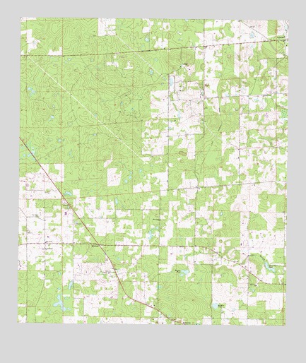
Fairfield, FL USGS Topographic Map
Click on map above to begin viewing in our Map Viewer.

This topographic map contains these locations and features:
Feature Name Type Latitude Longitude GNIS ID View Map
Arliss M Airport (historical)AirportN29.3408°W82.2634°309394View Map
Bethlehem Missionary Baptist ChurchChurchN29.2666°W82.2637°278566View Map
BlitchtonPopulated PlaceN29.2825°W82.3368°294688View Map
Blitchton Forestry Lookout TowerTowerN29.2711°W82.3312°278993View Map
Brooks BranchStreamN29.2761°W82.2598°279440View Map
CaraPopulated PlaceN29.3447°W82.2629°303906View Map
Crystal Springs Mobile Home ParkPopulated PlaceN29.2999°W82.3538°2451007View Map
EmathlaPopulated PlaceN29.2828°W82.2920°303907View Map
FairfieldPopulated PlaceN29.3669°W82.2512°282334View Map
Fairfield Baptist ChurchChurchN29.3647°W82.2509°2033651View Map
Fairfield Post OfficePost OfficeN29.3667°W82.2517°2759163View Map
Fairfield Presbyterian ChurchChurchN29.3686°W82.2518°2033653View Map
Greater Pine Grove Missionary Baptist ChurchChurchN29.2830°W82.3623°288839View Map
Heijahs Town (historical)Populated PlaceN29.3669°W82.2665°294482View Map
Holy Temple House of Prayer Praise and DeliveranceChurchN29.2719°W82.3620°2033649View Map
Hopkins PondLakeN29.2582°W82.2829°284263View Map
Idle Wild AirportAirportN29.2893°W82.3224°309735View Map
Liberty Chapel Baptist ChurchChurchN29.3400°W82.2901°2033654View Map
Ministry for Justice and Reconciliation (historical)ChurchN29.2808°W82.3068°301947View Map
Mount Herman United Methodist ChurchChurchN29.3450°W82.2679°2033650View Map
Mulvihill Field (historical)AirportN29.3341°W82.2507°309734View Map
New Chapel Missionary Baptist ChurchChurchN29.2930°W82.3084°287608View Map
Old Ship of Zion - End Time MinistriesChurchN29.3091°W82.3057°2033655View Map
Parkview Baptist Church (historical)ChurchN29.2753°W82.3095°301952View Map
Peter Gibson PondLakeN29.2747°W82.2589°288732View Map
Pine Grove CemeteryCemeteryN29.2939°W82.3645°288838View Map
Pleasant View Church (historical)ChurchN29.3441°W82.2618°289080View Map
Rayner PondLakeN29.2720°W82.2969°289519View Map
Reluctant Gremlin AirportAirportN29.3406°W82.2668°2676694View Map
Saint Hawthorne Primitive Baptist ChurchChurchN29.2808°W82.3620°290184View Map
WOGX-TV (Ocala)TowerN29.3591°W82.3312°309198View Map
WYIM-TV (Ocala)TowerN29.3661°W82.3409°309199View Map

Note: Coordinates in the location and feature list above are referenced to NAD83 datum.


Copyright (C) 2008-2024 Ryan Niemi / Sunset Dynamics ... All Rights Reserved