TopoQuest Logo
Do you find TopoQuest useful?
Help keep TopoQuest running and adding new maps/features by donating!
Bitcoin:  19c7KJd3qBynnjoSw5npx9KScwjBe4ifkT
Litecoin:  LXs6TkuXGGXo1vDsWCkWVdjQX94eUKd6ui
Home View Maps Find Maps Find Places Resources & Links


Fisher, Minnesota Topographic Map

USGS Map Title: Fisher, MN
USGS Map MRC: 47096G7
DRG (GeoTIFF) Download: o47096g7.tif


Neighboring USGS Topographic Map Quads:


  Mallory, MN  
47096H8
 

  Key West, MN  
47096H7
 

  Euclid, MN  
47096H6
 

  Bygland, MN  
47096G8
 

  Fisher, MN  
47096G7
 

  Crookston SW, MN  
47096G6
 

  Climax NW, ND  
47096F8
 

  Eldred, MN  
47096F7
 

  Girard, MN  
47096F6


Map MRC Location:

N48°
W97°
N48°
W96°
H8 H7 H6 H5 H4 H3 H2 H1
G8 G7 G6 G5 G4 G3 G2 G1
F8 F7 F6 F5 F4 F3 F2 F1
E8 E7 E6 E5 E4 E3 E2 E1
D8 D7 D6 D5 D4 D3 D2 D1
C8 C7 C6 C5 C4 C3 C2 C1
B8 B7 B6 B5 B4 B3 B2 B1
A8 A7 A6 A5 A4 A3 A2 A1
N47°
W97°
N47°
W96°

Fisher, MN USGS 1:24K Topographic Map Preview:
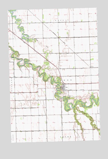
Fisher, MN USGS Topographic Map
Click on map above to begin viewing in our Map Viewer.

This topographic map contains these locations and features:
Feature Name Type Latitude Longitude GNIS ID View Map
Burnham CreekStreamN47.7819°W96.7848°640663View Map
City of FisherCivilN47.7992°W96.7995°2394767View Map
County Ditch Number FiftyoneCanalN47.7750°W96.8581°642174View Map
County Ditch Number One Hundred SevenCanalN47.7966°W96.8637°641593View Map
County Ditch Number One Hundred SixtynineCanalN47.7764°W96.8034°641727View Map
County Ditch Number One Hundred SixtythreeCanalN47.7894°W96.8517°641726View Map
County Ditch Number One Hundred ThirtyfourCanalN47.8108°W96.7742°641669View Map
County Ditch Number One Hundred ThirtyoneCanalN47.7603°W96.8648°641664View Map
County Ditch Number ThirtyCanalN47.8616°W96.7870°641939View Map
Erickson CemeteryCemeteryN47.7683°W96.7833°2081320View Map
FisherLocaleN47.8022°W96.7989°2081478View Map
FisherPopulated PlaceN47.8003°W96.8015°643704View Map
Fisher CemeteryCemeteryN47.8111°W96.8056°2081321View Map
Fisher Fire DepartmentBuildingN47.8011°W96.7997°2081474View Map
Fisher High SchoolSchoolN47.7978°W96.7972°2081480View Map
Fisher Lutheran CemeteryCemeteryN47.8029°W96.8152°2081319View Map
Fisher Lutheran ChurchChurchN47.8003°W96.8011°2081475View Map
Fisher Police DepartmentBuildingN47.8003°W96.8011°2081476View Map
Fisher Post OfficePost OfficeN47.8007°W96.7998°2081479View Map
Fisher's Landing Traveler Information CenterLocaleN47.8444°W96.8533°2081858View Map
FreemanPopulated PlaceN47.8194°W96.7609°654712View Map
Glacial Lake Agassiz Historical MarkerParkN47.8444°W96.8533°2081857View Map
Greenwood CemeteryCemeteryN47.7922°W96.7937°644466View Map
KQHT-FM (Crookston)TowerN47.8453°W96.8398°663027View Map
KYCK-FM (Crookston)TowerN47.8214°W96.8179°663028View Map
Original Site of Fisher's Landing Historical MarkerParkN47.8444°W96.8533°2081856View Map
Saint Francis ChurchChurchN47.7986°W96.7975°2081481View Map
Township of FisherCivilN47.8040°W96.8039°664171View Map
Trinity Lutheran ChurchChurchN47.8003°W96.8011°2081477View Map

Note: Coordinates in the location and feature list above are referenced to NAD83 datum.


Copyright (C) 2008-2024 Ryan Niemi / Sunset Dynamics ... All Rights Reserved