TopoQuest Logo
Do you find TopoQuest useful?
Help keep TopoQuest running and adding new maps/features by donating!
Bitcoin:  19c7KJd3qBynnjoSw5npx9KScwjBe4ifkT
Litecoin:  LXs6TkuXGGXo1vDsWCkWVdjQX94eUKd6ui
Home View Maps Find Maps Find Places Resources & Links


Foraker, Ohio Topographic Map

USGS Map Title: Foraker, OH
USGS Map MRC: 40083F6
DRG (GeoTIFF) Download: o40083f6.tif


Neighboring USGS Topographic Map Quads:


  Ada, OH  
40083G7
 

  Dunkirk, OH  
40083G6
 

  Forest, OH  
40083G5
 

  Alger, OH  
40083F7
 

  Foraker, OH  
40083F6
 

  Kenton, OH  
40083F5
 

  Roundhead, OH  
40083E7
 

  Silver Creek, OH  
40083E6
 

  Mount Victory, OH  
40083E5


Map MRC Location:

N41°
W84°
N41°
W83°
H8 H7 H6 H5 H4 H3 H2 H1
G8 G7 G6 G5 G4 G3 G2 G1
F8 F7 F6 F5 F4 F3 F2 F1
E8 E7 E6 E5 E4 E3 E2 E1
D8 D7 D6 D5 D4 D3 D2 D1
C8 C7 C6 C5 C4 C3 C2 C1
B8 B7 B6 B5 B4 B3 B2 B1
A8 A7 A6 A5 A4 A3 A2 A1
N40°
W84°
N40°
W83°

Foraker, OH USGS 1:24K Topographic Map Preview:
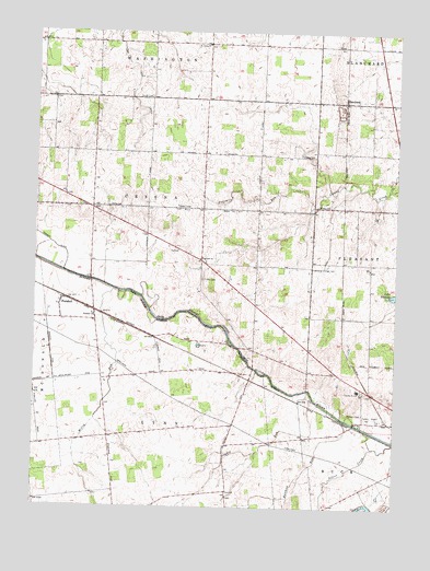
Foraker, OH USGS Topographic Map
Click on map above to begin viewing in our Map Viewer.

This topographic map contains these locations and features:
Feature Name Type Latitude Longitude GNIS ID View Map
Batchlet RunStreamN40.6481°W83.6422°1037673View Map
Bateson School (historical)SchoolN40.6870°W83.6735°1055398View Map
Beech Grove School (historical)SchoolN40.7187°W83.6335°1055400View Map
BlanchardPopulated PlaceN40.7320°W83.6435°1060880View Map
Blanchard Post Office (historical)Post OfficeN40.7320°W83.6430°1992730View Map
Blocktown (historical)Populated PlaceN40.7470°W83.6908°1055402View Map
Brush College (historical)SchoolN40.7178°W83.7105°1077359View Map
Buckeye School (historical)SchoolN40.7462°W83.6313°1055405View Map
Cessna CemeteryCemeteryN40.7178°W83.6585°1038971View Map
Eagle School (historical)SchoolN40.7467°W83.7102°1055411View Map
Eibling Circle E AirportAirportN40.7461°W83.6710°1082655View Map
Elmwood School (historical)SchoolN40.6289°W83.7277°1055414View Map
Fairview ChurchChurchN40.6903°W83.6930°1040359View Map
Fariview School (historical)SchoolN40.6964°W83.7110°1055419View Map
Flynn School (historical)SchoolN40.6431°W83.7235°1055420View Map
ForakerPopulated PlaceN40.6776°W83.7416°1064663View Map
Foraker ChurchChurchN40.6753°W83.7294°1040545View Map
Foraker Post Office (historical)Post OfficeN40.6778°W83.7416°1992738View Map
Fort McArthur (historical)MilitaryN40.6569°W83.6575°1680858View Map
Fourmile RunStreamN40.7031°W83.6541°1066008View Map
Friendship Grange HallBuildingN40.6881°W83.6541°1085220View Map
Fulton CemeteryCemeteryN40.6851°W83.6922°1040723View Map
Hardin Airport (historical)AirportN40.6489°W83.6313°1079604View Map
Hardin CountyCivilN40.6615°W83.6594°1074045View Map
Hardin County HomeBuildingN40.6562°W83.6374°1055429View Map
Hardin QuarryMineN40.7292°W83.6449°1056018View Map
Lake IdlewildReservoirN40.6811°W83.6251°1041916View Map
Liberty School (historical)SchoolN40.6892°W83.6335°1055441View Map
Lynn Valley School (historical)SchoolN40.6292°W83.6830°1055444View Map
McCoy RunStreamN40.6820°W83.7230°1066094View Map
Opossum School (historical)SchoolN40.6576°W83.7497°1055455View Map
Payden RunStreamN40.6531°W83.6533°1044336View Map
Potters FieldCemeteryN40.6500°W83.6363°1044723View Map
Saint Johns ChurchChurchN40.7467°W83.6916°1045533View Map
Salem School (historical)SchoolN40.7181°W83.6730°1055472View Map
Schingle School (historical)SchoolN40.6664°W83.6733°1055474View Map
Scioto School (historical)SchoolN40.6453°W83.6560°1055475View Map
Smith CemeteryCemeteryN40.7328°W83.7108°1046367View Map
Township of CessnaCivilN40.7034°W83.7041°1086258View Map
Township of LynnCivilN40.6326°W83.7062°1086264View Map

Note: Coordinates in the location and feature list above are referenced to NAD83 datum.


Copyright (C) 2008-2024 Ryan Niemi / Sunset Dynamics ... All Rights Reserved