TopoQuest Logo
Do you find TopoQuest useful?
Help keep TopoQuest running and adding new maps/features by donating!
Bitcoin:  19c7KJd3qBynnjoSw5npx9KScwjBe4ifkT
Litecoin:  LXs6TkuXGGXo1vDsWCkWVdjQX94eUKd6ui
Home View Maps Find Maps Find Places Resources & Links


Fort Morgan, Alabama Topographic Map

USGS Map Title: Fort Morgan, AL
USGS Map MRC: 30088B1
DRG (GeoTIFF) Download: o30088b1.tif


Neighboring USGS Topographic Map Quads:


  Heron Bay, AL  
30088C2
 

  Little Dauphin Island, AL  
30088C1
 

  Little Point Clear, AL  
30087C8
 

  Fort Morgan NW, AL  
30088B2
 

  Fort Morgan, AL  
30088B1
 

  Saint Andrews Bay, AL  
30087B8


Map MRC Location:

N31°
W89°
N31°
W88°
H8 H7 H6 H5 H4 H3 H2 H1
G8 G7 G6 G5 G4 G3 G2 G1
F8 F7 F6 F5 F4 F3 F2 F1
E8 E7 E6 E5 E4 E3 E2 E1
D8 D7 D6 D5 D4 D3 D2 D1
C8 C7 C6 C5 C4 C3 C2 C1
B8 B7 B6 B5 B4 B3 B2 B1
A8 A7 A6 A5 A4 A3 A2 A1
N30°
W89°
N30°
W88°

Fort Morgan, AL USGS 1:24K Topographic Map Preview:
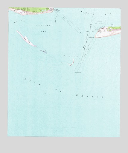
Fort Morgan, AL USGS Topographic Map
Click on map above to begin viewing in our Map Viewer.

This topographic map contains these locations and features:
Feature Name Type Latitude Longitude GNIS ID View Map
Alligator LakeLakeN30.2473°W88.0876°113030View Map
Battery Dearborn (historical)MilitaryN30.2294°W88.0119°158222View Map
Battery Duportail (historical)MilitaryN30.2278°W88.0228°158223View Map
Battery Schenck (historical)MilitaryN30.2294°W88.0236°158224View Map
Battery Stanton (historical)MilitaryN30.2481°W88.0750°1984567View Map
Battery Terrett (historical)MilitaryN30.2492°W88.0753°1984568View Map
Battery Thomas (historical)MilitaryN30.2289°W88.0233°158225View Map
Bienville BeachBeachN30.2471°W88.1236°114213View Map
Coffee Island (historical)IslandN30.1847°W88.0336°2079269View Map
Dauphin BeachBeachN30.2448°W88.1146°117085View Map
Dauphin Island Annex Brookley Air Force Base (historical)MilitaryN30.2483°W88.0772°1699986View Map
Dauphin Island SealabSchoolN30.2488°W88.0772°143289View Map
Dauphin Island SpitBarN30.2391°W88.0722°117089View Map
Dixey BarBarN30.2002°W88.0333°149383View Map
Fort GainesPopulated PlaceN30.2488°W88.0750°156366View Map
Fort Gaines (historical)MilitaryN30.2481°W88.0756°1984569View Map
Fort MorganPopulated PlaceN30.2285°W88.0231°156368View Map
Fort Morgan Airport (historical)AirportN30.2296°W88.0169°1992802View Map
Fort Morgan MuseumBuildingN30.2266°W88.0231°134578View Map
Front Range LightLocaleN30.2216°W88.0267°118730View Map
Gulfside Golf CourseLocaleN30.2491°W88.0872°1699988View Map
Isle Dauphin Country ClubLocaleN30.2446°W88.1028°143445View Map
Light House Battery (historical)MilitaryN30.2278°W88.0242°158228View Map
Little Pelican ChannelChannelN30.2058°W88.0903°149318View Map
Main ChannelChannelN30.2174°W88.0394°122225View Map
Middle ChannelChannelN30.2071°W88.0944°149319View Map
Mobile PointCapeN30.2221°W88.0283°155154View Map
Mobile Point LightLocaleN30.2277°W88.0239°122921View Map
Oleander PondLakeN30.2472°W88.0845°124277View Map
Pelican BayBayN30.2302°W88.0867°150000View Map
Pelican ChannelChannelN30.2044°W88.0833°149317View Map
Pelican IslandIslandN30.2266°W88.1069°158218View Map
Pelican PassageChannelN30.2369°W88.1136°124576View Map
Pelican PointCapeN30.2480°W88.0757°124577View Map
Revenue Point (historical)CapeN30.1891°W88.0403°149404View Map
Sand IslandIslandN30.1877°W88.0506°158217View Map
Sand Island (historical)IslandN30.1966°W88.0533°158219View Map
Sand Island ChannelChannelN30.2019°W88.0558°126316View Map
Sand Island LighthouseBuildingN30.1877°W88.0506°126317View Map
Sand Island ShoalBarN30.2021°W88.0769°143766View Map
South BankBarN30.2349°W88.0092°149409View Map
Southeast ShoalBarN30.2183°W88.0250°134708View Map
Swash ChannelChannelN30.2113°W88.0264°149413View Map
The CutChannelN30.1933°W88.0528°149316View Map
West BankBarN30.2210°W88.0542°149617View Map
West BankBarN30.2280°W88.0439°128753View Map

Note: Coordinates in the location and feature list above are referenced to NAD83 datum.


Copyright (C) 2008-2024 Ryan Niemi / Sunset Dynamics ... All Rights Reserved