TopoQuest Logo
Do you find TopoQuest useful?
Help keep TopoQuest running and adding new maps/features by donating!
Bitcoin:  19c7KJd3qBynnjoSw5npx9KScwjBe4ifkT
Litecoin:  LXs6TkuXGGXo1vDsWCkWVdjQX94eUKd6ui
Home View Maps Find Maps Find Places Resources & Links


Hackett, Pennsylvania Topographic Map

USGS Map Title: Hackett, PA
USGS Map MRC: 40080B1
DRG (GeoTIFF) Download: o40080b1.tif


Neighboring USGS Topographic Map Quads:


  Canonsburg, PA  
40080C2
 

  Bridgeville, PA  
40080C1
 

  Glassport, PA  
40079C8
 

  Washington East, PA  
40080B2
 

  Hackett, PA  
40080B1
 

  Monongahela, PA  
40079B8
 

  Amity, PA  
40080A2
 

  Ellsworth, PA  
40080A1
 

  California, PA  
40079A8


Map MRC Location:

N41°
W81°
N41°
W80°
H8 H7 H6 H5 H4 H3 H2 H1
G8 G7 G6 G5 G4 G3 G2 G1
F8 F7 F6 F5 F4 F3 F2 F1
E8 E7 E6 E5 E4 E3 E2 E1
D8 D7 D6 D5 D4 D3 D2 D1
C8 C7 C6 C5 C4 C3 C2 C1
B8 B7 B6 B5 B4 B3 B2 B1
A8 A7 A6 A5 A4 A3 A2 A1
N40°
W81°
N40°
W80°

Hackett, PA USGS 1:24K Topographic Map Preview:
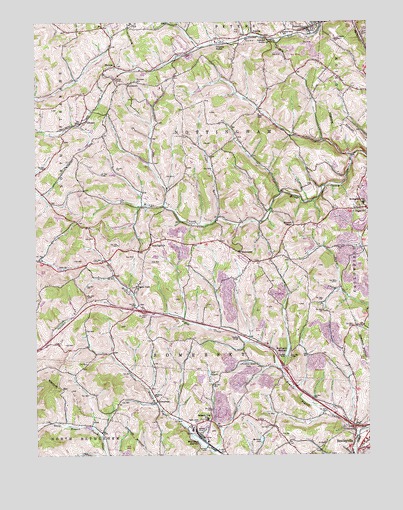
Hackett, PA USGS Topographic Map
Click on map above to begin viewing in our Map Viewer.

This topographic map contains these locations and features:
Feature Name Type Latitude Longitude GNIS ID View Map
Anderson StationLocaleN40.2442°W80.0356°1168290View Map
Bandel AirportAirportN40.1292°W80.0962°1193839View Map
Bentleyville DamDamN40.1484°W80.0248°1194585View Map
Bentleyville ReservoirReservoirN40.1552°W80.0303°1169282View Map
Bentworth Ambulance ServiceBuildingN40.1396°W80.0041°2719469View Map
Crouches StationLocaleN40.2431°W80.0542°1172770View Map
DunningsvillePopulated PlaceN40.1856°W80.0812°1173626View Map
Ebenezer Covered BridgeBridgeN40.1919°W80.0403°2740712View Map
Edwards ChapelChurchN40.1915°W80.0276°1174033View Map
EmeryPopulated PlaceN40.1751°W80.0864°1201597View Map
Faithful Green LakeReservoirN40.1520°W80.0450°1174570View Map
FarquharPopulated PlaceN40.1356°W80.0056°1201596View Map
Finleyville AirparkAirportN40.2461°W80.0116°1193892View Map
GilkesonPopulated PlaceN40.2209°W80.1059°1203669View Map
HackettPopulated PlaceN40.2478°W80.0217°1176345View Map
Henry Covered BridgeBridgeN40.2025°W80.0167°2740714View Map
HernLocaleN40.1559°W80.0287°1205943View Map
KammererPopulated PlaceN40.1837°W80.0478°1178211View Map
Lake CalydonReservoirN40.1476°W80.0595°1170956View Map
Lake EightyfourReservoirN40.1790°W80.1159°1192421View Map
Lil Tots Day Care CenterBuildingN40.1678°W80.0854°2430159View Map
Mine Number Six-Pond Six DamDamN40.1484°W80.0581°1194587View Map
Mine Number Sixty ReservoirReservoirN40.1291°W80.0635°1181310View Map
Mine Number Sixty-Pond Five DamDamN40.1467°W80.0631°1194583View Map
Mingo Creek County ParkParkN40.1992°W80.0328°1205944View Map
Mortons LakeReservoirN40.1294°W80.0404°1181595View Map
MunntownPopulated PlaceN40.2323°W80.0895°1182096View Map
Munntown CemeteryCemeteryN40.2334°W80.0864°1182097View Map
North Branch Pigeon CreekStreamN40.1317°W80.0042°1182547View Map
North Strabane Volunteer Fire Department Station 2 SubstationBuildingN40.2075°W80.1214°2645412View Map
Nottingham Christian CenterChurchN40.2362°W80.0982°2431119View Map
Nottingham Township SchoolSchoolN40.1976°W80.0009°1182704View Map
Peters Township SchoolSchoolN40.2470°W80.0309°1183632View Map
Pigeon Creek CemeteryCemeteryN40.1352°W80.0636°1183711View Map
Pigeon Creek ChurchChurchN40.1742°W80.0873°1183712View Map
Pond FiveReservoirN40.1470°W80.0626°1194584View Map
Pond SixReservoirN40.1510°W80.0604°1194586View Map
Raw Water Pond DamDamN40.1934°W80.0014°1194622View Map
Refuse Stilling Basin DamDamN40.1917°W80.0064°1194621View Map
Rolling GreenLocaleN40.1840°W80.0784°1205574View Map
Somerset Township Municipal BuildingBuildingN40.1446°W80.0829°2430771View Map
Somerset Township SchoolSchoolN40.1353°W80.0603°1187994View Map
Steel DamDamN40.1284°W80.0648°1194559View Map
Sugar RunStreamN40.1937°W80.0559°1188962View Map
ThomasPopulated PlaceN40.2376°W80.0939°1189470View Map
Thomas Presbyterian ChurchChurchN40.2368°W80.0960°2431348View Map
Thomas TunnelTunnelN40.2340°W80.0945°1189490View Map
Township of NottinghamCivilN40.2141°W80.0532°1217202View Map
Township of SomersetCivilN40.1480°W80.0612°1217206View Map
Treated Water Pond DamDamN40.1901°W80.0048°1194619View Map
VancevillePopulated PlaceN40.1406°W80.0792°1190348View Map
VenetiaPopulated PlaceN40.2467°W80.0423°1190376View Map
Venetia Post OfficePost OfficeN40.2457°W80.0371°2431951View Map
Wrights United Methodist ChurchChurchN40.2475°W80.0305°2431648View Map

Note: Coordinates in the location and feature list above are referenced to NAD83 datum.


Copyright (C) 2008-2024 Ryan Niemi / Sunset Dynamics ... All Rights Reserved