TopoQuest Logo
Do you find TopoQuest useful?
Help keep TopoQuest running and adding new maps/features by donating!
Bitcoin:  19c7KJd3qBynnjoSw5npx9KScwjBe4ifkT
Litecoin:  LXs6TkuXGGXo1vDsWCkWVdjQX94eUKd6ui
Home View Maps Find Maps Find Places Resources & Links


Hagerman Lake, Michigan Topographic Map

USGS Map Title: Hagerman Lake, MI
USGS Map MRC: 46088A7
DRG (GeoTIFF) Download: o46088a7.tif


Neighboring USGS Topographic Map Quads:


  Golden Lake, MI  
46088B8
 

  Beechwood, MI  
46088B7
 

  Gibbs City, MI  
46088B6
 

  Smoky Lake, MI  
46088A8
 

  Hagerman Lake, MI  
46088A7
 

  Iron River, MI  
46088A6
 

  Alvin NW, WI  
45088H8
 

  Alvin, WI  
45088H7
 

  Tipler, WI  
45088H6


Map MRC Location:

N47°
W89°
N47°
W88°
H8 H7 H6 H5 H4 H3 H2 H1
G8 G7 G6 G5 G4 G3 G2 G1
F8 F7 F6 F5 F4 F3 F2 F1
E8 E7 E6 E5 E4 E3 E2 E1
D8 D7 D6 D5 D4 D3 D2 D1
C8 C7 C6 C5 C4 C3 C2 C1
B8 B7 B6 B5 B4 B3 B2 B1
A8 A7 A6 A5 A4 A3 A2 A1
N46°
W89°
N46°
W88°

Hagerman Lake, MI USGS 1:24K Topographic Map Preview:
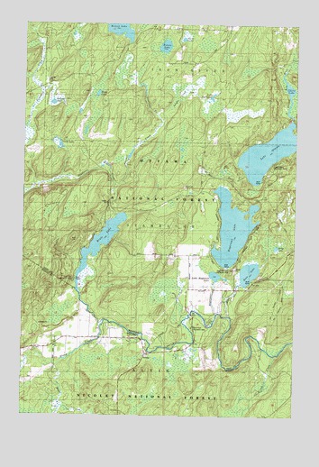
Hagerman Lake, MI USGS Topographic Map
Click on map above to begin viewing in our Map Viewer.

This topographic map contains these locations and features:
Feature Name Type Latitude Longitude GNIS ID View Map
Bass CreekStreamN46.0316°W88.7810°1619094View Map
Bass LakeLakeN46.0458°W88.7710°620711View Map
Bleat CreekStreamN46.0777°W88.7732°1619247View Map
Brule CreekStreamN46.0158°W88.8587°1578865View Map
Brule LakeLakeN46.0550°W88.8396°622132View Map
Brule Lookout TowerTowerN46.0561°W88.8529°1623262View Map
Brule River Recreation AreaLocaleN46.0283°W88.7968°1580990View Map
Chara LakeLakeN46.1034°W88.7536°1620942View Map
Circle LakeLakeN46.0850°W88.8597°623316View Map
Elvoy CreekStreamN46.0302°W88.8371°1579204View Map
Elvoy SchoolSchoolN46.0247°W88.8599°1579205View Map
Fern LakeLakeN46.1202°W88.8026°1622439View Map
Gadwall LakeLakeN46.0997°W88.8621°1619983View Map
Greig LakeLakeN46.0539°W88.7587°627426View Map
Hagerman CreekStreamN46.0325°W88.7857°1620105View Map
Hagerman LakeLakeN46.0599°W88.7790°627597View Map
Hagerman Lake Recreation AreaLocaleN46.0472°W88.7840°1622437View Map
Homan LakeLakeN46.1248°W88.8311°1621568View Map
Horn LakeLakeN46.1027°W88.8416°628590View Map
Jungle CreekStreamN46.0930°W88.8124°1620396View Map
Lake OttawaLakeN46.0842°W88.7631°1621125View Map
Lake Ottawa Recreation AreaLocaleN46.0802°W88.7618°1622438View Map
Lake TwentytwoLakeN46.1011°W88.7888°1621977View Map
Lambert CreekStreamN46.0722°W88.8335°630090View Map
Little Hagerman LakeLakeN46.0448°W88.7863°1620553View Map
Mile Post Zero and Treaty Tree Point of InterestLocaleN46.0386°W88.8521°1580991View Map
NelmaPopulated PlaceN46.0197°W88.8179°1579997View Map
Nelson LakeLakeN46.1180°W88.8109°633287View Map
Ottawa LakeLakeN46.0842°W88.7631°1621124View Map
Pendleton CreekStreamN46.0633°W88.8326°1621195View Map
Seventeen CreekStreamN46.0922°W88.8140°1621566View Map
State Line Recreation AreaLocaleN46.0436°W88.8515°1622436View Map
Wilson CreekStreamN46.0191°W88.7585°1580797View Map

Note: Coordinates in the location and feature list above are referenced to NAD83 datum.


Copyright (C) 2008-2024 Ryan Niemi / Sunset Dynamics ... All Rights Reserved