TopoQuest Logo
Do you find TopoQuest useful?
Help keep TopoQuest running and adding new maps/features by donating!
Bitcoin:  19c7KJd3qBynnjoSw5npx9KScwjBe4ifkT
Litecoin:  LXs6TkuXGGXo1vDsWCkWVdjQX94eUKd6ui
Home View Maps Find Maps Find Places Resources & Links


Harcourt, Iowa Topographic Map

USGS Map Title: Harcourt, IA
USGS Map MRC: 42094C2
DRG (GeoTIFF) Download: o42094c2.tif


Neighboring USGS Topographic Map Quads:


  Moorland, IA  
42094D3
 

  Fort Dodge South, IA  
42094D2
 

  Evanston, IA  
42094D1
 

  Gowrie, IA  
42094C3
 

  Harcourt, IA  
42094C2
 

  Lehigh, IA  
42094C1
 

  Paton, IA  
42094B3
 

  Lanyon, IA  
42094B2
 

  Boxholm, IA  
42094B1


Map MRC Location:

N43°
W95°
N43°
W94°
H8 H7 H6 H5 H4 H3 H2 H1
G8 G7 G6 G5 G4 G3 G2 G1
F8 F7 F6 F5 F4 F3 F2 F1
E8 E7 E6 E5 E4 E3 E2 E1
D8 D7 D6 D5 D4 D3 D2 D1
C8 C7 C6 C5 C4 C3 C2 C1
B8 B7 B6 B5 B4 B3 B2 B1
A8 A7 A6 A5 A4 A3 A2 A1
N42°
W95°
N42°
W94°

Harcourt, IA USGS 1:24K Topographic Map Preview:
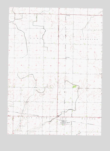
Harcourt, IA USGS Topographic Map
Click on map above to begin viewing in our Map Viewer.

This topographic map contains these locations and features:
Feature Name Type Latitude Longitude GNIS ID View Map
City of HarcourtCivilN42.2606°W94.1745°2394293View Map
Covenant ChurchChurchN42.2630°W94.1747°1996784View Map
Crooks (historical)LocaleN42.3255°W94.1738°1996613View Map
Crooks Post Office (historical)Post OfficeN42.3255°W94.1738°1996614View Map
Ditch Number 48CanalN42.2689°W94.2316°465719View Map
Faith Lutheran ChurchChurchN42.2628°W94.1758°1996782View Map
HarcourtPopulated PlaceN42.2628°W94.1758°457242View Map
Harcourt (historical)LocaleN42.2647°W94.1758°1996785View Map
Harcourt Community CenterBuildingN42.2628°W94.1758°1996780View Map
Harcourt Fire DepartmentBuildingN42.2625°W94.1761°2577406View Map
Harcourt Post OfficePost OfficeN42.2638°W94.1757°1996779View Map
Harcourt Public LibraryBuildingN42.2630°W94.1761°1996781View Map
Harcourt Town HallBuildingN42.2628°W94.1758°1996778View Map
Lost Grove CemeteryCemeteryN42.2583°W94.2330°458626View Map
LundgrenPopulated PlaceN42.3686°W94.1747°464632View Map
Lundgren (historical)LocaleN42.3686°W94.1747°1996611View Map
Lundgren Church Nature ParkParkN42.3666°W94.1697°1996592View Map
Lundgren Post Office (historical)Post OfficeN42.3686°W94.1747°1996612View Map
Methodist ChurchChurchN42.2630°W94.1769°1996783View Map
Palm GrovePopulated PlaceN42.3261°W94.1741°464694View Map
Palmgrove Post Office (historical)Post OfficeN42.3255°W94.1738°1996615View Map
Township of ClayCivilN42.3400°W94.2226°467612View Map
Township of Lost GroveCivilN42.2530°W94.2229°468304View Map

Note: Coordinates in the location and feature list above are referenced to NAD83 datum.


Copyright (C) 2008-2024 Ryan Niemi / Sunset Dynamics ... All Rights Reserved