TopoQuest Logo
Do you find TopoQuest useful?
Help keep TopoQuest running and adding new maps/features by donating!
Bitcoin:  19c7KJd3qBynnjoSw5npx9KScwjBe4ifkT
Litecoin:  LXs6TkuXGGXo1vDsWCkWVdjQX94eUKd6ui
Home View Maps Find Maps Find Places Resources & Links


Haviland, Kansas Topographic Map

USGS Map Title: Haviland, KS
USGS Map MRC: 37099E1
DRG (GeoTIFF) Download: o37099e1.tif


Neighboring USGS Topographic Map Quads:


  Haviland NW, KS  
37099F2
 

  Haviland NE, KS  
37099F1
 

  Cullison, KS  
37098F8
 

  Brenham, KS  
37099E2
 

  Haviland, KS  
37099E1
 

  Croft, KS  
37098E8
 

  Iron Mountain, KS  
37099D2
 

  Belvidere, KS  
37099D1
 

  Sun City, KS  
37098D8


Map MRC Location:

N38°
W100°
N38°
W99°
H8 H7 H6 H5 H4 H3 H2 H1
G8 G7 G6 G5 G4 G3 G2 G1
F8 F7 F6 F5 F4 F3 F2 F1
E8 E7 E6 E5 E4 E3 E2 E1
D8 D7 D6 D5 D4 D3 D2 D1
C8 C7 C6 C5 C4 C3 C2 C1
B8 B7 B6 B5 B4 B3 B2 B1
A8 A7 A6 A5 A4 A3 A2 A1
N37°
W100°
N37°
W99°

Haviland, KS USGS 1:24K Topographic Map Preview:
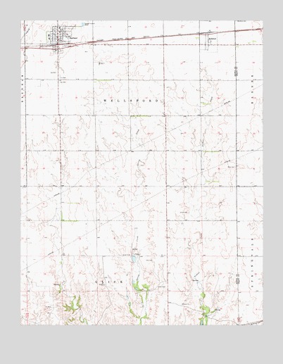
Haviland, KS USGS Topographic Map
Click on map above to begin viewing in our Map Viewer.

This topographic map contains these locations and features:
Feature Name Type Latitude Longitude GNIS ID View Map
Barclay CollegeSchoolN37.6211°W99.1045°2720228View Map
Barclay College Broadhurst Student CenterSchoolN37.6201°W99.1054°2692316View Map
Barclay College Coppock HallBuildingN37.6203°W99.1046°2692480View Map
Barclay College Hockett AuditoriumBuildingN37.6219°W99.1054°2692665View Map
Barclay College Jackson HallSchoolN37.6203°W99.1060°2692317View Map
Barclay College Lemmons HallBuildingN37.6198°W99.1052°2692481View Map
Barclay College Phillips HallSchoolN37.6210°W99.1046°2692318View Map
Barclay College Worden Memorial LibraryBuildingN37.6209°W99.1059°2692666View Map
Boles CemeteryCemeteryN37.5647°W99.0145°474265View Map
City of HavilandCivilN37.6176°W99.1051°485588View Map
Farmers Co - Operative Grain Elevator Number 1LocaleN37.6148°W99.1085°2695315View Map
Gail Ballard AirportAirportN37.6131°W99.1159°481387View Map
HavilandPopulated PlaceN37.6195°W99.1065°474263View Map
Haviland City HallBuildingN37.6157°W99.1060°2693218View Map
Haviland Elementary SchoolSchoolN37.6189°W99.1109°2497436View Map
Haviland Friends ChurchChurchN37.6167°W99.1044°2690095View Map
Haviland High SchoolSchoolN37.6175°W99.1108°481044View Map
Haviland Post OfficePost OfficeN37.6156°W99.1065°2693762View Map
Haviland United Methodist ChurchChurchN37.6181°W99.1066°2689443View Map
Haviland Volunteer Fire DepartmentBuildingN37.6156°W99.1059°2111408View Map
Haviland Wastewater Treatment FacilityLocaleN37.6234°W99.0933°2692018View Map
Kiowa County LibraryBuildingN37.6158°W99.1065°2694844View Map
Township of Wellsford (historical)CivilN37.5934°W99.0695°473908View Map
WellsfordPopulated PlaceN37.6167°W99.0287°474264View Map

Note: Coordinates in the location and feature list above are referenced to NAD83 datum.


Copyright (C) 2008-2024 Ryan Niemi / Sunset Dynamics ... All Rights Reserved