TopoQuest Logo
Do you find TopoQuest useful?
Help keep TopoQuest running and adding new maps/features by donating!
Bitcoin:  19c7KJd3qBynnjoSw5npx9KScwjBe4ifkT
Litecoin:  LXs6TkuXGGXo1vDsWCkWVdjQX94eUKd6ui
Home View Maps Find Maps Find Places Resources & Links


Haynesville, Virginia Topographic Map

USGS Map Title: Haynesville, VA
USGS Map MRC: 37076H6
DRG (GeoTIFF) Download: o37076h6.tif


Neighboring USGS Topographic Map Quads:


  Montross, VA  
38076A7
 

  Machodoc, VA  
38076A6
 

  Kinsale, VA  
38076A5
 

  Tappahannock, VA  
37076H7
 

  Haynesville, VA  
37076H6
 

  Lottsburg, VA  
37076H5
 

  Dunnsville, VA  
37076G7
 

  Morattico, VA  
37076G6
 

  Lively, VA  
37076G5


Map MRC Location:

N38°
W77°
N38°
W76°
H8 H7 H6 H5 H4 H3 H2 H1
G8 G7 G6 G5 G4 G3 G2 G1
F8 F7 F6 F5 F4 F3 F2 F1
E8 E7 E6 E5 E4 E3 E2 E1
D8 D7 D6 D5 D4 D3 D2 D1
C8 C7 C6 C5 C4 C3 C2 C1
B8 B7 B6 B5 B4 B3 B2 B1
A8 A7 A6 A5 A4 A3 A2 A1
N37°
W77°
N37°
W76°

Haynesville, VA USGS 1:24K Topographic Map Preview:
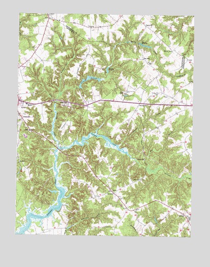
Haynesville, VA USGS Topographic Map
Click on map above to begin viewing in our Map Viewer.

This topographic map contains these locations and features:
Feature Name Type Latitude Longitude GNIS ID View Map
Bald Eagle GullyValleyN37.9327°W76.7251°1791290View Map
Belle VilleBuildingN37.9707°W76.7441°1791291View Map
Beulah CemeteryCemeteryN37.9996°W76.7283°1791371View Map
Beulah ChurchChurchN37.9996°W76.7283°1463275View Map
Bladensfield PlantationLocaleN37.9929°W76.7291°1791292View Map
Booker BarBarN37.8985°W76.7172°1478024View Map
Branham Mill AirparkAirportN37.9715°W76.7073°2675630View Map
Branham Mill SwampSwampN37.9504°W76.7221°1463768View Map
Calvary CemeteryCemeteryN37.8896°W76.6644°1791295View Map
Calvary ChurchChurchN37.8896°W76.6641°1464288View Map
Cedar Point LandingLocaleN37.8885°W76.7211°1478029View Map
Church of God of WarsawChurchN37.9497°W76.6998°2520241View Map
Cobham ParkPopulated PlaceN37.9407°W76.7463°1495407View Map
Cobham Park Baptist ChurchChurchN37.9407°W76.7469°1791304View Map
Cobham Park CemeteryCemeteryN37.9401°W76.7472°1791305View Map
Cobham Park School (historical)SchoolN37.9182°W76.7488°1791306View Map
Deep LandingLocaleN37.8771°W76.7422°1478027View Map
District 1CivilN37.8779°W76.6719°1927190View Map
District 2CivilN37.9643°W76.7051°1927211View Map
Drinking SwampStreamN37.9260°W76.6769°1465958View Map
Drinking Swamp BridgeBridgeN37.9382°W76.6605°1791308View Map
Emmanuel CemeteryCemeteryN37.8954°W76.6758°1466278View Map
Emmanuel Episcopal Church (historical)ChurchN37.8954°W76.6763°1791310View Map
EmmertonPopulated PlaceN37.8993°W76.6797°1495510View Map
Farnham CemeteryCemeteryN37.8862°W76.6252°1791311View Map
Farnham ChurchChurchN37.8860°W76.6252°1791312View Map
Folly NeckCapeN37.8757°W76.7277°1791314View Map
Folly School (historical)SchoolN37.8793°W76.7136°1791315View Map
Gardy Mill (historical)LocaleN37.9668°W76.6866°1791316View Map
Gardys MillpondReservoirN37.9686°W76.6861°1466991View Map
Garlands DamDamN37.9585°W76.7058°1490786View Map
Garlands Mill (historical)LocaleN37.9585°W76.7061°1791317View Map
Garlands MillpondReservoirN37.9641°W76.6984°1502020View Map
Good Shepherd MissionChurchN37.9557°W76.6725°1791318View Map
HaynesvillePopulated PlaceN37.9501°W76.6625°1467865View Map
Haynesville Correctional CenterBuildingN37.9555°W76.6690°2519582View Map
Haynesville Correctional Center Unit 17BuildingN37.9555°W76.6734°2767100View Map
Haynesville Post OfficePost OfficeN37.9499°W76.6643°2519618View Map
Haynesville School (historical)SchoolN37.9579°W76.6594°1791320View Map
Hogans HillSummitN37.9935°W76.6647°1791413View Map
Hogans HillPopulated PlaceN37.9937°W76.6586°1477418View Map
Hogans Mill DamDamN37.9837°W76.6638°1490793View Map
Hogans MillpondReservoirN37.9828°W76.6598°1502038View Map
Indian FieldPopulated PlaceN37.9485°W76.7166°1495740View Map
Jerusalem CemeteryCemeteryN37.9004°W76.6811°1791322View Map
Jerusalem ChurchChurchN37.9001°W76.6808°1468709View Map
KennardPopulated PlaceN37.9157°W76.7477°1468949View Map
Little Totuskey CreekStreamN37.9246°W76.7197°1469674View Map
LyellsPopulated PlaceN37.9971°W76.7288°1477507View Map
Lyells ChapelChurchN37.9729°W76.6575°1469945View Map
Lyells Chapel CemeteryCemeteryN37.9732°W76.6575°1791324View Map
Marshy SwampStreamN37.9543°W76.7194°1470121View Map
Mill BranchStreamN37.9132°W76.6572°1470469View Map
Moores MillPopulated PlaceN37.9185°W76.6586°1495963View Map
Mulberry ChurchChurchN37.9071°W76.6611°1471245View Map
North Bend LandingLocaleN37.8935°W76.7163°1478030View Map
Northern Neck Vocational Technical CenterSchoolN37.9447°W76.7478°2464875View Map
Phillips LandingLocaleN37.8871°W76.7363°1480191View Map
Rappahannock High SchoolSchoolN37.9490°W76.7434°1472984View Map
Rich NeckPopulated PlaceN37.9751°W76.6602°1473182View Map
Richmond CountyCivilN37.9371°W76.7297°1480164View Map
Richmond County Elementary SchoolSchoolN37.9455°W76.7447°1779178View Map
Richmond County Intermediate SchoolSchoolN37.9340°W76.7406°1779179View Map
Richmond County Rescue SquadBuildingN37.9500°W76.7479°2331795View Map
Richmond County Volunteer Fire Department Station 2BuildingN37.8837°W76.6251°2331781View Map
Richmond HillSummitN37.9390°W76.7150°1496148View Map
Richmond Hill PlantationLocaleN37.9349°W76.7169°1791346View Map
School LandingLocaleN37.8843°W76.7275°1478028View Map
Shipyard LandingLocaleN37.8826°W76.7419°1478026View Map
SlashPopulated PlaceN37.9754°W76.6283°1477760View Map
State Prison Camp Number 17LocaleN37.9565°W76.6727°1491263View Map
ThreewayPopulated PlaceN37.9926°W76.6991°1477811View Map
Totuskey BridgeBridgeN37.9235°W76.7205°1475796View Map
Totuskey CemeteryCemeteryN37.9551°W76.6505°1791357View Map
Totuskey ChurchChurchN37.9557°W76.6511°1475797View Map
Totuskey Ferry (historical)CrossingN37.9237°W76.7205°1791358View Map
Town of Warsaw Aerated LagoonsLocaleN37.9309°W76.7444°2520571View Map
Virginia State Police Division 1 Area 2 OfficeBuildingN37.9808°W76.7375°2332102View Map
Wilberts CornerPopulated PlaceN37.9801°W76.6397°1496417View Map
Yellowbank LandingLocaleN37.8996°W76.7136°1488848View Map

Note: Coordinates in the location and feature list above are referenced to NAD83 datum.


Copyright (C) 2008-2024 Ryan Niemi / Sunset Dynamics ... All Rights Reserved