TopoQuest Logo
Do you find TopoQuest useful?
Help keep TopoQuest running and adding new maps/features by donating!
Bitcoin:  19c7KJd3qBynnjoSw5npx9KScwjBe4ifkT
Litecoin:  LXs6TkuXGGXo1vDsWCkWVdjQX94eUKd6ui
Home View Maps Find Maps Find Places Resources & Links


Hinton, Iowa Topographic Map

USGS Map Title: Hinton, IA
USGS Map MRC: 42096F3
DRG (GeoTIFF) Download: o42096f3.tif


Neighboring USGS Topographic Map Quads:


  Ireton SW, IA  
42096G4
 

  Brunsville, IA  
42096G3
 

  Le Mars, IA  
42096G2
 

  Millnerville, IA  
42096F4
 

  Hinton, IA  
42096F3
 

  Union Center NW, IA  
42096F2
 

  Sioux City North, IA  
42096E4
 

  James, IA  
42096E3
 

  Union Center SW, IA  
42096E2


Map MRC Location:

N43°
W97°
N43°
W96°
H8 H7 H6 H5 H4 H3 H2 H1
G8 G7 G6 G5 G4 G3 G2 G1
F8 F7 F6 F5 F4 F3 F2 F1
E8 E7 E6 E5 E4 E3 E2 E1
D8 D7 D6 D5 D4 D3 D2 D1
C8 C7 C6 C5 C4 C3 C2 C1
B8 B7 B6 B5 B4 B3 B2 B1
A8 A7 A6 A5 A4 A3 A2 A1
N42°
W97°
N42°
W96°

Hinton, IA USGS 1:24K Topographic Map Preview:
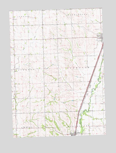
Hinton, IA USGS Topographic Map
Click on map above to begin viewing in our Map Viewer.

This topographic map contains these locations and features:
Feature Name Type Latitude Longitude GNIS ID View Map
Assumption Catholic CemeteryCemeteryN42.7217°W96.2581°1906952View Map
Carter CreekStreamN42.6472°W96.2806°455190View Map
City of MerrillCivilN42.7206°W96.2525°2395103View Map
Ellendale Post Office (historical)Post OfficeN42.7128°W96.3703°1906816View Map
Farmers Co-operative ElevatorLocaleN42.6278°W96.2917°1906943View Map
Grace Evangelical ChurchChurchN42.6278°W96.2917°1906944View Map
Hillside CemeteryCemeteryN42.7292°W96.2547°457508View Map
Hillview Recreation AreaParkN42.6417°W96.3253°1906793View Map
HintonPopulated PlaceN42.6278°W96.2917°457521View Map
HintonLocaleN42.6278°W96.2914°1906947View Map
Hinton AmbulanceBuildingN42.6268°W96.2934°2599694View Map
Hinton Elementary SchoolSchoolN42.6258°W96.2965°2719786View Map
Hinton Fire DepartmentBuildingN42.6268°W96.2934°1906945View Map
Hinton Middle SchoolSchoolN42.6254°W96.2964°2719787View Map
Hinton Post OfficePost OfficeN42.6278°W96.2917°1906946View Map
Kissinger Elementary SchoolSchoolN42.7192°W96.2555°1906903View Map
Liberty SchoolSchoolN42.6928°W96.3686°458330View Map
Melbourne CemeteryCemeteryN42.6555°W96.2517°458952View Map
Melbourne ChurchChurchN42.6492°W96.2678°458953View Map
Melbourne Post Office (historical)Post OfficeN42.6500°W96.2534°1906808View Map
Merrill Police DepartmentBuildingN42.7194°W96.2557°1906896View Map
Merrill Public LibraryBuildingN42.7180°W96.2514°1906895View Map
PotosiaPopulated PlaceN42.6636°W96.3720°464094View Map
Potosia Post Office (historical)Post OfficeN42.6636°W96.3720°1906800View Map
Rosbach Post Office (historical)Post OfficeN42.7367°W96.3709°466475View Map
Saint Johns Lutheran ChurchChurchN42.7230°W96.2531°1906902View Map
Saint Joseph Catholic ChurchChurchN42.7217°W96.2531°1906901View Map
Saint Joseph CemeteryCemeteryN42.7414°W96.3709°461094View Map
Saint Joseph ChurchChurchN42.7136°W96.3703°461103View Map
Saint Paul ChurchChurchN42.7494°W96.3314°461280View Map
Saint Pauls Lutheran CemeteryCemeteryN42.7484°W96.3315°1906975View Map
Township of PlymouthCivilN42.6921°W96.2724°468551View Map
United Methodist ChurchChurchN42.7200°W96.2514°1906900View Map
United Methodist ChurchChurchN42.6255°W96.2939°1906948View Map
WrenPopulated PlaceN42.6455°W96.2864°464811View Map

Note: Coordinates in the location and feature list above are referenced to NAD83 datum.


Copyright (C) 2008-2024 Ryan Niemi / Sunset Dynamics ... All Rights Reserved