TopoQuest Logo
Do you find TopoQuest useful?
Help keep TopoQuest running and adding new maps/features by donating!
Bitcoin:  19c7KJd3qBynnjoSw5npx9KScwjBe4ifkT
Litecoin:  LXs6TkuXGGXo1vDsWCkWVdjQX94eUKd6ui
Home View Maps Find Maps Find Places Resources & Links


Kermit, Texas Topographic Map

USGS Map Title: Kermit, TX
USGS Map MRC: 31103G1
DRG (GeoTIFF) Download: o31103g1.tif


Neighboring USGS Topographic Map Quads:


  Kermit NW, TX  
31103H2
 

  Vesrue, TX  
31103H1
 

  Notrees NW, TX  
31102H8
 

  Wink North, TX  
31103G2
 

  Kermit, TX  
31103G1
 

  Wheeler Ranch, TX  
31102G8
 

  Wink South, TX  
31103F2
 

  Pyote NE, TX  
31103F1
 

  China Ranch, TX  
31102F8


Map MRC Location:

N32°
W104°
N32°
W103°
H8 H7 H6 H5 H4 H3 H2 H1
G8 G7 G6 G5 G4 G3 G2 G1
F8 F7 F6 F5 F4 F3 F2 F1
E8 E7 E6 E5 E4 E3 E2 E1
D8 D7 D6 D5 D4 D3 D2 D1
C8 C7 C6 C5 C4 C3 C2 C1
B8 B7 B6 B5 B4 B3 B2 B1
A8 A7 A6 A5 A4 A3 A2 A1
N31°
W104°
N31°
W103°

Kermit, TX USGS 1:24K Topographic Map Preview:
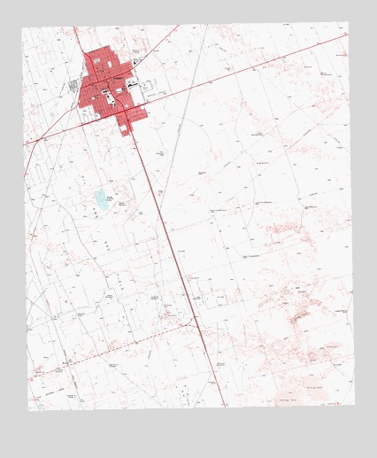
Kermit, TX USGS Topographic Map
Click on map above to begin viewing in our Map Viewer.

This topographic map contains these locations and features:
Feature Name Type Latitude Longitude GNIS ID View Map
Auter WindmillLocaleN31.7871°W103.0918°1351349View Map
Church of ChristChurchN31.8579°W103.0913°2024846View Map
Church of GodChurchN31.8523°W103.1002°2024847View Map
Church of God in ChristChurchN31.8546°W103.1060°2024848View Map
City of KermitCivilN31.8540°W103.0923°2411537View Map
Community ChurchChurchN31.8557°W103.0924°2024849View Map
Crawford WindmillLocaleN31.7862°W103.0774°1355332View Map
East Primary SchoolSchoolN31.8511°W103.0900°2009266View Map
Hogg WindmillLocaleN31.7807°W103.0032°1359383View Map
Horse WindmillLocaleN31.7635°W103.1118°1359619View Map
Hugh WindmillLocaleN31.8293°W103.0360°1359793View Map
KermitPopulated PlaceN31.8576°W103.0927°1360598View Map
Kermit City HallBuildingN31.8557°W103.0973°2753831View Map
Kermit City ParkParkN31.8415°W103.0871°2029041View Map
Kermit Elementary SchoolSchoolN31.8634°W103.0809°1365870View Map
Kermit High SchoolSchoolN31.8560°W103.0827°2009267View Map
Kermit Junior High SchoolSchoolN31.8549°W103.0820°2009268View Map
Kermit Police DepartmentBuildingN31.8557°W103.0973°2750608View Map
Kermit Post OfficePost OfficeN31.8601°W103.0949°2731312View Map
Kermit Volunteer Fire DepartmentBuildingN31.8556°W103.0977°2551984View Map
Kermit WindmillLocaleN31.8168°W103.0891°1360599View Map
Little Sand WindmillLocaleN31.8165°W103.0368°1361461View Map
Lowe WindmillLocaleN31.7860°W103.0585°1361898View Map
North Crow WindmillLocaleN31.8140°W103.0538°1364030View Map
Northside Baptist ChurchChurchN31.8610°W103.0968°2024959View Map
Plaza ParkParkN31.8637°W103.0963°1365391View Map
Purple Sage Elementary SchoolSchoolN31.8529°W103.0918°2009269View Map
Robinson Airport (historical)AirportN31.8585°W103.0757°1387009View Map
South Crow WindmillLocaleN31.7990°W103.0421°1368665View Map
South Rusk WindmillLocaleN31.8579°W103.0110°1368759View Map
South Sand WindmillLocaleN31.8385°W103.0332°1368764View Map
South WindmillLocaleN31.8148°W103.0185°1368821View Map
Two Section WindmillLocaleN31.7646°W103.0941°1370394View Map
Vest WindmillLocaleN31.8329°W103.0710°1370626View Map
Walton ParkParkN31.8537°W103.0877°1370838View Map
Wieseman WindmillLocaleN31.7640°W103.0529°1371492View Map
Winkler CountyCivilN31.8500°W103.0482°1384033View Map
Winkler County Constable's Office Precincts 1 and 4BuildingN31.8571°W103.0937°2750788View Map
Winkler County Emergency Medical ServicesBuildingN31.8408°W103.0887°2655781View Map
Winkler County Emergency Medical ServicesBuildingN31.8499°W103.0903°2656199View Map
Winkler County JailBuildingN31.8414°W103.0892°2738852View Map
Winkler County Memorial HospitalHospitalN31.8493°W103.0902°2718187View Map
Winkler County ParkParkN31.8546°W103.0782°2029887View Map
Winkler County Sheriff's OfficeBuildingN31.8416°W103.0893°2750529View Map

Note: Coordinates in the location and feature list above are referenced to NAD83 datum.


Copyright (C) 2008-2024 Ryan Niemi / Sunset Dynamics ... All Rights Reserved