TopoQuest Logo
Do you find TopoQuest useful?
Help keep TopoQuest running and adding new maps/features by donating!
Bitcoin:  19c7KJd3qBynnjoSw5npx9KScwjBe4ifkT
Litecoin:  LXs6TkuXGGXo1vDsWCkWVdjQX94eUKd6ui
Home View Maps Find Maps Find Places Resources & Links


Keytesville, Missouri Topographic Map

USGS Map Title: Keytesville, MO
USGS Map MRC: 39092D8
DRG (GeoTIFF) Download: o39092d8.tif


Neighboring USGS Topographic Map Quads:


  Indian Grove, MO  
39093E1
 

  Mike, MO  
39092E8
 

  Bynumville, MO  
39092E7
 

  Brunswick East, MO  
39093D1
 

  Keytesville, MO  
39092D8
 

  Salisbury, MO  
39092D7
 

  New Frankfort, MO  
39093C1
 

  Cambridge, MO  
39092C8
 

  Forest Green, MO  
39092C7


Map MRC Location:

N40°
W93°
N40°
W92°
H8 H7 H6 H5 H4 H3 H2 H1
G8 G7 G6 G5 G4 G3 G2 G1
F8 F7 F6 F5 F4 F3 F2 F1
E8 E7 E6 E5 E4 E3 E2 E1
D8 D7 D6 D5 D4 D3 D2 D1
C8 C7 C6 C5 C4 C3 C2 C1
B8 B7 B6 B5 B4 B3 B2 B1
A8 A7 A6 A5 A4 A3 A2 A1
N39°
W93°
N39°
W92°

Keytesville, MO USGS 1:24K Topographic Map Preview:
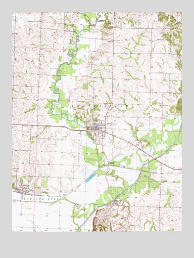
Keytesville, MO USGS Topographic Map
Click on map above to begin viewing in our Map Viewer.

This topographic map contains these locations and features:
Feature Name Type Latitude Longitude GNIS ID View Map
Agee School (historical)SchoolN39.4556°W92.9235°766188View Map
Allen School (historical)SchoolN39.4586°W92.9813°734074View Map
Bell School (historical)SchoolN39.4920°W92.9063°734076View Map
Bennett CemeteryCemeteryN39.4855°W92.8884°2681414View Map
Bennett ChurchChurchN39.4847°W92.8888°713949View Map
Bethel ChurchChurchN39.4836°W92.9257°714068View Map
Chariton County Sheriff's OfficeBuildingN39.4325°W92.9419°2752300View Map
City of KeytesvilleCivilN39.4313°W92.9370°2395525View Map
Cotterell School (historical)SchoolN39.4625°W92.9269°734078View Map
Cottonwood CreekStreamN39.4950°W92.9377°716367View Map
DaltonPopulated PlaceN39.3975°W92.9899°716651View Map
Dalton CemeteryCemeteryN39.4006°W92.9901°2681416View Map
Eisberg Farms AirportAirportN39.4100°W92.8913°2770273View Map
Horseshoe LakeLakeN39.3888°W92.9508°719872View Map
KeytesvillePopulated PlaceN39.4345°W92.9382°720566View Map
KeytesvilleLocaleN39.4128°W92.9294°720567View Map
Keytesville City CemeteryCemeteryN39.4367°W92.9421°2681417View Map
Keytesville Fire DepartmentBuildingN39.4342°W92.9377°2621700View Map
Keytesville Police DepartmentBuildingN39.4346°W92.9392°2752177View Map
Keytesville Post OfficePost OfficeN39.4347°W92.9396°2782630View Map
Long BranchStreamN39.4917°W92.9441°721513View Map
Long CreekStreamN39.4147°W92.8994°721540View Map
Mussel ForkStreamN39.3986°W92.9171°723088View Map
O'Bryan School (historical)SchoolN39.4761°W92.8985°734077View Map
Price BridgeBridgeN39.3922°W92.9263°755371View Map
Puzzle CreekStreamN39.4064°W92.9060°725012View Map
Scribner School (historical)SchoolN39.4542°W92.8896°734079View Map
Swain School (historical)SchoolN39.4903°W92.9708°734073View Map
Taylor School (historical)SchoolN39.4050°W92.9641°734075View Map
Town of DaltonCivilN39.3976°W92.9921°2396676View Map
Township of Bowling GreenCivilN39.3759°W92.9955°766457View Map
Township of KeytesvilleCivilN39.4515°W92.9285°766463View Map
Varner CemeteryCemeteryN39.4395°W92.8905°728147View Map

Note: Coordinates in the location and feature list above are referenced to NAD83 datum.


Copyright (C) 2008-2024 Ryan Niemi / Sunset Dynamics ... All Rights Reserved