TopoQuest Logo
Do you find TopoQuest useful?
Help keep TopoQuest running and adding new maps/features by donating!
Bitcoin:  19c7KJd3qBynnjoSw5npx9KScwjBe4ifkT
Litecoin:  LXs6TkuXGGXo1vDsWCkWVdjQX94eUKd6ui
Home View Maps Find Maps Find Places Resources & Links


Kingsley, Iowa Topographic Map

USGS Map Title: Kingsley, IA
USGS Map MRC: 42095E8
DRG (GeoTIFF) Download: o42095e8.tif


Neighboring USGS Topographic Map Quads:


  Union Center, IA  
42096F1
 

  Kingsley NW, IA  
42095F8
 

  Fielding, IA  
42095F7
 

  Union Center SE, IA  
42096E1
 

  Kingsley, IA  
42095E8
 

  Pierson, IA  
42095E7
 

  Moville, IA  
42096D1
 

  Correctionville NW, IA  
42095D8
 

  Correctionville, IA  
42095D7


Map MRC Location:

N43°
W96°
N43°
W95°
H8 H7 H6 H5 H4 H3 H2 H1
G8 G7 G6 G5 G4 G3 G2 G1
F8 F7 F6 F5 F4 F3 F2 F1
E8 E7 E6 E5 E4 E3 E2 E1
D8 D7 D6 D5 D4 D3 D2 D1
C8 C7 C6 C5 C4 C3 C2 C1
B8 B7 B6 B5 B4 B3 B2 B1
A8 A7 A6 A5 A4 A3 A2 A1
N42°
W96°
N42°
W95°

Kingsley, IA USGS 1:24K Topographic Map Preview:
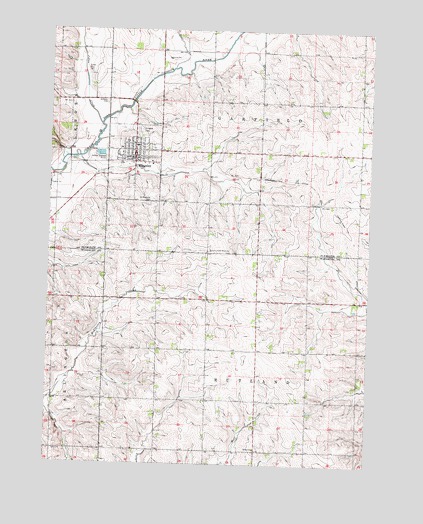
Kingsley, IA USGS Topographic Map
Click on map above to begin viewing in our Map Viewer.

This topographic map contains these locations and features:
Feature Name Type Latitude Longitude GNIS ID View Map
Brookside Golf ClubLocaleN42.5850°W95.9734°1906909View Map
Church of the BrethrenChurchN42.5908°W95.9686°1906915View Map
Church of the Brethren CemeteryCemeteryN42.5612°W95.9293°1906937View Map
City of KingsleyCivilN42.5865°W95.9679°2395537View Map
Colonial Manor of KingsleyHospitalN42.5908°W95.9725°1906906View Map
Deer CreekStreamN42.6139°W95.9528°455859View Map
Elkhorn CemeteryCemeteryN42.6041°W95.9783°456306View Map
Farmers Cooperative ElevatorLocaleN42.5867°W95.9683°1906910View Map
First Lutheran ChurchChurchN42.5922°W95.9675°1906916View Map
Johns CreekStreamN42.5978°W95.9806°457961View Map
KingsleyPopulated PlaceN42.5883°W95.9675°458095View Map
Kingsley - Pierson Elementary SchoolSchoolN42.5862°W95.9795°1906911View Map
Kingsley - Pierson High SchoolSchoolN42.5862°W95.9791°2719713View Map
Kingsley Baptist ChurchChurchN42.5897°W95.9595°1906918View Map
Kingsley CemeteryCemeteryN42.5964°W95.9658°458096View Map
Kingsley Chiropractic ClinicHospitalN42.5880°W95.9683°1906905View Map
Kingsley Fire DepartmentBuildingN42.5870°W95.9636°2577516View Map
Kingsley Medical ClinicHospitalN42.5875°W95.9670°1906908View Map
Kingsley Nursing and Rehabilitation CenterHospitalN42.5908°W95.9725°1906907View Map
Kingsley Post OfficePost OfficeN42.5886°W95.9678°1906912View Map
Kingsley Public LibraryBuildingN42.5894°W95.9678°1906913View Map
Lozier Post Office (historical)Post OfficeN42.5472°W95.9003°1995508View Map
Northwest Foot and Ankle AssociationHospitalN42.5883°W95.9678°1906904View Map
Saint Michaels CemeteryCemeteryN42.5758°W95.9603°461229View Map
Saint Michaels ChurchChurchN42.5886°W95.9725°1906917View Map
Salem ChurchChurchN42.5044°W95.9186°461368View Map
Township of GarfieldCivilN42.6048°W95.9188°467898View Map
Township of RutlandCivilN42.5179°W95.9189°468649View Map
United Methodist ChurchChurchN42.5903°W95.9686°1906914View Map

Note: Coordinates in the location and feature list above are referenced to NAD83 datum.


Copyright (C) 2008-2024 Ryan Niemi / Sunset Dynamics ... All Rights Reserved