TopoQuest Logo
Do you find TopoQuest useful?
Help keep TopoQuest running and adding new maps/features by donating!
Bitcoin:  19c7KJd3qBynnjoSw5npx9KScwjBe4ifkT
Litecoin:  LXs6TkuXGGXo1vDsWCkWVdjQX94eUKd6ui
Home View Maps Find Maps Find Places Resources & Links


Lake Butler, Florida Topographic Map

USGS Map Title: Lake Butler, FL
USGS Map MRC: 30082A3
DRG (GeoTIFF) Download: o30082a3.tif


Neighboring USGS Topographic Map Quads:


  Olustee, FL  
30082B4
 

  Sanderson South, FL  
30082B3
 

  Manning, FL  
30082B2
 

  Lulu, FL  
30082A4
 

  Lake Butler, FL  
30082A3
 

  Raiford, FL  
30082A2
 

  Worthington Springs, FL  
29082H4
 

  Brooker, FL  
29082H3
 

  Sampson, FL  
29082H2


Map MRC Location:

N31°
W83°
N31°
W82°
H8 H7 H6 H5 H4 H3 H2 H1
G8 G7 G6 G5 G4 G3 G2 G1
F8 F7 F6 F5 F4 F3 F2 F1
E8 E7 E6 E5 E4 E3 E2 E1
D8 D7 D6 D5 D4 D3 D2 D1
C8 C7 C6 C5 C4 C3 C2 C1
B8 B7 B6 B5 B4 B3 B2 B1
A8 A7 A6 A5 A4 A3 A2 A1
N30°
W83°
N30°
W82°

Lake Butler, FL USGS 1:24K Topographic Map Preview:
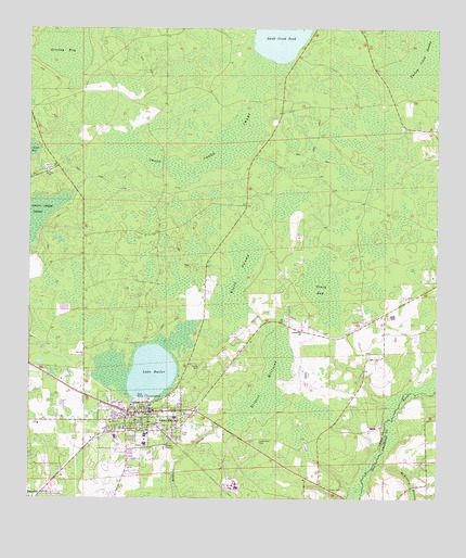
Lake Butler, FL USGS Topographic Map
Click on map above to begin viewing in our Map Viewer.

This topographic map contains these locations and features:
Feature Name Type Latitude Longitude GNIS ID View Map
Black SwampSwampN30.0567°W82.3117°278942View Map
Butler LakeLakeN30.0339°W82.3372°279740View Map
City of Lake ButlerCivilN30.0180°W82.3422°2404858View Map
Cypress Pointe Mobile Home ParkPopulated PlaceN30.0239°W82.3516°2450107View Map
DanvillePopulated PlaceN30.0014°W82.3712°294739View Map
Dekle CemeteryCemeteryN30.0138°W82.3421°281471View Map
First Baptist ChurchChurchN30.0235°W82.3366°2450108View Map
First Christian ChurchChurchN30.0241°W82.3395°2450109View Map
First United Methodist ChurchChurchN30.0232°W82.3413°2450110View Map
Goldies Mobile Home ParkPopulated PlaceN30.0106°W82.3419°2450103View Map
Granny BaySwampN30.1207°W82.3634°305747View Map
JohnstownPopulated PlaceN30.0444°W82.2721°300830View Map
Lake ButlerPopulated PlaceN30.0227°W82.3396°285222View Map
Lake Butler Church of GodChurchN30.0199°W82.3433°2450111View Map
Lake Butler Elementary SchoolSchoolN30.0170°W82.3481°299406View Map
Lake Butler Hospital Hand Surgical CenterHospitalN30.0227°W82.3269°298955View Map
Lake Butler Middle SchoolSchoolN30.0176°W82.3393°299407View Map
Lake Butler Post OfficePost OfficeN30.0240°W82.3402°2768003View Map
Lake Butler Volunteer Fire DepartmentBuildingN30.0197°W82.3454°2644164View Map
Lakeside ParkLocaleN30.0264°W82.3373°285308View Map
Little Rock CemeteryCemeteryN30.0155°W82.3043°285789View Map
Mac's Mobile Home ParkPopulated PlaceN30.0138°W82.3440°2450104View Map
Maines Devoe Mobile Home ParkPopulated PlaceN30.0187°W82.3481°2450105View Map
McKinney BranchStreamN30.0100°W82.2679°286633View Map
Mount Zion ChurchChurchN30.0869°W82.3690°287347View Map
New River Volunteer Fire Department Station 3BuildingN30.0037°W82.2542°2644678View Map
Piney BaySwampN30.0561°W82.2844°288946View Map
Richard MillpondSwampN30.0316°W82.3019°289674View Map
Swift Creek PondLakeN30.1245°W82.2978°291965View Map
Trinity Baptist ChurchChurchN30.0178°W82.3415°2450113View Map
Union CountyCivilN30.0438°W82.3714°306913View Map
Union County Adult High SchoolSchoolN30.0177°W82.3366°299408View Map
Union County Department of Emergency ServicesBuildingN30.0181°W82.3313°2644416View Map
Union County Public LibraryBuildingN30.0233°W82.3401°2450102View Map
Union County Sheriff's OfficeBuildingN30.0234°W82.3386°2755965View Map
Varnes CemeteryCemeteryN30.0352°W82.3223°292738View Map
Virginias Trailer ParkPopulated PlaceN30.0166°W82.3432°2450106View Map

Note: Coordinates in the location and feature list above are referenced to NAD83 datum.


Copyright (C) 2008-2024 Ryan Niemi / Sunset Dynamics ... All Rights Reserved