TopoQuest Logo
Do you find TopoQuest useful?
Help keep TopoQuest running and adding new maps/features by donating!
Bitcoin:  19c7KJd3qBynnjoSw5npx9KScwjBe4ifkT
Litecoin:  LXs6TkuXGGXo1vDsWCkWVdjQX94eUKd6ui
Home View Maps Find Maps Find Places Resources & Links


Lake Kerr, Florida Topographic Map

USGS Map Title: Lake Kerr, FL
USGS Map MRC: 29081C7
DRG (GeoTIFF) Download: o29081c7.tif


Neighboring USGS Topographic Map Quads:


  Eureka Dam, FL  
29081D8
 

  Lake Delancy, FL  
29081D7
 

  Welaka, FL  
29081D6
 

  Fort McCoy, FL  
29081C8
 

  Lake Kerr, FL  
29081C7
 

  Salt Springs, FL  
29081C6
 

  Lynne, FL  
29081B8
 

  Halfmoon Lake, FL  
29081B7
 

  Juniper Springs, FL  
29081B6


Map MRC Location:

N30°
W82°
N30°
W81°
H8 H7 H6 H5 H4 H3 H2 H1
G8 G7 G6 G5 G4 G3 G2 G1
F8 F7 F6 F5 F4 F3 F2 F1
E8 E7 E6 E5 E4 E3 E2 E1
D8 D7 D6 D5 D4 D3 D2 D1
C8 C7 C6 C5 C4 C3 C2 C1
B8 B7 B6 B5 B4 B3 B2 B1
A8 A7 A6 A5 A4 A3 A2 A1
N29°
W82°
N29°
W81°

Lake Kerr, FL USGS 1:24K Topographic Map Preview:
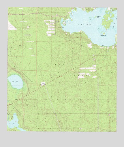
Lake Kerr, FL USGS Topographic Map
Click on map above to begin viewing in our Map Viewer.

This topographic map contains these locations and features:
Feature Name Type Latitude Longitude GNIS ID View Map
Eureka Lookout TowerTowerN29.3553°W81.8512°305644View Map
First Baptist CemeteryCemeteryN29.3333°W81.7542°2380991View Map
First Baptist Church of Salt SpringsChurchN29.3344°W81.7542°306871View Map
Florida Gas Transmission Company Radio TowerTowerN29.2969°W81.8353°2380990View Map
Hulls CreekStreamN29.2566°W81.8748°305842View Map
Kauffmans IslandIslandN29.3641°W81.7790°305897View Map
Kerr CityPopulated PlaceN29.3703°W81.7831°305904View Map
Kerr IslandIslandN29.3480°W81.8318°307808View Map
Lake EatonLakeN29.2589°W81.8675°305619View Map
Lake Eaton CampgroundLocaleN29.2541°W81.8645°307047View Map
Lake KerrLakeN29.3552°W81.7800°305905View Map
Lake Kerr KeyIslandN29.3489°W81.7642°305922View Map
Little Lake KerrLakeN29.3593°W81.7524°305964View Map
Moorehead ParkParkN29.3553°W81.8120°306058View Map
Mud LakeLakeN29.3001°W81.8651°306084View Map
New Beginnings Church of GodChurchN29.3339°W81.7572°2380989View Map
North Hunt Information CenterLocaleN29.3661°W81.8204°307022View Map
Petes IslandIslandN29.3611°W81.8037°306214View Map
Point PleasantPopulated PlaceN29.3597°W81.8090°306240View Map
Salt Springs IslandIslandN29.3136°W81.7937°307073View Map
Youth Camp Recreation SiteLocaleN29.2641°W81.8687°307048View Map

Note: Coordinates in the location and feature list above are referenced to NAD83 datum.


Copyright (C) 2008-2024 Ryan Niemi / Sunset Dynamics ... All Rights Reserved