TopoQuest Logo
Do you find TopoQuest useful?
Help keep TopoQuest running and adding new maps/features by donating!
Bitcoin:  19c7KJd3qBynnjoSw5npx9KScwjBe4ifkT
Litecoin:  LXs6TkuXGGXo1vDsWCkWVdjQX94eUKd6ui
Home View Maps Find Maps Find Places Resources & Links


Lima, Montana Topographic Map

USGS Map Title: Lima, MT
USGS Map MRC: 44112F5
DRG (GeoTIFF) Download: o44112f5.tif


Neighboring USGS Topographic Map Quads:


  Briggs Ranch, MT  
44112G6
 

  Rock Island Ranch, MT  
44112G5
 

  Vinegar Hill, MT  
44112G4
 

  Dell, MT  
44112F6
 

  Lima, MT  
44112F5
 

  Henry Gulch, MT  
44112F4
 

  Gallagher Gulch, MT  
44112E6
 

  Lima Peaks, MT  
44112E5
 

  Snowline, MT  
44112E4


Map MRC Location:

N45°
W113°
N45°
W112°
H8 H7 H6 H5 H4 H3 H2 H1
G8 G7 G6 G5 G4 G3 G2 G1
F8 F7 F6 F5 F4 F3 F2 F1
E8 E7 E6 E5 E4 E3 E2 E1
D8 D7 D6 D5 D4 D3 D2 D1
C8 C7 C6 C5 C4 C3 C2 C1
B8 B7 B6 B5 B4 B3 B2 B1
A8 A7 A6 A5 A4 A3 A2 A1
N44°
W113°
N44°
W112°

Lima, MT USGS 1:24K Topographic Map Preview:
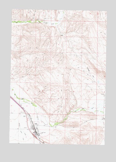
Lima, MT USGS Topographic Map
Click on map above to begin viewing in our Map Viewer.

This topographic map contains these locations and features:
Feature Name Type Latitude Longitude GNIS ID View Map
12S08W32DAAA01 WellWellN44.7463°W112.5945°807205View Map
14S08W04CCDA01 WellWellN44.6399°W112.5889°807135View Map
14S08W05ACB_01 WellWellN44.6474°W112.6025°807136View Map
Alder CreekStreamN44.6321°W112.5867°778919View Map
Antelope FlatFlatN44.6910°W112.5211°768298View Map
Birch CreekStreamN44.6388°W112.6117°779926View Map
Great Northern Railway Historical MarkerParkN44.6255°W112.5814°1813139View Map
Interchange 15CrossingN44.6319°W112.5925°1797216View Map
Junction CreekStreamN44.6599°W112.5931°785606View Map
LimaPopulated PlaceN44.6369°W112.5920°773340View Map
LimaLocaleN44.6357°W112.5903°1797303View Map
Lima City ParkParkN44.6346°W112.5897°1797164View Map
Lima Community ChurchChurchN44.6369°W112.5920°1797151View Map
Lima MissionChurchN44.6369°W112.5920°1797149View Map
Lima Post OfficePost OfficeN44.6352°W112.5920°1797114View Map
Lima Rural Volunteer Fire DepartmentBuildingN44.6379°W112.5929°1797066View Map
Lima SchoolSchoolN44.6349°W112.5927°1797120View Map
Mount Moriah CemeteryCemeteryN44.6355°W112.5844°774423View Map
Red Rock (historical)LocaleN44.6527°W112.5925°1797291View Map
Sportsman Inn and RV ParkLocaleN44.6369°W112.5920°1797188View Map
The Church of Jesus Christ of Latter Day SaintsChurchN44.6369°W112.5920°1797150View Map
Town of LimaCivilN44.6384°W112.5919°2412896View Map

Note: Coordinates in the location and feature list above are referenced to NAD83 datum.


Copyright (C) 2008-2024 Ryan Niemi / Sunset Dynamics ... All Rights Reserved