TopoQuest Logo
Do you find TopoQuest useful?
Help keep TopoQuest running and adding new maps/features by donating!
Bitcoin:  19c7KJd3qBynnjoSw5npx9KScwjBe4ifkT
Litecoin:  LXs6TkuXGGXo1vDsWCkWVdjQX94eUKd6ui
Home View Maps Find Maps Find Places Resources & Links


Little Soldier Mountain, Idaho Topographic Map

USGS Map Title: Little Soldier Mountain, ID
USGS Map MRC: 44115F1
DRG (GeoTIFF) Download: o44115f1.tif


Neighboring USGS Topographic Map Quads:


  Big Baldy, ID  
44115G2
 

  Pungo Mountain, ID  
44115G1
 

  Norton Ridge, ID  
44114G8
 

  Artillery Dome, ID  
44115F2
 

  Little Soldier Mountain, ID  
44115F1
 

  Sliderock Ridge, ID  
44114F8
 

  Soldier Creek, ID  
44115E2
 

  Greyhound Mountain, ID  
44115E1
 

  Pinyon Peak, ID  
44114E8


Map MRC Location:

N45°
W116°
N45°
W115°
H8 H7 H6 H5 H4 H3 H2 H1
G8 G7 G6 G5 G4 G3 G2 G1
F8 F7 F6 F5 F4 F3 F2 F1
E8 E7 E6 E5 E4 E3 E2 E1
D8 D7 D6 D5 D4 D3 D2 D1
C8 C7 C6 C5 C4 C3 C2 C1
B8 B7 B6 B5 B4 B3 B2 B1
A8 A7 A6 A5 A4 A3 A2 A1
N44°
W116°
N44°
W115°

Little Soldier Mountain, ID USGS 1:24K Topographic Map Preview:
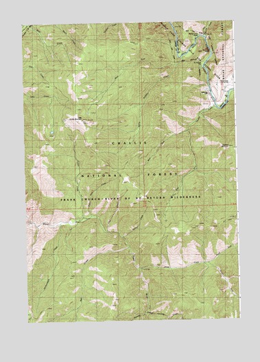
Little Soldier Mountain, ID USGS Topographic Map
Click on map above to begin viewing in our Map Viewer.

This topographic map contains these locations and features:
Feature Name Type Latitude Longitude GNIS ID View Map
Bell CreekStreamN44.6560°W115.0643°377322View Map
Cabin CreekStreamN44.6674°W115.0932°378631View Map
Chet CreekStreamN44.6624°W115.0768°379245View Map
East Fork Thomas CreekStreamN44.7049°W115.0279°381185View Map
Hardscrabble CreekStreamN44.6660°W115.1051°382906View Map
Little Soldier CampgroundLocaleN44.7369°W115.0323°394455View Map
Little Soldier CreekStreamN44.7360°W115.0298°384959View Map
Little Soldier MountainSummitN44.7094°W115.0909°384960View Map
Lucinda CreekStreamN44.6282°W115.0559°386259View Map
Marble CreekStreamN44.7438°W115.0170°386455View Map
Marble Creek CampgroundLocaleN44.7430°W115.0176°394465View Map
Marble Creek CampgroundLocaleN44.7444°W115.0226°394466View Map
Marble Creek Number Two CampsiteLocaleN44.7430°W115.0176°394464View Map
Marble Creek RapidRapidsN44.7440°W115.0201°2785555View Map
Middle Fork LodgeLocaleN44.7196°W115.0157°376199View Map
North Fork Sheep CreekStreamN44.6491°W115.0182°387777View Map
Potter Vine CreekStreamN44.6691°W115.0865°388823View Map
Scarface MountainSummitN44.6977°W115.0045°390003View Map
Sheep CreekStreamN44.6463°W115.0579°390187View Map
Sheep Creek BridgeBridgeN44.6469°W115.0576°394458View Map
Ski Jump RapidRapidsN44.7380°W115.0147°376200View Map
South Fork Sheep CreekStreamN44.6488°W115.0182°391023View Map
Spruce CreekStreamN44.6599°W115.0684°391240View Map
State Land CampgroundLocaleN44.7202°W115.0026°394457View Map
Sunflower CampsiteLocaleN44.7299°W115.0187°394456View Map
Sunflower FlatFlatN44.7319°W115.0182°391652View Map
Thomas CreekStreamN44.7146°W115.0118°392019View Map
Thomas Creek AirportAirportN44.7242°W115.0030°400937View Map
West Fork Little Soldier CreekStreamN44.7319°W115.0340°393139View Map
West Fork Thomas CreekStreamN44.7052°W115.0279°393210View Map

Note: Coordinates in the location and feature list above are referenced to NAD83 datum.


Copyright (C) 2008-2024 Ryan Niemi / Sunset Dynamics ... All Rights Reserved