TopoQuest Logo
Do you find TopoQuest useful?
Help keep TopoQuest running and adding new maps/features by donating!
Bitcoin:  19c7KJd3qBynnjoSw5npx9KScwjBe4ifkT
Litecoin:  LXs6TkuXGGXo1vDsWCkWVdjQX94eUKd6ui
Home View Maps Find Maps Find Places Resources & Links


Londonderry, Ohio Topographic Map

USGS Map Title: Londonderry, OH
USGS Map MRC: 39082C7
DRG (GeoTIFF) Download: o39082c7.tif


Neighboring USGS Topographic Map Quads:


  Kingston, OH  
39082D8
 

  Hallsville, OH  
39082D7
 

  Laurelville, OH  
39082D6
 

  Chillicothe East, OH  
39082C8
 

  Londonderry, OH  
39082C7
 

  Ratcliffburg, OH  
39082C6
 

  Waverly North, OH  
39082B8
 

  Richmond Dale, OH  
39082B7
 

  Byer, OH  
39082B6


Map MRC Location:

N40°
W83°
N40°
W82°
H8 H7 H6 H5 H4 H3 H2 H1
G8 G7 G6 G5 G4 G3 G2 G1
F8 F7 F6 F5 F4 F3 F2 F1
E8 E7 E6 E5 E4 E3 E2 E1
D8 D7 D6 D5 D4 D3 D2 D1
C8 C7 C6 C5 C4 C3 C2 C1
B8 B7 B6 B5 B4 B3 B2 B1
A8 A7 A6 A5 A4 A3 A2 A1
N39°
W83°
N39°
W82°

Londonderry, OH USGS 1:24K Topographic Map Preview:
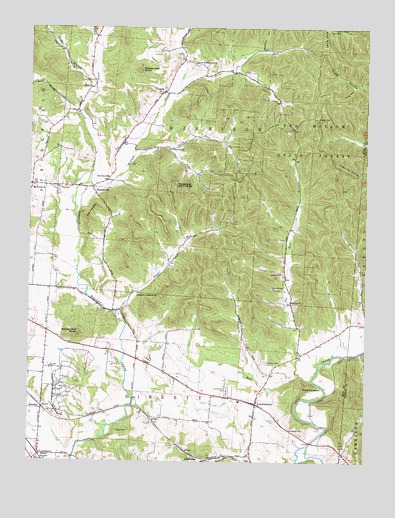
Londonderry, OH USGS Topographic Map
Click on map above to begin viewing in our Map Viewer.

This topographic map contains these locations and features:
Feature Name Type Latitude Longitude GNIS ID View Map
Bluelick RunStreamN39.2748°W82.7743°1066592View Map
Butcher HollowValleyN39.3690°W82.7893°1038561View Map
Chapel CreekStreamN39.3692°W82.8496°1038994View Map
Charleston (historical)Populated PlaceN39.3695°W82.8193°1061265View Map
Charleston CemeteryCemeteryN39.3645°W82.8143°1963457View Map
Claypool CemeteryCemeteryN39.2592°W82.8418°1039151View Map
Cox RunStreamN39.2826°W82.7502°1039426View Map
Cranberry RunStreamN39.2737°W82.7896°1067201View Map
Etam ChurchChurchN39.3576°W82.8530°1040238View Map
Frog HollowValleyN39.3581°W82.7552°1040703View Map
Goshen RunStreamN39.2503°W82.7952°1040979View Map
Harrison Elementary SchoolSchoolN39.3317°W82.8463°1081405View Map
Harrison Township Fire DepartmentBuildingN39.3429°W82.8400°2550383View Map
Jones FordCrossingN39.2678°W82.8360°1063453View Map
Kingdom of Heaven ChurchChurchN39.2984°W82.8346°1042273View Map
Liberty Township Fire DepartmentBuildingN39.2689°W82.8114°2550382View Map
LickskilletPopulated PlaceN39.2501°W82.8096°1062852View Map
Little Walnut CreekStreamN39.3301°W82.8538°1063454View Map
LondonderryPopulated PlaceN39.2667°W82.7904°1061441View Map
Londonderry CemeteryCemeteryN39.2703°W82.8013°1042723View Map
Londonderry Elementary SchoolSchoolN39.2676°W82.7966°1050025View Map
Londonderry Post OfficePost OfficeN39.2667°W82.7902°2043402View Map
MooresvillePopulated PlaceN39.3278°W82.8513°1065053View Map
Mooresville Post Office (historical)Post OfficeN39.3287°W82.8518°2056656View Map
Mount Carmel CemeteryCemeteryN39.3290°W82.8730°1963465View Map
Mount Carmel ChurchChurchN39.3295°W82.8732°1061160View Map
Peecher CemeteryCemeteryN39.2787°W82.7868°1044359View Map
Piny RunStreamN39.3562°W82.8232°1066894View Map
Poe RunStreamN39.2737°W82.7699°1066903View Map
Poe Valley (historical)Populated PlaceN39.2967°W82.7777°1050026View Map
Point LookoutSummitN39.2720°W82.7727°1063455View Map
Rattlesnake KnobSummitN39.2865°W82.8563°1049111View Map
Rattlesnake KnobSummitN39.3626°W82.8349°1049112View Map
RupelsPopulated PlaceN39.2520°W82.8705°1062996View Map
SchooleyPopulated PlaceN39.2656°W82.8699°1065291View Map
Schooley Post Office (historical)Post OfficeN39.2653°W82.8693°2043397View Map
Schooley Station CemeteryCemeteryN39.2637°W82.8657°1963469View Map
Smiths Store (historical)LocaleN39.2876°W82.8680°1050024View Map
Spud RunStreamN39.3384°W82.8363°1046606View Map
Spud Run ChurchChurchN39.3401°W82.8230°1046607View Map
Sugar RunStreamN39.2934°W82.8421°1066990View Map
Tar Hollow State ForestForestN39.3509°W82.7716°1046951View Map
Timmons CemeteryCemeteryN39.3010°W82.7804°1047065View Map
Township of HarrisonCivilN39.3409°W82.8072°1086897View Map
Township of LibertyCivilN39.2712°W82.8400°1086900View Map
True HollowValleyN39.3598°W82.8530°1047176View Map
TucsonPopulated PlaceN39.3565°W82.8260°1063066View Map
Tucson Post Office (historical)Post OfficeN39.3570°W82.8263°2056674View Map
Twin KnobsSummitN39.3192°W82.8527°1049254View Map
United ChurchChurchN39.3042°W82.7821°1047349View Map

Note: Coordinates in the location and feature list above are referenced to NAD83 datum.


Copyright (C) 2008-2024 Ryan Niemi / Sunset Dynamics ... All Rights Reserved