TopoQuest Logo
Do you find TopoQuest useful?
Help keep TopoQuest running and adding new maps/features by donating!
Bitcoin:  19c7KJd3qBynnjoSw5npx9KScwjBe4ifkT
Litecoin:  LXs6TkuXGGXo1vDsWCkWVdjQX94eUKd6ui
Home View Maps Find Maps Find Places Resources & Links


Lost Corner, Arkansas Topographic Map

USGS Map Title: Lost Corner, AR
USGS Map MRC: 35092E7
DRG (GeoTIFF) Download: o35092e7.tif


Neighboring USGS Topographic Map Quads:


  Smyrna, AR  
35092F8
 

  Tilly, AR  
35092F7
 

  Alread, AR  
35092F6
 

  Solo, AR  
35092E8
 

  Lost Corner, AR  
35092E7
 

  Rex, AR  
35092E6
 

  Hector, AR  
35092D8
 

  Jerusalem, AR  
35092D7
 

  Cleveland, AR  
35092D6


Map MRC Location:

N36°
W93°
N36°
W92°
H8 H7 H6 H5 H4 H3 H2 H1
G8 G7 G6 G5 G4 G3 G2 G1
F8 F7 F6 F5 F4 F3 F2 F1
E8 E7 E6 E5 E4 E3 E2 E1
D8 D7 D6 D5 D4 D3 D2 D1
C8 C7 C6 C5 C4 C3 C2 C1
B8 B7 B6 B5 B4 B3 B2 B1
A8 A7 A6 A5 A4 A3 A2 A1
N35°
W93°
N35°
W92°

Lost Corner, AR USGS 1:24K Topographic Map Preview:
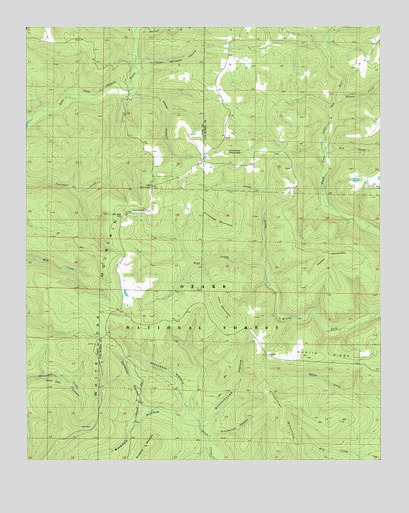
Lost Corner, AR USGS Topographic Map
Click on map above to begin viewing in our Map Viewer.

This topographic map contains these locations and features:
Feature Name Type Latitude Longitude GNIS ID View Map
Armstead MountainSummitN35.5681°W92.8091°71660View Map
AustinPopulated PlaceN35.5306°W92.7907°59210View Map
Austin RidgeRidgeN35.5323°W92.7779°70478View Map
Austin SchoolSchoolN35.5370°W92.7988°45985View Map
Campbell HollowValleyN35.5151°W92.8304°47349View Map
Dry CreekStreamN35.5876°W92.7696°59211View Map
East Fork WildernessReserveN35.5838°W92.8737°74420View Map
Hatley MountainSummitN35.5606°W92.7693°77145View Map
John MountainSummitN35.5434°W92.8052°57994View Map
Kincannon MountainSummitN35.5154°W92.7877°72259View Map
Koones Gulf (historical)Populated PlaceN35.5676°W92.7557°68676View Map
Lost CornerPopulated PlaceN35.5717°W92.8341°57097View Map
Moccasin HollowValleyN35.5137°W92.8179°52123View Map
Napier HollowValleyN35.6062°W92.8382°52571View Map
New Hope CemeteryCemeteryN35.5712°W92.8413°59201View Map
New Hope SchoolSchoolN35.5684°W92.8413°52704View Map
North Prong Brushy ForkStreamN35.5565°W92.7907°59212View Map
North Prong Brushy ForkStreamN35.5417°W92.7871°74486View Map
Northwood (historical)Populated PlaceN35.6017°W92.8666°62013View Map
Oak MountainSummitN35.5795°W92.8304°52940View Map
Okay (historical)Populated PlaceN35.5559°W92.8429°62014View Map
Schoolhouse HollowValleyN35.5092°W92.8135°74477View Map
Snowlick MountainSummitN35.5890°W92.8038°58653View Map
Stoebuck MountainSummitN35.5140°W92.8313°79312View Map
Stoebuck MountainSummitN35.5054°W92.8313°73722View Map
Sweden HollowValleyN35.5145°W92.8302°73796View Map
Township of Hill (historical)CivilN35.5792°W92.8446°70141View Map
Township of White Oak (historical)CivilN35.5042°W92.8002°68708View Map
Victor Millsaps HollowValleyN35.6151°W92.8338°55905View Map
West Prong Brushy ForkStreamN35.5564°W92.7906°59213View Map
Wilson CreekStreamN35.6031°W92.7654°74173View Map

Note: Coordinates in the location and feature list above are referenced to NAD83 datum.


Copyright (C) 2008-2024 Ryan Niemi / Sunset Dynamics ... All Rights Reserved