TopoQuest Logo
Do you find TopoQuest useful?
Help keep TopoQuest running and adding new maps/features by donating!
Bitcoin:  19c7KJd3qBynnjoSw5npx9KScwjBe4ifkT
Litecoin:  LXs6TkuXGGXo1vDsWCkWVdjQX94eUKd6ui
Home View Maps Find Maps Find Places Resources & Links


Loudon, New Hampshire Topographic Map

USGS Map Title: Loudon, NH
USGS Map MRC: 43071C4
DRG (GeoTIFF) Download: o43071c4.tif


Neighboring USGS Topographic Map Quads:


  Northfield, NH  
43071D5
 

  Belmont, NH  
43071D4
 

  Gilmanton Ironworks, NH  
43071D3
 

  Penacook, NH  
43071C5
 

  Loudon, NH  
43071C4
 

  Pittsfield, NH  
43071C3
 

  Concord, NH  
43071B5
 

  Suncook, NH  
43071B4
 

  Gossville, NH  
43071B3


Map MRC Location:

N44°
W72°
N44°
W71°
H8 H7 H6 H5 H4 H3 H2 H1
G8 G7 G6 G5 G4 G3 G2 G1
F8 F7 F6 F5 F4 F3 F2 F1
E8 E7 E6 E5 E4 E3 E2 E1
D8 D7 D6 D5 D4 D3 D2 D1
C8 C7 C6 C5 C4 C3 C2 C1
B8 B7 B6 B5 B4 B3 B2 B1
A8 A7 A6 A5 A4 A3 A2 A1
N43°
W72°
N43°
W71°

Loudon, NH USGS 1:24K Topographic Map Preview:
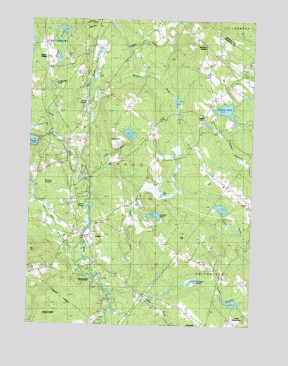
Loudon, NH USGS Topographic Map
Click on map above to begin viewing in our Map Viewer.

This topographic map contains these locations and features:
Feature Name Type Latitude Longitude GNIS ID View Map
Academy BrookStreamN43.3501°W71.4490°865195View Map
Bear HillSummitN43.2859°W71.4123°865443View Map
Bee Hole BrookStreamN43.2640°W71.4503°865505View Map
Bog PondLakeN43.3032°W71.4251°865702View Map
Bumfagon BrookStreamN43.3429°W71.4651°865854View Map
Carding Mill PondLakeN43.3484°W71.4861°865999View Map
Center DamDamN43.3667°W71.4812°1775593View Map
Center PondReservoirN43.3660°W71.4834°1775594View Map
Chichester Central SchoolSchoolN43.2545°W71.3784°866093View Map
Clark BrookStreamN43.3101°W71.4656°866175View Map
Clough HillSummitN43.3259°W71.4473°866219View Map
Clough PondLakeN43.3250°W71.4984°866221View Map
Cooper Farm AirportAirportN43.2821°W71.4568°1917017View Map
Crooked PondLakeN43.2950°W71.4288°866409View Map
Crowley HeliportAirportN43.3409°W71.4703°873414View Map
East DamDamN43.3701°W71.4778°1775595View Map
East Turning PondReservoirN43.3590°W71.4840°1775592View Map
East Turning Pond DamDamN43.3584°W71.4828°1775591View Map
Giddis BrookStreamN43.2629°W71.4415°867055View Map
Gues Meadow BrookStreamN43.3429°W71.4653°867269View Map
Hunting SwampSwampN43.3076°W71.4867°867683View Map
Long PondReservoirN43.3704°W71.4854°1775498View Map
Long Pond DikeDamN43.3684°W71.4845°1775497View Map
LoudonPopulated PlaceN43.2856°W71.4673°868178View Map
Loudon CemeteryCemeteryN43.2890°W71.4695°1917164View Map
Loudon Census Designated PlaceCensusN43.2828°W71.4647°2629726View Map
Loudon CenterPopulated PlaceN43.3359°W71.4017°868180View Map
Loudon Center ChurchChurchN43.3326°W71.4309°868181View Map
Loudon Center Freewill Baptist ChurchChurchN43.2884°W71.4692°1917165View Map
Loudon Elementary SchoolSchoolN43.2861°W71.4732°1917167View Map
Loudon Fire Department Station 1BuildingN43.2860°W71.4658°2605175View Map
Loudon Fire Department Station 2BuildingN43.3421°W71.4621°2605239View Map
Loudon Police DepartmentBuildingN43.2859°W71.4658°2753016View Map
Lovering CemeteryCemeteryN43.3195°W71.4806°868192View Map
Lynxfield PondLakeN43.2685°W71.4056°868224View Map
Meadow Ledge FarmLocaleN43.3136°W71.4289°2611144View Map
New Hampshire International SpeedwayLocaleN43.3548°W71.4592°1917200View Map
Pearls CornerPopulated PlaceN43.3423°W71.4684°869043View Map
Pickard BrookStreamN43.3304°W71.4887°869120View Map
Pine Island BrookStreamN43.2745°W71.4715°869192View Map
Runaway PondReservoirN43.3709°W71.4809°1775596View Map
Sabattus HeightsPopulated PlaceN43.3651°W71.4020°869666View Map
Sanborn PondLakeN43.3386°W71.3898°869764View Map
Sanborn Pond Outlet DamDamN43.3334°W71.3845°1775084View Map
Shaker BranchStreamN43.3184°W71.4690°869862View Map
Shaker CemeteryCemeteryN43.3614°W71.4914°1917302View Map
Shaker PondsLakeN43.3660°W71.4834°869867View Map
Shaker VillagePopulated PlaceN43.3587°W71.4901°869869View Map
Smalls PondLakeN43.2978°W71.4695°869958View Map
Soucook River State ForestForestN43.2704°W71.4723°870011View Map
Speedway HeliportAirportN43.3584°W71.4628°873413View Map
Town of ChichesterCivilN43.2574°W71.3997°873566View Map
Town of LoudonCivilN43.3210°W71.4412°873652View Map
West Turning PondReservoirN43.3590°W71.4840°1775590View Map
West Turning Pond DamDamN43.3584°W71.4845°1775589View Map

Note: Coordinates in the location and feature list above are referenced to NAD83 datum.


Copyright (C) 2008-2024 Ryan Niemi / Sunset Dynamics ... All Rights Reserved