TopoQuest Logo
Do you find TopoQuest useful?
Help keep TopoQuest running and adding new maps/features by donating!
Bitcoin:  19c7KJd3qBynnjoSw5npx9KScwjBe4ifkT
Litecoin:  LXs6TkuXGGXo1vDsWCkWVdjQX94eUKd6ui
Home View Maps Find Maps Find Places Resources & Links


Luther, Iowa Topographic Map

USGS Map Title: Luther, IA
USGS Map MRC: 41093H7
DRG (GeoTIFF) Download: o41093h7.tif


Neighboring USGS Topographic Map Quads:


  Boone West, IA  
42093A8
 

  Boone East, IA  
42093A7
 

  Ames West, IA  
42093A6
 

  Madrid NW, IA  
41093H8
 

  Luther, IA  
41093H7
 

  Slater, IA  
41093H6
 

  Woodward, IA  
41093G8
 

  Granger, IA  
41093G7
 

  Polk City, IA  
41093G6


Map MRC Location:

N42°
W94°
N42°
W93°
H8 H7 H6 H5 H4 H3 H2 H1
G8 G7 G6 G5 G4 G3 G2 G1
F8 F7 F6 F5 F4 F3 F2 F1
E8 E7 E6 E5 E4 E3 E2 E1
D8 D7 D6 D5 D4 D3 D2 D1
C8 C7 C6 C5 C4 C3 C2 C1
B8 B7 B6 B5 B4 B3 B2 B1
A8 A7 A6 A5 A4 A3 A2 A1
N41°
W94°
N41°
W93°

Luther, IA USGS 1:24K Topographic Map Preview:
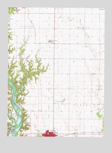
Luther, IA USGS Topographic Map
Click on map above to begin viewing in our Map Viewer.

This topographic map contains these locations and features:
Feature Name Type Latitude Longitude GNIS ID View Map
Belle Point Post Office (historical)Post OfficeN41.9430°W93.8252°1996450View Map
Big Creek BridgeBridgeN41.8928°W93.7505°1996581View Map
Big Creek Bridge TwoBridgeN41.9217°W93.7563°1996582View Map
Camp LaurieLocaleN41.8872°W93.8549°455124View Map
Cassel CemeteryCemeteryN41.8775°W93.8341°455203View Map
Caton BranchStreamN41.8830°W93.8649°455214View Map
Church of ChristChurchN41.8769°W93.8169°1996510View Map
Church of GodChurchN41.8767°W93.8199°1996509View Map
Church of God ProphecyChurchN41.9283°W93.8472°1996504View Map
City of LutherCivilN41.9669°W93.8176°2395786View Map
City of MadridCivilN41.8757°W93.8204°2395812View Map
Clay Castle MuseumBuildingN41.8761°W93.8211°1996503View Map
Dalander CemeteryCemeteryN41.8949°W93.8503°455771View Map
Eternal Life ChurchChurchN41.9678°W93.8188°1996554View Map
Eversoll CreekStreamN41.8858°W93.8597°456448View Map
Fairview CemeteryCemeteryN41.9005°W93.8319°456488View Map
Family Foot Care Specialists CenterHospitalN41.8767°W93.8219°1996512View Map
Garden Post Office (historical)Post OfficeN41.9364°W93.7669°1996452View Map
Garden PrairieLocaleN41.9372°W93.7624°466199View Map
Garden Prairie CemeteryCemeteryN41.9367°W93.7661°1996568View Map
Garden Prairie ChurchChurchN41.9364°W93.7661°456826View Map
Heartland Co-op ElevatorLocaleN41.9678°W93.8188°1996552View Map
Hillsdale CemeteryCemeteryN41.8775°W93.7861°457504View Map
Hull CemeteryCemeteryN41.9603°W93.8666°457714View Map
Hull Post Office (historical)Post OfficeN41.9911°W93.7961°466503View Map
Iowa ArboretumParkN41.9444°W93.8572°1996505View Map
Iowa State Experimental FarmLocaleN41.9094°W93.8038°463425View Map
Long RefugeParkN41.9486°W93.8391°1996506View Map
LutherPopulated PlaceN41.9678°W93.8188°458684View Map
Luther (historical)LocaleN41.9678°W93.8188°1996551View Map
Luther Post Office (historical)Post OfficeN41.9678°W93.8188°1996553View Map
MadridPopulated PlaceN41.8767°W93.8233°458731View Map
Madrid Elementary SchoolSchoolN41.8773°W93.8223°1996513View Map
Madrid HomeHospitalN41.8783°W93.8277°1996511View Map
Madrid Junior / Senior High SchoolSchoolN41.8836°W93.8139°1996501View Map
Madrid Junior High SchoolSchoolN41.8833°W93.8136°2720037View Map
Madrid Post OfficePost OfficeN41.8751°W93.8232°1996500View Map
Madrid Public LibraryBuildingN41.8761°W93.8208°1996499View Map
Pleasant View SchoolSchoolN41.9347°W93.8302°463868View Map
Richardson BranchStreamN41.9164°W93.8658°460612View Map
Saint Johns Lutheran ChurchChurchN41.8767°W93.8244°1996508View Map
Saint Paul United Church of ChristChurchN41.8761°W93.8174°1996507View Map
Swede Point ParkParkN41.8861°W93.8474°1996515View Map
Township of ColfaxCivilN41.9926°W93.7570°467632View Map
Township of DouglasCivilN41.9116°W93.8454°467725View Map
Township of GardenCivilN41.9070°W93.7569°467888View Map
Township of WorthCivilN41.9967°W93.8628°469017View Map
Worth Post Office (historical)Post OfficeN41.9644°W93.8338°1996453View Map

Note: Coordinates in the location and feature list above are referenced to NAD83 datum.


Copyright (C) 2008-2024 Ryan Niemi / Sunset Dynamics ... All Rights Reserved