TopoQuest Logo
Do you find TopoQuest useful?
Help keep TopoQuest running and adding new maps/features by donating!
Bitcoin:  19c7KJd3qBynnjoSw5npx9KScwjBe4ifkT
Litecoin:  LXs6TkuXGGXo1vDsWCkWVdjQX94eUKd6ui
Home View Maps Find Maps Find Places Resources & Links


Mifflinburg, Pennsylvania Topographic Map

USGS Map Title: Mifflinburg, PA
USGS Map MRC: 40077H1
DRG (GeoTIFF) Download: o40077h1.tif


Neighboring USGS Topographic Map Quads:


  Carroll, PA  
41077A2
 

  Williamsport SE, PA  
41077A1
 

  Allenwood, PA  
41076A8
 

  Hartleton, PA  
40077H2
 

  Mifflinburg, PA  
40077H1
 

  Lewisburg, PA  
40076H8
 

  Beavertown, PA  
40077G2
 

  Middleburg, PA  
40077G1
 

  Freeburg, PA  
40076G8


Map MRC Location:

N41°
W78°
N41°
W77°
H8 H7 H6 H5 H4 H3 H2 H1
G8 G7 G6 G5 G4 G3 G2 G1
F8 F7 F6 F5 F4 F3 F2 F1
E8 E7 E6 E5 E4 E3 E2 E1
D8 D7 D6 D5 D4 D3 D2 D1
C8 C7 C6 C5 C4 C3 C2 C1
B8 B7 B6 B5 B4 B3 B2 B1
A8 A7 A6 A5 A4 A3 A2 A1
N40°
W78°
N40°
W77°

Mifflinburg, PA USGS 1:24K Topographic Map Preview:
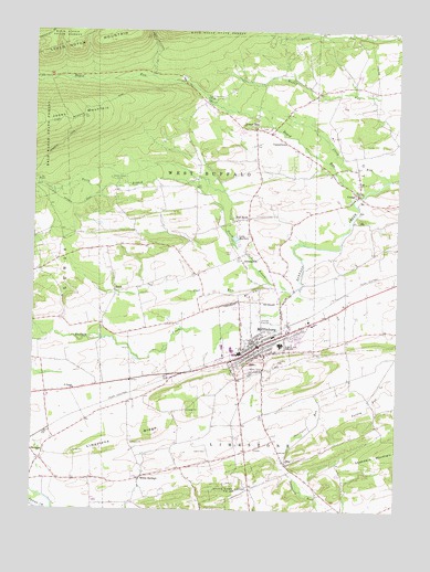
Mifflinburg, PA USGS Topographic Map
Click on map above to begin viewing in our Map Viewer.

This topographic map contains these locations and features:
Feature Name Type Latitude Longitude GNIS ID View Map
Borough of MifflinburgCivilN40.9201°W77.0463°1215633View Map
Centennial SchoolSchoolN40.9809°W77.0683°1197288View Map
Chambers SpringSpringN40.9126°W77.0580°1202324View Map
Church of the BrethrenChurchN40.9087°W77.0911°1197292View Map
Coal RunStreamN40.9345°W77.0436°1172067View Map
Cornelius SchoolSchoolN40.9856°W77.0300°1197287View Map
CowanPopulated PlaceN40.9576°W77.0136°1172547View Map
DicePopulated PlaceN40.8879°W77.0380°1173236View Map
End O'Narrows BridgeBridgeN40.9817°W77.0650°1174251View Map
Forest HillPopulated PlaceN40.9745°W77.0494°1174968View Map
Green Grove SchoolSchoolN40.8995°W77.0461°1197284View Map
J F T AirportAirportN40.9445°W77.0454°1194141View Map
JohnstownPopulated PlaceN40.9401°W77.0527°1178132View Map
Lake McClureLakeN40.9457°W77.0551°1180642View Map
Lewis CemeteryCemeteryN40.8906°W77.0647°1179231View Map
Limestone RidgeRidgeN40.8951°W77.0833°1179359View Map
Long CemeteryCemeteryN40.9117°W77.0439°1197294View Map
Louden SchoolSchoolN40.9434°W77.0777°1197290View Map
MifflinburgPopulated PlaceN40.9176°W77.0478°1213637View Map
Mifflinburg Community AmbulanceBuildingN40.9203°W77.0416°2722116View Map
Mifflinburg Elementary SchoolSchoolN40.9201°W77.0305°1207316View Map
Mifflinburg Hose Company 3BuildingN40.9181°W77.0463°2652758View Map
Mifflinburg Middle SchoolSchoolN40.9217°W77.0289°1207315View Map
Mifflinburg Police DepartmentBuildingN40.9204°W77.0454°2780534View Map
Mifflinburg Post OfficePost OfficeN40.9183°W77.0480°2779754View Map
North Branch Buffalo CreekStreamN40.9320°W77.0364°1182528View Map
Pontius SchoolSchoolN40.9304°W77.0116°1197286View Map
RandPopulated PlaceN40.9315°W77.0964°1184641View Map
Rand School (historical)SchoolN40.9312°W77.0964°1197291View Map
Rapid RunStreamN40.9576°W77.0116°1193170View Map
Red BankPopulated PlaceN40.9509°W77.0536°1217368View Map
Red Bank School (historical)SchoolN40.9512°W77.0500°1197289View Map
Saint Peters ChurchChurchN40.9065°W77.1105°1197293View Map
Sand Bridge State ParkParkN40.9984°W77.1147°1198242View Map
State Game Lands Number 201ParkN40.8787°W77.0603°1188484View Map
Stone Haven CampLocaleN40.9617°W77.0986°1188720View Map
Stony RunStreamN40.9615°W77.0033°1188794View Map
Swengel Post OfficePost OfficeN40.8908°W77.1248°2779585View Map
TannertownPopulated PlaceN40.9709°W77.0377°1189264View Map
Township of LimestoneCivilN40.8901°W77.0362°1217134View Map
Township of West BuffaloCivilN40.9911°W77.0696°1217136View Map
Turkey RunStreamN40.8990°W77.0258°1189948View Map
Turkey Run SchoolSchoolN40.9004°W77.0069°1197285View Map
Union CountyCivilN40.9630°W77.0623°1213689View Map
Wehrs SchoolSchoolN40.8804°W77.0489°1197283View Map
Western Area High SchoolSchoolN40.9184°W77.0394°1191142View Map
White SpringsPopulated PlaceN40.8831°W77.0878°1198312View Map
WWMC-FM (Mifflinburg)TowerN40.9145°W77.0400°1200265View Map

Note: Coordinates in the location and feature list above are referenced to NAD83 datum.


Copyright (C) 2008-2024 Ryan Niemi / Sunset Dynamics ... All Rights Reserved