TopoQuest Logo
Do you find TopoQuest useful?
Help keep TopoQuest running and adding new maps/features by donating!
Bitcoin:  19c7KJd3qBynnjoSw5npx9KScwjBe4ifkT
Litecoin:  LXs6TkuXGGXo1vDsWCkWVdjQX94eUKd6ui
Home View Maps Find Maps Find Places Resources & Links


Mineral Mountain, Arizona Topographic Map

USGS Map Title: Mineral Mountain, AZ
USGS Map MRC: 33111B2
DRG (GeoTIFF) Download: o33111b2.tif


Neighboring USGS Topographic Map Quads:


  Florence Junction, AZ  
33111C3
 

  Picketpost Mountain, AZ  
33111C2
 

  Superior, AZ  
33111C1
 

  Florence NE, AZ  
33111B3
 

  Mineral Mountain, AZ  
33111B2
 

  Teapot Mountain, AZ  
33111B1
 

  Florence SE, AZ  
33111A3
 

  North Butte, AZ  
33111A2
 

  Grayback, AZ  
33111A1


Map MRC Location:

N34°
W112°
N34°
W111°
H8 H7 H6 H5 H4 H3 H2 H1
G8 G7 G6 G5 G4 G3 G2 G1
F8 F7 F6 F5 F4 F3 F2 F1
E8 E7 E6 E5 E4 E3 E2 E1
D8 D7 D6 D5 D4 D3 D2 D1
C8 C7 C6 C5 C4 C3 C2 C1
B8 B7 B6 B5 B4 B3 B2 B1
A8 A7 A6 A5 A4 A3 A2 A1
N33°
W112°
N33°
W111°

Mineral Mountain, AZ USGS 1:24K Topographic Map Preview:
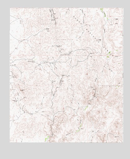
Mineral Mountain, AZ USGS Topographic Map
Click on map above to begin viewing in our Map Viewer.

This topographic map contains these locations and features:
Feature Name Type Latitude Longitude GNIS ID View Map
Ajax MineMineN33.2078°W111.1835°25550View Map
Alamo Number One TankReservoirN33.2217°W111.1729°41250View Map
Alamo Number Two TankReservoirN33.2470°W111.1835°40303View Map
Bell ButteSummitN33.1751°W111.1760°42795View Map
Columbia MineMineN33.1745°W111.1579°27830View Map
Filaria SpringSpringN33.2395°W111.1335°28989View Map
Herring MineMineN33.1870°W111.1921°29906View Map
Martinez MineMineN33.1681°W111.1551°40380View Map
Martinez WellWellN33.1681°W111.1551°31551View Map
Mesa TankReservoirN33.2295°W111.1590°40382View Map
Mineral MountainSummitN33.1734°W111.2365°31910View Map
Myres MineMineN33.1814°W111.1929°32222View Map
Oklahoma MineMineN33.1637°W111.2429°32490View Map
Orphan Boy MineMineN33.2076°W111.1607°32566View Map
Picket Mill WellWellN33.2451°W111.1687°40407View Map
Red Mountain MineMineN33.1303°W111.1340°33487View Map
ReymertPopulated PlaceN33.2298°W111.2093°33589View Map
Reymert MineMineN33.2448°W111.2018°33590View Map
Rock TankReservoirN33.2387°W111.1396°2062277View Map
Seep SpringSpringN33.1914°W111.1368°40427View Map
Silver Bell MineMineN33.1762°W111.1579°34426View Map
Sunset MineMineN33.1820°W111.2015°34971View Map
Talley TankReservoirN33.2067°W111.1464°41249View Map
Trough SpringsSpringN33.2201°W111.1490°35478View Map
Woodpecker MineMineN33.2142°W111.1962°36378View Map

Note: Coordinates in the location and feature list above are referenced to NAD83 datum.


Copyright (C) 2008-2024 Ryan Niemi / Sunset Dynamics ... All Rights Reserved