TopoQuest Logo
Do you find TopoQuest useful?
Help keep TopoQuest running and adding new maps/features by donating!
Bitcoin:  19c7KJd3qBynnjoSw5npx9KScwjBe4ifkT
Litecoin:  LXs6TkuXGGXo1vDsWCkWVdjQX94eUKd6ui
Home View Maps Find Maps Find Places Resources & Links


Mount Olive, Texas Topographic Map

USGS Map Title: Mount Olive, TX
USGS Map MRC: 29096A6
DRG (GeoTIFF) Download: o29096a6.tif


Neighboring USGS Topographic Map Quads:


  Morales, TX  
29096B7
 

  Cordele, TX  
29096B6
 

  Ganado NE, TX  
29096B5
 

  Navidad, TX  
29096A7
 

  Mount Olive, TX  
29096A6
 

  Ganado, TX  
29096A5
 

  Inez, TX  
28096H7
 

  Edna, TX  
28096H6
 

  Manson, TX  
28096H5


Map MRC Location:

N30°
W97°
N30°
W96°
H8 H7 H6 H5 H4 H3 H2 H1
G8 G7 G6 G5 G4 G3 G2 G1
F8 F7 F6 F5 F4 F3 F2 F1
E8 E7 E6 E5 E4 E3 E2 E1
D8 D7 D6 D5 D4 D3 D2 D1
C8 C7 C6 C5 C4 C3 C2 C1
B8 B7 B6 B5 B4 B3 B2 B1
A8 A7 A6 A5 A4 A3 A2 A1
N29°
W97°
N29°
W96°

Mount Olive, TX USGS 1:24K Topographic Map Preview:
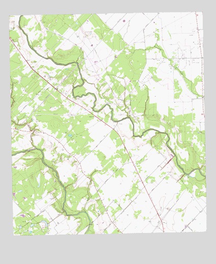
Mount Olive, TX USGS Topographic Map
Click on map above to begin viewing in our Map Viewer.

This topographic map contains these locations and features:
Feature Name Type Latitude Longitude GNIS ID View Map
Andrews CemeteryCemeteryN29.0986°W96.7344°1351120View Map
Burnettville CemeteryCemeteryN29.0347°W96.6475°1353351View Map
Chase CemeteryCemeteryN29.1180°W96.7475°1354332View Map
Collier Oil FieldOilfieldN29.0572°W96.7080°1354794View Map
Cordele Oil FieldOilfieldN29.1000°W96.6444°1354985View Map
Edna-Cordele DivisionCivilN29.0753°W96.6591°1938713View Map
Edwards CemeteryCemeteryN29.0208°W96.7239°1356831View Map
Enon CemeteryCemeteryN29.0772°W96.7078°1357037View Map
Harrison CemeteryCemeteryN29.0261°W96.7222°1358860View Map
Hines CemeteryCemeteryN29.1047°W96.7450°1359295View Map
Kerr CemeteryCemeteryN29.0572°W96.7355°1360602View Map
KTMR-AM (Edna)TowerN29.0280°W96.6683°1385551View Map
Laughter CemeteryCemeteryN29.0414°W96.7216°1360979View Map
Manly CemeteryCemeteryN29.0403°W96.7094°1362132View Map
Milby BranchStreamN29.0128°W96.7028°1362830View Map
Milby CemeteryCemeteryN29.0194°W96.6966°1362831View Map
Mount OlivePopulated PlaceN29.0669°W96.6944°1380220View Map
Mount Olive CemeteryCemeteryN29.0683°W96.7089°1363275View Map
Strane CemeteryCemeteryN29.1210°W96.7285°1369262View Map
Wilkerson CemeteryCemeteryN29.0891°W96.7250°1371537View Map

Note: Coordinates in the location and feature list above are referenced to NAD83 datum.


Copyright (C) 2008-2024 Ryan Niemi / Sunset Dynamics ... All Rights Reserved