TopoQuest Logo
Do you find TopoQuest useful?
Help keep TopoQuest running and adding new maps/features by donating!
Bitcoin:  19c7KJd3qBynnjoSw5npx9KScwjBe4ifkT
Litecoin:  LXs6TkuXGGXo1vDsWCkWVdjQX94eUKd6ui
Home View Maps Find Maps Find Places Resources & Links


Mount Saint Helens, Washington Topographic Map

USGS Map Title: Mount Saint Helens, WA
USGS Map MRC: 46122B2
DRG (GeoTIFF) Download: o46122b2.tif


Neighboring USGS Topographic Map Quads:


  Elk Rock, WA  
46122C3
 

  Spirit Lake West, WA  
46122C2
 

  Spirit Lake East, WA  
46122C1
 

  Goat Mountain, WA  
46122B3
 

  Mount Saint Helens, WA  
46122B2
 

  Smith Creek Butte, WA  
46122B1
 

  Cougar, WA  
46122A3
 

  Mount Mitchell, WA  
46122A2
 

  Cedar Flats, WA  
46122A1


Map MRC Location:

N47°
W123°
N47°
W122°
H8 H7 H6 H5 H4 H3 H2 H1
G8 G7 G6 G5 G4 G3 G2 G1
F8 F7 F6 F5 F4 F3 F2 F1
E8 E7 E6 E5 E4 E3 E2 E1
D8 D7 D6 D5 D4 D3 D2 D1
C8 C7 C6 C5 C4 C3 C2 C1
B8 B7 B6 B5 B4 B3 B2 B1
A8 A7 A6 A5 A4 A3 A2 A1
N46°
W123°
N46°
W122°

Mount Saint Helens, WA USGS 1:24K Topographic Map Preview:
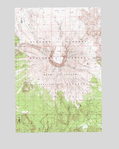
Mount Saint Helens, WA USGS Topographic Map
Click on map above to begin viewing in our Map Viewer.

This topographic map contains these locations and features:
Feature Name Type Latitude Longitude GNIS ID View Map
1980 CraterCraterN46.1990°W122.1892°1528460View Map
Alpine ButteSummitN46.2173°W122.1509°1515828View Map
Ape GlacierGlacierN46.2014°W122.1692°1515927View Map
Big Lizard (historical)GlacierN46.2098°W122.1854°1516530View Map
Butte Camp (historical)LocaleN46.1671°W122.2279°1517152View Map
Butte Camp DomeSummitN46.1725°W122.2324°1528433View Map
Crater GlacierGlacierN46.1971°W122.1920°2090268View Map
Crescent RidgeRidgeN46.1998°W122.2318°1528454View Map
Dogs HeadSummitN46.1997°W122.1762°1518840View Map
Dryer GlacierGlacierN46.1876°W122.1940°1518981View Map
East DomeSummitN46.1971°W122.1512°1528463View Map
False Summit (historical)SummitN46.2004°W122.1851°1519472View Map
Floating Island Lava FlowLavaN46.2334°W122.2107°1519653View Map
Forsyth GlacierGlacierN46.2102°W122.1736°1519701View Map
Goat Rocks (historical)PillarN46.2109°W122.1904°1520059View Map
June LakeLakeN46.1518°W122.1584°1521516View Map
Lava DomeLavaN46.1990°W122.1889°1528456View Map
Leschi Glacier (historical)GlacierN46.2079°W122.1818°1522032View Map
Loowit CreekStreamN46.2359°W122.1837°1998950View Map
Loowit FallsFallsN46.2236°W122.1836°1998946View Map
Loowit Glacier (historical)GlacierN46.2118°W122.1865°1522451View Map
Monitor RidgeRidgeN46.1748°W122.1901°1528457View Map
Mount Saint HelensSummitN46.1912°W122.1944°1525360View Map
Mount Saint Helens National Volcanic MonumentParkN46.2332°W122.1845°1529463View Map
Nelson GlacierGlacierN46.2045°W122.1706°1523617View Map
Pine Creek TrailTrailN46.1907°W122.1304°1524443View Map
Plains of AbrahamFlatN46.2067°W122.1416°1515716View Map
Pumice ButteSummitN46.1990°W122.1343°1524687View Map
Pumice PlainAreaN46.2457°W122.1845°1528443View Map
Redrock PassGapN46.1437°W122.2351°1528904View Map
Saint Helens WayTrailN46.1471°W122.1729°1525359View Map
Sasquatch StepsAreaN46.2248°W122.1868°1528447View Map
Shoestring GlacierGlacierN46.1890°W122.1679°1525696View Map
Studebaker RidgeRidgeN46.2365°W122.2237°1528458View Map
Sugar BowlBasinN46.2054°W122.1732°1526664View Map
Swift Creek FlowLavaN46.1618°W122.1956°1528444View Map
Swift GlacierGlacierN46.1856°W122.1860°1526864View Map
Talus GlacierGlacierN46.2030°W122.2089°1526915View Map
The Boot (historical)RidgeN46.2032°W122.1882°1527025View Map
The BreachGapN46.2068°W122.1887°1528430View Map
The Island (historical)GlacierN46.2034°W122.1848°1527041View Map
Timberline Campground (historical)LocaleN46.2254°W122.1598°1527238View Map
Toutle GlacierGlacierN46.2057°W122.2045°1527323View Map
Windy PassGapN46.2165°W122.1532°1528229View Map
Wishbone Glacier (historical)GlacierN46.2118°W122.1979°1528267View Map
Worm FlowsLavaN46.1707°W122.1595°1528459View Map

Note: Coordinates in the location and feature list above are referenced to NAD83 datum.


Copyright (C) 2008-2024 Ryan Niemi / Sunset Dynamics ... All Rights Reserved