TopoQuest Logo
Do you find TopoQuest useful?
Help keep TopoQuest running and adding new maps/features by donating!
Bitcoin:  19c7KJd3qBynnjoSw5npx9KScwjBe4ifkT
Litecoin:  LXs6TkuXGGXo1vDsWCkWVdjQX94eUKd6ui
Home View Maps Find Maps Find Places Resources & Links


Neillsville, Wisconsin Topographic Map

USGS Map Title: Neillsville, WI
USGS Map MRC: 44090E5
DRG (GeoTIFF) Download: o44090e5.tif


Neighboring USGS Topographic Map Quads:


  Willard, WI  
44090F6
 

  Loyal West, WI  
44090F5
 

  Loyal East, WI  
44090F4
 

  Columbia, WI  
44090E6
 

  Neillsville, WI  
44090E5
 

  Granton, WI  
44090E4
 

  Hatfield, WI  
44090D6
 

  Hatfield NE, WI  
44090D5
 

  City Point NW, WI  
44090D4


Map MRC Location:

N45°
W91°
N45°
W90°
H8 H7 H6 H5 H4 H3 H2 H1
G8 G7 G6 G5 G4 G3 G2 G1
F8 F7 F6 F5 F4 F3 F2 F1
E8 E7 E6 E5 E4 E3 E2 E1
D8 D7 D6 D5 D4 D3 D2 D1
C8 C7 C6 C5 C4 C3 C2 C1
B8 B7 B6 B5 B4 B3 B2 B1
A8 A7 A6 A5 A4 A3 A2 A1
N44°
W91°
N44°
W90°

Neillsville, WI USGS 1:24K Topographic Map Preview:
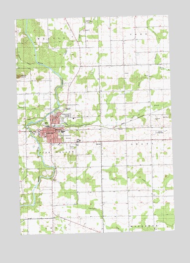
Neillsville, WI USGS Topographic Map
Click on map above to begin viewing in our Map Viewer.

This topographic map contains these locations and features:
Feature Name Type Latitude Longitude GNIS ID View Map
Assembly of God ChurchChurchN44.5597°W90.5999°1837636View Map
Beaver Creek SchoolSchoolN44.5673°W90.5054°2715731View Map
Bible Baptist ChurchChurchN44.5669°W90.5876°1837638View Map
Calvary Lutheran ChurchChurchN44.5569°W90.6054°1837644View Map
Cawley CreekStreamN44.5930°W90.5918°1562827View Map
City of NeillsvilleCivilN44.5604°W90.5902°1583786View Map
Clark County Alternative Charter SchoolSchoolN44.5594°W90.6134°2715760View Map
Clark County FairgroundsParkN44.5508°W90.5821°1837646View Map
Clark County Sheriff's OfficeBuildingN44.5602°W90.5945°2759535View Map
Cunningham CreekStreamN44.5327°W90.6021°1563623View Map
Fountain ParkParkN44.5619°W90.5954°1837664View Map
Happy Hollow School (historical)SchoolN44.5966°W90.5424°1837674View Map
Hay Meadow CreekStreamN44.5027°W90.5026°1566204View Map
Jack CreekStreamN44.5305°W90.5929°1567053View Map
Kingdom Hall of Jehovahs WitnessesChurchN44.5675°W90.5932°1837682View Map
Listeman ArboretumParkN44.5550°W90.6071°1837687View Map
Living Hope Evangelical ChurchChurchN44.5589°W90.5957°1837688View Map
Marguerite Listeman ParkParkN44.5661°W90.5896°1837694View Map
Memorial Medical CenterHospitalN44.5578°W90.6079°1837702View Map
Middle Branch O'Neill CreekStreamN44.5947°W90.5090°1569412View Map
Mound CreekStreamN44.6000°W90.6085°1569791View Map
NeillsvillePopulated PlaceN44.5600°W90.5962°1570146View Map
Neillsville Area Fire DepartmentBuildingN44.5623°W90.5966°2697478View Map
Neillsville City CemeteryCemeteryN44.5680°W90.5840°1837700View Map
Neillsville Elementary SchoolSchoolN44.5591°W90.5878°2715728View Map
Neillsville High SchoolSchoolN44.5594°W90.5898°1837701View Map
Neillsville Middle SchoolSchoolN44.5592°W90.5878°2715842View Map
Neillsville Municipal AirportAirportN44.5559°W90.5153°1582103View Map
Neillsville Municipal Ambulance ServiceBuildingN44.5569°W90.6073°2698275View Map
Neillsville Police DepartmentBuildingN44.5597°W90.5968°2759647View Map
Neillsville Post OfficePost OfficeN44.5611°W90.5962°1837703View Map
Neillsville Wastewater Treatment FacilityLocaleN44.5644°W90.6072°2723705View Map
North Branch O'Neill CreekStreamN44.5625°W90.5515°1570384View Map
Northside ParkParkN44.5661°W90.5962°1837704View Map
O'Neill CreekStreamN44.5658°W90.6040°1570596View Map
Panther CreekStreamN44.6214°W90.5682°1571007View Map
Pine Valley Mound School (historical)SchoolN44.5886°W90.6154°1837711View Map
Reed School (historical)SchoolN44.5525°W90.5371°1837716View Map
Saint John's Lutheran SchoolSchoolN44.5602°W90.6066°1573024View Map
Saint Johns Evangelical Lutheran ChurchChurchN44.5602°W90.6063°1837727View Map
Saint Marys Catholic ChurchChurchN44.5680°W90.5904°1837731View Map
Saint Marys CemeteryCemeteryN44.5680°W90.5849°1573264View Map
Schuster ParkParkN44.5550°W90.5890°1837736View Map
South Branch O'Neill CreekStreamN44.5625°W90.5512°1574409View Map
Spooner CreekStreamN44.5652°W90.6129°1574569View Map
Tock Memorial FieldParkN44.5577°W90.6029°1837746View Map
Town of Pine ValleyCivilN44.5522°W90.6216°1583927View Map
Uncle Sam School (historical)SchoolN44.6072°W90.5732°1837748View Map
Visions II SchoolSchoolN44.5515°W90.5869°2715652View Map
Washington School (historical)SchoolN44.5244°W90.5382°1837752View Map
WCCN-AM (Neillsville)TowerN44.5716°W90.5876°1582333View Map
WCCN-FM (Neillsville)TowerN44.5716°W90.5876°1582432View Map
WCCN-FM (Neillsville)TowerN44.5919°W90.6204°1582433View Map

Note: Coordinates in the location and feature list above are referenced to NAD83 datum.


Copyright (C) 2008-2024 Ryan Niemi / Sunset Dynamics ... All Rights Reserved