TopoQuest Logo
Do you find TopoQuest useful?
Help keep TopoQuest running and adding new maps/features by donating!
Bitcoin:  19c7KJd3qBynnjoSw5npx9KScwjBe4ifkT
Litecoin:  LXs6TkuXGGXo1vDsWCkWVdjQX94eUKd6ui
Home View Maps Find Maps Find Places Resources & Links


New Athens East, Illinois Topographic Map

USGS Map Title: New Athens East, IL
USGS Map MRC: 38089C7
DRG (GeoTIFF) Download: o38089c7.tif


Neighboring USGS Topographic Map Quads:


  Freeburg, IL  
38089D8
 

  Mascoutah, IL  
38089D7
 

  Venedy, IL  
38089D6
 

  New Athens West, IL  
38089C8
 

  New Athens East, IL  
38089C7
 

  Saint Libory, IL  
38089C6
 

  Red Bud, IL  
38089B8
 

  Baldwin, IL  
38089B7
 

  Tilden, IL  
38089B6


Map MRC Location:

N39°
W90°
N39°
W89°
H8 H7 H6 H5 H4 H3 H2 H1
G8 G7 G6 G5 G4 G3 G2 G1
F8 F7 F6 F5 F4 F3 F2 F1
E8 E7 E6 E5 E4 E3 E2 E1
D8 D7 D6 D5 D4 D3 D2 D1
C8 C7 C6 C5 C4 C3 C2 C1
B8 B7 B6 B5 B4 B3 B2 B1
A8 A7 A6 A5 A4 A3 A2 A1
N38°
W90°
N38°
W89°

New Athens East, IL USGS 1:24K Topographic Map Preview:
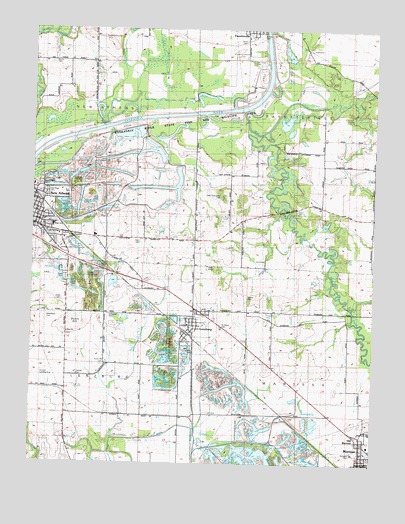
New Athens East, IL USGS Topographic Map
Click on map above to begin viewing in our Map Viewer.

This topographic map contains these locations and features:
Feature Name Type Latitude Longitude GNIS ID View Map
Ahlheim CemeteryCemeteryN38.3114°W89.8654°426226View Map
Berger FarmsLocaleN38.2975°W89.8061°2680927View Map
Bickel AirportAirportN38.3337°W89.7696°2679068View Map
Blackjack School (historical)SchoolN38.3164°W89.8037°1773011View Map
Cobb Thompson CemeteryCemeteryN38.3270°W89.8070°426235View Map
Cottonwood Hills LandfillLocaleN38.2575°W89.7808°2680786View Map
Drum Hill BranchStreamN38.3589°W89.8276°426317View Map
Dutch HillSummitN38.2906°W89.8559°426319View Map
East Dutch Hill School (historical)SchoolN38.2789°W89.8479°1821815View Map
Hickory Grove School (historical)SchoolN38.2864°W89.7757°1821827View Map
Irwin CemeteryCemeteryN38.3137°W89.8376°426383View Map
Irwin School (historical)SchoolN38.3145°W89.8348°1773019View Map
Lentzburg Village ParkParkN38.2828°W89.8190°426236View Map
LenzburgPopulated PlaceN38.2873°W89.8173°426406View Map
Lenzburg Fire DepartmentBuildingN38.2888°W89.8148°2640641View Map
Lenzburg Post OfficePost OfficeN38.2904°W89.8169°2788653View Map
Lindauer AirportAirportN38.3058°W89.8565°426228View Map
Little Mud CreekStreamN38.3462°W89.7895°426412View Map
Lively CemeteryCemeteryN38.3159°W89.8640°426225View Map
MarissaPopulated PlaceN38.2500°W89.7501°426421View Map
Marissa Police DepartmentBuildingN38.2549°W89.7538°2758927View Map
Marissa Sewage Treatment PlantLocaleN38.2531°W89.7559°2469064View Map
MedStar AmbulanceBuildingN38.2549°W89.7538°2673913View Map
Moore CemeteryCemeteryN38.2978°W89.7962°426234View Map
Mud CreekStreamN38.3517°W89.7984°426439View Map
New Athens City CemeteryCemeteryN38.3300°W89.8720°426444View Map
New Athens Fire Protection DistrictBuildingN38.3177°W89.8713°2640851View Map
New Athens First Baptist ChurchChurchN38.3189°W89.8737°426229View Map
New Athens High SchoolSchoolN38.3103°W89.8687°426227View Map
New Athens Police DepartmentBuildingN38.3179°W89.8717°2758934View Map
New Athens United Methodist ChurchChurchN38.3228°W89.8732°426231View Map
Oak Ridge CemeteryCemeteryN38.3273°W89.8695°426451View Map
Old Dutch Hill CemeteryCemeteryN38.2792°W89.8470°426320View Map
Old MarissaPopulated PlaceN38.2584°W89.7543°426456View Map
Pleasant Ridge School (historical)SchoolN38.3359°W89.7570°1821880View Map
Point LookoutSummitN38.3700°W89.8459°1821864View Map
Point Lookout School (historical)SchoolN38.3725°W89.8532°1821882View Map
Progressive GrangeBuildingN38.2756°W89.8587°428383View Map
Pulliam CemeteryCemeteryN38.3731°W89.7918°426232View Map
Saint Agatha CemeteryCemeteryN38.3159°W89.8632°426496View Map
Saint Pauls Lutheran ChurchChurchN38.3187°W89.8718°426230View Map
Saint Peters Church CemeteryCemeteryN38.2895°W89.8062°426238View Map
Saint Peters United Church of ChristChurchN38.2887°W89.8179°426237View Map
Schaller AirportAirportN38.2787°W89.8717°426239View Map
Schneider CemeteryCemeteryN38.2925°W89.8465°426524View Map
Spitz-Bilgere CemeteryCemeteryN38.2867°W89.8623°2052837View Map
Sturm CemeteryCemeteryN38.3653°W89.8679°426544View Map
Suemmicht CemeteryCemeteryN38.3725°W89.8507°426233View Map
Township of FayettevilleCivilN38.3590°W89.7570°428997View Map
Township of LenzburgCivilN38.2648°W89.8624°429246View Map
Township of MarissaCivilN38.2626°W89.7591°429326View Map
Township of New AthensCivilN38.3513°W89.8713°429429View Map
Trinity Fayetteville CemeteryCemeteryN38.3656°W89.7956°426983View Map
Trinity United Church of Christ CemeteryCemeteryN38.3720°W89.7984°426556View Map
Village of LenzburgCivilN38.2859°W89.8179°2398420View Map
Village of MarissaCivilN38.2502°W89.7746°2399258View Map
Village of New AthensCivilN38.3188°W89.8743°2399452View Map
Wabash Valley CollegeSchoolN38.2503°W89.7507°1821898View Map
Wedekind CemeteryCemeteryN38.2920°W89.8693°426241View Map
Wildy CemeteryCemeteryN38.2964°W89.8640°426573View Map
Zion CemeteryCemeteryN38.2870°W89.8626°426240View Map
Zion ChurchChurchN38.2881°W89.8626°426242View Map

Note: Coordinates in the location and feature list above are referenced to NAD83 datum.


Copyright (C) 2008-2024 Ryan Niemi / Sunset Dynamics ... All Rights Reserved