TopoQuest Logo
Do you find TopoQuest useful?
Help keep TopoQuest running and adding new maps/features by donating!
Bitcoin:  19c7KJd3qBynnjoSw5npx9KScwjBe4ifkT
Litecoin:  LXs6TkuXGGXo1vDsWCkWVdjQX94eUKd6ui
Home View Maps Find Maps Find Places Resources & Links


New Athens West, Illinois Topographic Map

USGS Map Title: New Athens West, IL
USGS Map MRC: 38089C8
DRG (GeoTIFF) Download: o38089c8.tif


Neighboring USGS Topographic Map Quads:


  Millstadt, IL  
38090D1
 

  Freeburg, IL  
38089D8
 

  Mascoutah, IL  
38089D7
 

  Paderborn, IL  
38090C1
 

  New Athens West, IL  
38089C8
 

  New Athens East, IL  
38089C7
 

  Ames, IL  
38090B1
 

  Red Bud, IL  
38089B8
 

  Baldwin, IL  
38089B7


Map MRC Location:

N39°
W90°
N39°
W89°
H8 H7 H6 H5 H4 H3 H2 H1
G8 G7 G6 G5 G4 G3 G2 G1
F8 F7 F6 F5 F4 F3 F2 F1
E8 E7 E6 E5 E4 E3 E2 E1
D8 D7 D6 D5 D4 D3 D2 D1
C8 C7 C6 C5 C4 C3 C2 C1
B8 B7 B6 B5 B4 B3 B2 B1
A8 A7 A6 A5 A4 A3 A2 A1
N38°
W90°
N38°
W89°

New Athens West, IL USGS 1:24K Topographic Map Preview:
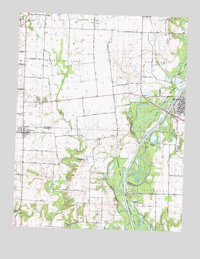
New Athens West, IL USGS Topographic Map
Click on map above to begin viewing in our Map Viewer.

This topographic map contains these locations and features:
Feature Name Type Latitude Longitude GNIS ID View Map
Beck Area Vocational InstituteSchoolN38.2878°W89.9495°426003View Map
Belcher RidgeRidgeN38.3742°W89.8901°426264View Map
Brick School (historical)SchoolN38.3445°W89.9982°1821799View Map
Broad HollowValleyN38.3714°W89.9629°426280View Map
Broad Hollow GrangeBuildingN38.3714°W89.9443°428380View Map
Broad Hollow School (historical)SchoolN38.3714°W89.9440°1821800View Map
Brush LakeLakeN38.3207°W89.9078°1773013View Map
Brushy LakeLakeN38.2647°W89.9122°426284View Map
Calamus Lake School (historical)SchoolN38.3353°W89.9145°1821802View Map
Darmstatter CemeteryCemeteryN38.3531°W89.8987°426311View Map
Election Precinct 1CivilN38.3051°W89.9944°1928604View Map
Election Precinct 6CivilN38.2645°W89.9725°1928626View Map
Escarda DairyLocaleN38.2739°W89.9994°2680968View Map
Five Points School (historical)SchoolN38.3659°W89.9090°1821820View Map
Freedom CemeteryCemeteryN38.3150°W89.9987°426364View Map
Friedens United Church of ChristChurchN38.3051°W89.9926°423350View Map
Halfmoon LakeLakeN38.3222°W89.8923°426356View Map
Hanft ParkParkN38.2987°W89.8795°426012View Map
HeckerPopulated PlaceN38.3051°W89.9943°410019View Map
Hecker CemeteryCemeteryN38.3056°W89.9818°423351View Map
Hecker Fire Protection DistrictBuildingN38.3045°W89.9940°2640800View Map
Hecker Post OfficePost OfficeN38.3049°W89.9957°2788867View Map
Hentzels LakeLakeN38.2580°W89.9054°426365View Map
Hilltop LakeLakeN38.2518°W89.8964°426371View Map
Hirst CemeteryCemeteryN38.3223°W89.9845°426010View Map
Hirst School (historical)SchoolN38.3226°W89.9923°1773018View Map
Immanuel CemeteryCemeteryN38.2839°W89.9437°410786View Map
Immanuel Church (historical)ChurchN38.2837°W89.9445°1821672View Map
Kirsch School (historical)SchoolN38.2681°W89.9434°1821678View Map
Klein School (historical)SchoolN38.3278°W89.9407°1773020View Map
Koch CemeteryCemeteryN38.3012°W89.9229°423354View Map
Leilich CemeteryCemeteryN38.3384°W89.9226°426008View Map
LementonPopulated PlaceN38.3748°W89.9034°1821861View Map
Lively BranchStreamN38.3009°W89.8957°426414View Map
Maurer CemeteryCemeteryN38.3703°W89.9590°426007View Map
McQuillan School (historical)SchoolN38.2806°W89.9990°1821687View Map
Meng CemeteryCemeteryN38.3631°W89.8857°426009View Map
New AthensPopulated PlaceN38.3264°W89.8770°426443View Map
New Athens Ambulance ServiceBuildingN38.3234°W89.8796°2673777View Map
New Athens Assembly of God ChurchChurchN38.3262°W89.8784°426002View Map
New Athens City HallBuildingN38.3253°W89.8762°1821874View Map
New Athens District LibraryBuildingN38.3267°W89.8782°1987613View Map
New Athens Post OfficePost OfficeN38.3242°W89.8785°1821875View Map
Nike Site SL-40C (historical)MilitaryN38.2900°W89.9486°1987520View Map
Nike Site SL-40L (historical)MilitaryN38.2697°W89.9500°1987521View Map
Okaw Valley ParkParkN38.3245°W89.8815°426004View Map
Prairie du Long CreekStreamN38.2584°W89.9662°426471View Map
Round PondLakeN38.2508°W89.9045°426493View Map
Saint Agatha Catholic ChurchChurchN38.3228°W89.8757°426001View Map
Saint Augustine Catholic ChurchChurchN38.3076°W89.9951°423353View Map
Saint Augustine Catholic SchoolSchoolN38.3078°W89.9951°423352View Map
Saint Johns United Church of ChristChurchN38.3220°W89.8759°426000View Map
Saint Marcus CemeteryCemeteryN38.2575°W89.9979°423355View Map
Saint Marcus ChapelChurchN38.2584°W89.9973°425682View Map
Sawmill LakeLakeN38.2611°W89.9215°418044View Map
Schwebel Brothers DamDamN38.3450°W89.9134°1691409View Map
Schwebel LakeReservoirN38.3450°W89.9140°1691410View Map
Silver CreekStreamN38.3378°W89.8751°426532View Map
Smith RLA AirportAirportN38.2592°W89.9395°423349View Map
Smith RLA AirportAirportN38.2584°W89.9415°427365View Map
Stone LakeReservoirN38.2661°W89.9611°419165View Map
Stubblefield LakeLakeN38.2898°W89.9090°419232View Map
Talbot CemeteryCemeteryN38.3578°W89.9579°426006View Map
Tamarawa RidgeRidgeN38.3034°W89.9262°419531View Map
Tammora CemeteryCemeteryN38.3117°W89.9157°426553View Map
Todd CemeteryCemeteryN38.3298°W89.9168°426011View Map
Township of Prairie Du LongCivilN38.3519°W89.9813°429600View Map
Upper School (historical)SchoolN38.2978°W89.9379°1808753View Map
Village of HeckerCivilN38.3051°W89.9944°2398483View Map
West Dutch Hill School (historical)SchoolN38.2828°W89.8807°1821900View Map
West Fork Richland CreekStreamN38.3376°W89.9651°426570View Map
White Cabin SloughGutN38.3125°W89.8979°1821902View Map
Wildy FieldAirportN38.2674°W89.8940°427602View Map
Wirth IslandIslandN38.2512°W89.9020°426575View Map
Wiskamp CemeteryCemeteryN38.3595°W89.9548°426005View Map

Note: Coordinates in the location and feature list above are referenced to NAD83 datum.


Copyright (C) 2008-2024 Ryan Niemi / Sunset Dynamics ... All Rights Reserved