TopoQuest Logo
Do you find TopoQuest useful?
Help keep TopoQuest running and adding new maps/features by donating!
Bitcoin:  19c7KJd3qBynnjoSw5npx9KScwjBe4ifkT
Litecoin:  LXs6TkuXGGXo1vDsWCkWVdjQX94eUKd6ui
Home View Maps Find Maps Find Places Resources & Links


North Bend, Louisiana Topographic Map

USGS Map Title: North Bend, LA
USGS Map MRC: 29091F4
DRG (GeoTIFF) Download: o29091f4.tif


Neighboring USGS Topographic Map Quads:


  Franklin, LA  
29091G5
 

  Centerville, LA  
29091G4
 

  Tiger Island, LA  
29091G3
 

  Ellerslie, LA  
29091F5
 

  North Bend, LA  
29091F4
 

  Patterson, LA  
29091F3
 

  Point Chevreuil, LA  
29091E5
 

  Belle Isle, LA  
29091E4
 

  Lake Salve, LA  
29091E3


Map MRC Location:

N30°
W92°
N30°
W91°
H8 H7 H6 H5 H4 H3 H2 H1
G8 G7 G6 G5 G4 G3 G2 G1
F8 F7 F6 F5 F4 F3 F2 F1
E8 E7 E6 E5 E4 E3 E2 E1
D8 D7 D6 D5 D4 D3 D2 D1
C8 C7 C6 C5 C4 C3 C2 C1
B8 B7 B6 B5 B4 B3 B2 B1
A8 A7 A6 A5 A4 A3 A2 A1
N29°
W92°
N29°
W91°

North Bend, LA USGS 1:24K Topographic Map Preview:
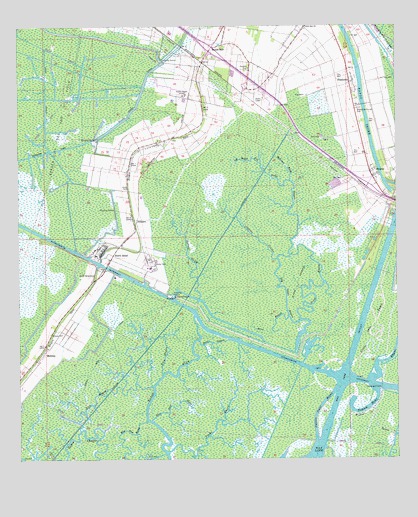
North Bend, LA USGS Topographic Map
Click on map above to begin viewing in our Map Viewer.

This topographic map contains these locations and features:
Feature Name Type Latitude Longitude GNIS ID View Map
BalcoPopulated PlaceN29.7202°W91.4412°1628829View Map
Bayou BlueStreamN29.6716°W91.4407°559875View Map
Bayou SalePopulated PlaceN29.7441°W91.4362°560072View Map
Bear BayouStreamN29.6594°W91.4307°560115View Map
Bear BayouStreamN29.6663°W91.4112°560116View Map
Berwick PocketSwampN29.7019°W91.4979°1628831View Map
Bethel BayouStreamN29.6588°W91.3754°560159View Map
Big Oaks BayouStreamN29.6560°W91.4093°560187View Map
CabotPopulated PlaceN29.6891°W91.4640°551427View Map
ClausenPopulated PlaceN29.7160°W91.4540°1628828View Map
Clausen CouleeStreamN29.6830°W91.4148°560438View Map
Crow BayouStreamN29.6655°W91.4073°560549View Map
Crow IslandIslandN29.6760°W91.4082°560551View Map
Douglas CemeteryCemeteryN29.7380°W91.4240°560646View Map
East Over BayouStreamN29.6363°W91.4565°560693View Map
FairfaxPopulated PlaceN29.7288°W91.3884°1628825View Map
Garden City Gas and Oil FieldOilfieldN29.7213°W91.4896°560814View Map
Gratt CemeteryCemeteryN29.7030°W91.4643°560894View Map
Hickerson BayouStreamN29.7055°W91.4104°560960View Map
JohnsonPopulated PlaceN29.6941°W91.4623°1627364View Map
Lattery CanalCanalN29.7280°W91.4909°1627452View Map
Little Oaks BayouStreamN29.6494°W91.3898°1627531View Map
Little Zion ChurchChurchN29.7499°W91.4054°1627546View Map
Log BayouStreamN29.7119°W91.4232°1627555View Map
MariaPopulated PlaceN29.7319°W91.4243°1628824View Map
MarylandPopulated PlaceN29.7124°W91.4626°1628827View Map
MidwayPopulated PlaceN29.6552°W91.4915°1627652View Map
Midway CemeteryCemeteryN29.6613°W91.4898°1627653View Map
North BendPopulated PlaceN29.6827°W91.4698°1627784View Map
North Bend CanalCanalN29.6549°W91.4732°1627785View Map
North Bend CemeteryCemeteryN29.6783°W91.4754°1627786View Map
Plume BayouStreamN29.6272°W91.4512°1627946View Map
Rice BayouStreamN29.6335°W91.4801°1628046View Map
Rice BayouStreamN29.6499°W91.4526°1628047View Map
RicohocPopulated PlaceN29.7077°W91.3834°1628055View Map
Saint Mary ParishCivilN29.6346°W91.4729°1629492View Map
Saint Mary Parish Sheriff's OfficeBuildingN29.7438°W91.4357°2333932View Map
ShadysidePopulated PlaceN29.7341°W91.3904°1628204View Map
Shadyside-Fairfax CemeteryCemeteryN29.7263°W91.3868°1628205View Map
ToddPopulated PlaceN29.7083°W91.4637°1628832View Map
Ward FourCivilN29.7169°W91.4368°1628618View Map
Wax North ChannelChannelN29.6533°W91.3965°1628452View Map
Wax South ChannelBayN29.6411°W91.3997°1628453View Map
West Over BayouStreamN29.6360°W91.4579°1628480View Map
Wildcat BayouStreamN29.6405°W91.3915°1628504View Map
Yellow Bayou CanalCanalN29.7283°W91.4609°1628539View Map

Note: Coordinates in the location and feature list above are referenced to NAD83 datum.


Copyright (C) 2008-2024 Ryan Niemi / Sunset Dynamics ... All Rights Reserved