TopoQuest Logo
Do you find TopoQuest useful?
Help keep TopoQuest running and adding new maps/features by donating!
Bitcoin:  19c7KJd3qBynnjoSw5npx9KScwjBe4ifkT
Litecoin:  LXs6TkuXGGXo1vDsWCkWVdjQX94eUKd6ui
Home View Maps Find Maps Find Places Resources & Links


Nuremberg, Pennsylvania Topographic Map

USGS Map Title: Nuremberg, PA
USGS Map MRC: 40076H2
DRG (GeoTIFF) Download: o40076h2.tif


Neighboring USGS Topographic Map Quads:


  Mifflinville, PA  
41076A3
 

  Berwick, PA  
41076A2
 

  Sybertsville, PA  
41076A1
 

  Shumans, PA  
40076H3
 

  Nuremberg, PA  
40076H2
 

  Conyngham, PA  
40076H1
 

  Ashland, PA  
40076G3
 

  Shenandoah, PA  
40076G2
 

  Delano, PA  
40076G1


Map MRC Location:

N41°
W77°
N41°
W76°
H8 H7 H6 H5 H4 H3 H2 H1
G8 G7 G6 G5 G4 G3 G2 G1
F8 F7 F6 F5 F4 F3 F2 F1
E8 E7 E6 E5 E4 E3 E2 E1
D8 D7 D6 D5 D4 D3 D2 D1
C8 C7 C6 C5 C4 C3 C2 C1
B8 B7 B6 B5 B4 B3 B2 B1
A8 A7 A6 A5 A4 A3 A2 A1
N40°
W77°
N40°
W76°

Nuremberg, PA USGS 1:24K Topographic Map Preview:
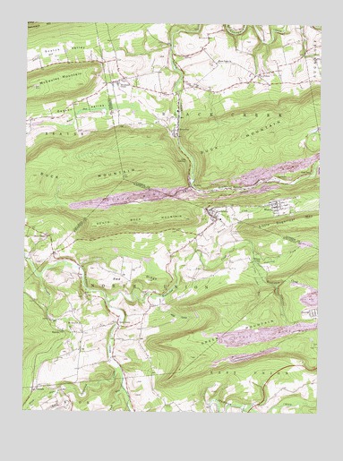
Nuremberg, PA USGS Topographic Map
Click on map above to begin viewing in our Map Viewer.

This topographic map contains these locations and features:
Feature Name Type Latitude Longitude GNIS ID View Map
Barnes RunStreamN40.9823°W76.1838°1202218View Map
Black Creek ChurchChurchN40.9879°W76.1677°1169698View Map
Black Creek Township Volunteer Fire CompanyBuildingN40.9475°W76.1633°2652609View Map
Buck MountainSummitN40.9509°W76.2074°1170524View Map
Crooked RunStreamN40.9181°W76.2427°1192316View Map
Dark RunStreamN40.8820°W76.2060°1172946View Map
Davis ChapelChurchN40.9312°W76.2399°1172985View Map
Deep Hollow Run (historical)StreamN40.9479°W76.1638°1202373View Map
DerringerPopulated PlaceN40.9498°W76.1441°1203405View Map
Derringer CollieryBuildingN40.9506°W76.1435°1207105View Map
Falls RunStreamN40.9743°W76.1849°1202216View Map
Fern GlenPopulated PlaceN40.9468°W76.1588°1203561View Map
FerndalePopulated PlaceN40.8820°W76.2441°1203562View Map
Five PointsPopulated PlaceN40.9837°W76.1519°1203586View Map
Glen JunctionPopulated PlaceN40.9562°W76.1797°1203681View Map
GowenPopulated PlaceN40.9476°W76.1788°1203704View Map
Gowen Breaker StationPopulated PlaceN40.9459°W76.1813°1212393View Map
Gowen CollieryBuildingN40.9462°W76.1813°1207104View Map
Green MountainSummitN40.9006°W76.1594°1192549View Map
Gum RunPopulated PlaceN40.9520°W76.1299°1203733View Map
Little Catawissa CreekStreamN40.8898°W76.2088°1179498View Map
Little Crooked RunStreamN40.9301°W76.1535°1179517View Map
Little Tomhicken CreekStreamN40.9159°W76.1430°1179697View Map
Mc Donald's AirportAirportN40.8857°W76.1524°1194129View Map
Millers CornerPopulated PlaceN40.9234°W76.1522°1204182View Map
MonticelloPopulated PlaceN40.9684°W76.2474°1202108View Map
Mount Zion ChurchChurchN40.9031°W76.2258°1181928View Map
Mountain GrovePopulated PlaceN40.9815°W76.2108°1181951View Map
NurembergPopulated PlaceN40.9395°W76.1716°1182716View Map
Nuremberg CemeteryCemeteryN40.9329°W76.1610°1182717View Map
Nuremberg Census Designated PlaceCensusN40.9377°W76.1685°2389598View Map
Nuremberg Community AmbulanceBuildingN40.9415°W76.1632°2722117View Map
Nuremberg Post OfficePost OfficeN40.9384°W76.1705°2773228View Map
Nuremburg Weston Volunteer Fire Department District 19 Station 1BuildingN40.9415°W76.1562°2652698View Map
OneidaPopulated PlaceN40.9076°W76.1255°1182991View Map
Raccoon CreekStreamN40.9256°W76.1738°1184572View Map
RaricksPopulated PlaceN40.9009°W76.2338°1204462View Map
Red RidgeRidgeN40.9179°W76.2022°1184774View Map
Roberts RunStreamN40.9390°W76.1780°1202217View Map
Rock GlenPopulated PlaceN40.9654°W76.1844°1185252View Map
Rock Glen Post OfficePost OfficeN40.9655°W76.1861°2772949View Map
Scotch RunStreamN40.9931°W76.1880°1212392View Map
Scotch Valley StationBuildingN40.9870°W76.2477°1207117View Map
SlabtownPopulated PlaceN40.8929°W76.1966°1202220View Map
Slauchs Run (historical)StreamN40.9037°W76.1383°1202221View Map
South Buck MountainSummitN40.9359°W76.2033°1188044View Map
Stony RunStreamN40.8809°W76.2324°1188807View Map
Sugarloaf CreekStreamN40.9265°W76.1502°1188994View Map
Sugarloaf Golf CourseLocaleN40.9820°W76.1755°1205622View Map
The CoveBayN40.9090°W76.1916°1189396View Map
Tomhicken CreekStreamN40.9098°W76.2163°1189638View Map
Tomhicken FallsFallsN40.9170°W76.1408°1202219View Map
Township of Black CreekCivilN40.9737°W76.1649°1216703View Map
Township of North UnionCivilN40.9129°W76.2028°1217009View Map
WestonPopulated PlaceN40.9415°W76.1422°1191175View Map
Weston Census Designated PlaceCensusN40.9426°W76.1401°2631314View Map
Zion GrovePopulated PlaceN40.9026°W76.2085°1205016View Map
Zion Grove Post OfficePost OfficeN40.8972°W76.2253°2775121View Map

Note: Coordinates in the location and feature list above are referenced to NAD83 datum.


Copyright (C) 2008-2024 Ryan Niemi / Sunset Dynamics ... All Rights Reserved