TopoQuest Logo
Do you find TopoQuest useful?
Help keep TopoQuest running and adding new maps/features by donating!
Bitcoin:  19c7KJd3qBynnjoSw5npx9KScwjBe4ifkT
Litecoin:  LXs6TkuXGGXo1vDsWCkWVdjQX94eUKd6ui
Home View Maps Find Maps Find Places Resources & Links


Oak Grove, Kentucky Topographic Map

USGS Map Title: Oak Grove, KY
USGS Map MRC: 36087F4
DRG (GeoTIFF) Download: o36087f4.tif


Neighboring USGS Topographic Map Quads:


  Church Hill, KY  
36087G5
 

  Hopkinsville, KY  
36087G4
 

  Pembroke, KY  
36087G3
 

  Herndon, KY  
36087F5
 

  Oak Grove, KY  
36087F4
 

  Trenton, KY  
36087F3
 

  Woodlawn, TN  
36087E5
 

  New Providence, TN  
36087E4
 

  Clarksville, TN  
36087E3


Map MRC Location:

N37°
W88°
N37°
W87°
H8 H7 H6 H5 H4 H3 H2 H1
G8 G7 G6 G5 G4 G3 G2 G1
F8 F7 F6 F5 F4 F3 F2 F1
E8 E7 E6 E5 E4 E3 E2 E1
D8 D7 D6 D5 D4 D3 D2 D1
C8 C7 C6 C5 C4 C3 C2 C1
B8 B7 B6 B5 B4 B3 B2 B1
A8 A7 A6 A5 A4 A3 A2 A1
N36°
W88°
N36°
W87°

Oak Grove, KY USGS 1:24K Topographic Map Preview:
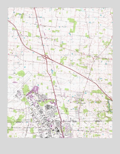
Oak Grove, KY USGS Topographic Map
Click on map above to begin viewing in our Map Viewer.

This topographic map contains these locations and features:
Feature Name Type Latitude Longitude GNIS ID View Map
BethelPopulated PlaceN36.6295°W87.4339°1311460View Map
Bethel United Methodist ChurchChurchN36.6339°W87.4356°1319585View Map
BirchwoodPopulated PlaceN36.6284°W87.4250°1311461View Map
Blanchfield Army Community HospitalHospitalN36.6364°W87.4474°2660369View Map
Boiling Spring ChurchChurchN36.6303°W87.4008°1277889View Map
City of Oak GroveCivilN36.6686°W87.4216°2404406View Map
Clarksville Fire Rescue Station 7BuildingN36.6323°W87.4218°2654009View Map
Colonel Florence A Blanchfield Army Community HospitalHospitalN36.6364°W87.4472°1319613View Map
Commissioner District 8CivilN36.6318°W87.4417°2464691View Map
Cumberland Hall HospitalHospitalN36.7384°W87.4682°2660336View Map
EdgotenPopulated PlaceN36.6417°W87.4239°507912View Map
Estep Physical Fitness CenterBuildingN36.6281°W87.4506°1319624View Map
FidelioPopulated PlaceN36.7328°W87.4586°507994View Map
Fort Campbell Department of Defense Fire Department Station 3BuildingN36.6694°W87.4880°2637356View Map
Fort Campbell Department of Defense Fire Department Station 5BuildingN36.6678°W87.4706°2637358View Map
Fort Campbell High SchoolSchoolN36.6256°W87.4395°1319635View Map
Fort Campbell North Census Designated PlaceCensusN36.6555°W87.4659°2402496View Map
Fryar StadiumParkN36.6342°W87.4550°1319637View Map
Gate Number 1LocaleN36.6653°W87.4789°517154View Map
Gate Number 2LocaleN36.6700°W87.4725°517155View Map
Gate Number 4LocaleN36.6450°W87.4370°517156View Map
Gate Number 4LocaleN36.6873°W87.4925°517157View Map
Gate Number 5LocaleN36.6542°W87.4403°517158View Map
Gate Number 6LocaleN36.6612°W87.4420°517159View Map
Gate Number ThreeLocaleN36.6364°W87.4367°1285235View Map
Good Hope CemeteryCemeteryN36.6700°W87.4081°492953View Map
Good Hope ChurchChurchN36.6609°W87.4125°492954View Map
Green AcresPopulated PlaceN36.6367°W87.4272°1311502View Map
Greewild School (historical)SchoolN36.6312°W87.4028°1319641View Map
HensleytownPopulated PlaceN36.6587°W87.4128°494076View Map
Jackson Elementary SchoolSchoolN36.6281°W87.4447°1648386View Map
KennedyPopulated PlaceN36.6484°W87.4150°495643View Map
Lee Recreation CenterBuildingN36.6362°W87.4564°1319660View Map
Lester Memorial Presbyterian ChurchChurchN36.7012°W87.3821°496298View Map
Longview ChurchChurchN36.7345°W87.4639°497157View Map
Oak GrovePopulated PlaceN36.6650°W87.4428°499655View Map
Oak Grove Fire Department and Emergency Medical ServicesBuildingN36.6649°W87.4327°2636529View Map
Oak Grove Police DepartmentBuildingN36.6721°W87.4088°2767591View Map
Oak Grove-Pembroke DivisionCivilN36.7478°W87.3848°1937195View Map
Olive Physical Fitness CenterBuildingN36.6367°W87.4633°1319688View Map
Pembrook PlacePopulated PlaceN36.6362°W87.4125°1311541View Map
Perez Baseball FieldParkN36.6348°W87.4564°1319691View Map
Saint ElmoPopulated PlaceN36.7025°W87.3928°508996View Map
Salem Baptist ChurchChurchN36.7087°W87.4188°502777View Map
South ChapelChurchN36.6273°W87.4600°1270838View Map
Stryker VillagePopulated PlaceN36.6384°W87.4403°1311562View Map
Taylor Dental ClinicHospitalN36.6298°W87.4581°1319721View Map
WABD-AM (Fort Campbell)TowerN36.6412°W87.4345°517806View Map
Wickham Hall Pratt MuseumBuildingN36.6384°W87.4553°1319732View Map

Note: Coordinates in the location and feature list above are referenced to NAD83 datum.


Copyright (C) 2008-2024 Ryan Niemi / Sunset Dynamics ... All Rights Reserved