TopoQuest Logo
Do you find TopoQuest useful?
Help keep TopoQuest running and adding new maps/features by donating!
Bitcoin:  19c7KJd3qBynnjoSw5npx9KScwjBe4ifkT
Litecoin:  LXs6TkuXGGXo1vDsWCkWVdjQX94eUKd6ui
Home View Maps Find Maps Find Places Resources & Links


Belvidere NW, Illinois Topographic Map

USGS Map Title: Belvidere NW, IL
USGS Map MRC: 42088D8
DRG (GeoTIFF) Download: o42088d8.tif


Neighboring USGS Topographic Map Quads:


  Beloit, WI  
42089E1
 

  Shopiere, WI  
42088E8
 

  Clinton, WI  
42088E7
 

  South Beloit, IL  
42089D1
 

  Belvidere NW, IL  
42088D8
 

  Belvidere NE, IL  
42088D7
 

  Rockford North, IL  
42089C1
 

  Caledonia, IL  
42088C8
 

  Belvidere North, IL  
42088C7


Map MRC Location:

N43°
W89°
N43°
W88°
H8 H7 H6 H5 H4 H3 H2 H1
G8 G7 G6 G5 G4 G3 G2 G1
F8 F7 F6 F5 F4 F3 F2 F1
E8 E7 E6 E5 E4 E3 E2 E1
D8 D7 D6 D5 D4 D3 D2 D1
C8 C7 C6 C5 C4 C3 C2 C1
B8 B7 B6 B5 B4 B3 B2 B1
A8 A7 A6 A5 A4 A3 A2 A1
N42°
W89°
N42°
W88°

Belvidere NW, IL USGS 1:24K Topographic Map Preview:
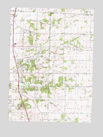
Belvidere NW, IL USGS Topographic Map
Click on map above to begin viewing in our Map Viewer.

This topographic map contains these locations and features:
Feature Name Type Latitude Longitude GNIS ID View Map
Bamblett CemeteryCemeteryN42.4575°W88.9098°403868View Map
Bamblett School (historical)SchoolN42.4578°W88.9096°1695233View Map
Beloit AirportAirportN42.4983°W88.9689°1581883View Map
Booth School (historical)SchoolN42.4522°W88.9401°1695238View Map
Brown School (historical)SchoolN42.3847°W88.9504°1695265View Map
Burroak School (historical)SchoolN42.4175°W88.9559°1695266View Map
Clayton Andrews County Forest PreserveReserveN42.4425°W88.9568°424408View Map
Compass Rose AirportAirportN42.4556°W88.9051°427762View Map
Cummings School (historical)SchoolN42.3775°W88.9154°1695243View Map
Fish School (historical)SchoolN42.4728°W88.8801°1695245View Map
Forest Hill CemeteryCemeteryN42.4781°W88.9182°408506View Map
Gray School (historical)SchoolN42.4286°W88.9201°1695246View Map
Hayward School (historical)SchoolN42.4856°W88.9979°1695268View Map
Hunter Post Office (historical)Post OfficeN42.4439°W88.8807°1764568View Map
Interchange 1CrossingN42.4917°W88.9946°1811316View Map
Interchange 3CrossingN42.4578°W88.9951°1811317View Map
Kinnikinnick Creek Nature PreserveReserveN42.4181°W88.9251°424410View Map
Kinnikinnick Creek Nature PreserveParkN42.4150°W88.9232°2012633View Map
Ledgewood SchoolSchoolN42.4310°W88.9726°1811303View Map
Lee Creek AirportAirportN42.4626°W88.8783°2679032View Map
Livingston CemeteryCemeteryN42.4158°W88.8801°412454View Map
Livingston School (historical)SchoolN42.4142°W88.8859°1695249View Map
Manchester ChurchChurchN42.4725°W88.9190°412881View Map
Mc Curdy StripAirportN42.4459°W88.9001°427765View Map
Nichol School (historical)SchoolN42.4717°W88.9959°1695269View Map
Oak Hill CemeteryCemeteryN42.4720°W88.8898°414826View Map
Pinnacle Hill CemeteryCemeteryN42.4729°W88.9797°415720View Map
Porter QuarryMineN42.3922°W88.9790°1968233View Map
Porter QuarryMineN42.4697°W88.9698°1968234View Map
Red Brick School (historical)SchoolN42.4797°W88.9187°1695255View Map
Roland Olson County Forest PreserveReserveN42.4036°W88.9543°424411View Map
Roscoe CemeteryCemeteryN42.4162°W88.9998°424454View Map
Roscoe QuarryMineN42.3884°W88.9832°1968236View Map
Scottish CemeteryCemeteryN42.3769°W88.9410°418133View Map
Shaw School (historical)SchoolN42.4284°W88.9784°1695270View Map
Stagecoach HillsPopulated PlaceN42.4209°W88.9809°424409View Map
The Ledges County Forest PreserveReserveN42.4417°W88.9737°424407View Map
Township of ManchesterCivilN42.4542°W88.8812°429315View Map
Township of RoscoeCivilN42.4492°W88.9939°429670View Map
White School (historical)SchoolN42.4722°W88.9607°1695272View Map
Wyman School (historical)SchoolN42.3997°W88.9159°1695264View Map

Note: Coordinates in the location and feature list above are referenced to NAD83 datum.


Copyright (C) 2008-2024 Ryan Niemi / Sunset Dynamics ... All Rights Reserved