TopoQuest Logo
Do you find TopoQuest useful?
Help keep TopoQuest running and adding new maps/features by donating!
Bitcoin:  19c7KJd3qBynnjoSw5npx9KScwjBe4ifkT
Litecoin:  LXs6TkuXGGXo1vDsWCkWVdjQX94eUKd6ui
Home View Maps Find Maps Find Places Resources & Links


Belvidere South, Illinois Topographic Map

USGS Map Title: Belvidere South, IL
USGS Map MRC: 42088B7
DRG (GeoTIFF) Download: o42088b7.tif


Neighboring USGS Topographic Map Quads:


  Caledonia, IL  
42088C8
 

  Belvidere North, IL  
42088C7
 

  Garden Prairie, IL  
42088C6
 

  Cherry Valley, IL  
42088B8
 

  Belvidere South, IL  
42088B7
 

  Riley, IL  
42088B6
 

  Fairdale, IL  
42088A8
 

  Kirkland, IL  
42088A7
 

  Genoa, IL  
42088A6


Map MRC Location:

N43°
W89°
N43°
W88°
H8 H7 H6 H5 H4 H3 H2 H1
G8 G7 G6 G5 G4 G3 G2 G1
F8 F7 F6 F5 F4 F3 F2 F1
E8 E7 E6 E5 E4 E3 E2 E1
D8 D7 D6 D5 D4 D3 D2 D1
C8 C7 C6 C5 C4 C3 C2 C1
B8 B7 B6 B5 B4 B3 B2 B1
A8 A7 A6 A5 A4 A3 A2 A1
N42°
W89°
N42°
W88°

Belvidere South, IL USGS 1:24K Topographic Map Preview:
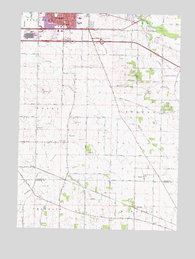
Belvidere South, IL USGS Topographic Map
Click on map above to begin viewing in our Map Viewer.

This topographic map contains these locations and features:
Feature Name Type Latitude Longitude GNIS ID View Map
Arbuckle School (historical)SchoolN42.1295°W88.7684°1705993View Map
Belvidere Assembly Plant HeliportAirportN42.2411°W88.8732°427059View Map
Belvidere Fire Department Station 2BuildingN42.2475°W88.8355°2682127View Map
Belvidere High SchoolSchoolN42.2442°W88.8298°1764572View Map
Belvidere InterchangeCrossingN42.2342°W88.8120°424625View Map
Belvidere Tollway OasisLocaleN42.2342°W88.8345°404158View Map
Bloods Point CemeteryCemeteryN42.1753°W88.8379°404566View Map
Bloods Point School (historical)SchoolN42.1897°W88.8359°1706014View Map
Canada School (historical)SchoolN42.1386°W88.8690°1705990View Map
Charter Oak CemeteryCemeteryN42.1417°W88.8559°421743View Map
Charter Oak School (historical)SchoolN42.1384°W88.8420°1705991View Map
Church of the NazareneChurchN42.2484°W88.8059°406110View Map
Cohoon School (historical)SchoolN42.2156°W88.8379°1706013View Map
Colvin ParkPopulated PlaceN42.1381°W88.7834°422570View Map
Davis School (historical)SchoolN42.1675°W88.7759°1706015View Map
Gould School (historical)SchoolN42.2411°W88.7879°1706010View Map
Graves School (historical)SchoolN42.1731°W88.8615°1706018View Map
Gray FarmsLocaleN42.1806°W88.8214°2629493View Map
Henderson AirportAirportN42.2143°W88.7535°427057View Map
HerbertPopulated PlaceN42.1547°W88.7762°410090View Map
Highland HospitalHospitalN42.2431°W88.8395°1764567View Map
Mosquito CreekStreamN42.2461°W88.7798°413881View Map
North Kingston School (historical)SchoolN42.1395°W88.7506°1705989View Map
Nystrom's NurseryBuildingN42.2247°W88.8625°2629478View Map
Prairie Oaks Forest PreserveParkN42.1294°W88.8049°2761617View Map
Reeds Crossing (historical)Populated PlaceN42.2014°W88.7987°1720215View Map
Sager School (historical)SchoolN42.2414°W88.8226°1706011View Map
Schandelmeir School (historical)SchoolN42.1325°W88.8090°1705992View Map
Scrivens School (historical)SchoolN42.1642°W88.8037°1706016View Map
Shannon School (historical)SchoolN42.1645°W88.8362°1706017View Map
Shattucks Grove CemeteryCemeteryN42.1933°W88.7623°418301View Map
Stone School (historical)SchoolN42.1989°W88.7509°1706009View Map
Swedish American Medical Center BelvidereHospitalN42.2431°W88.8398°2662355View Map
Township of SpringCivilN42.1972°W88.7640°429783View Map
Untied Acres AirportAirportN42.2275°W88.7648°2679028View Map
Witbeck School (historical)SchoolN42.2264°W88.8612°1706012View Map
Zion Evangelical Lutheran ChurchChurchN42.2447°W88.8420°1764741View Map

Note: Coordinates in the location and feature list above are referenced to NAD83 datum.


Copyright (C) 2008-2024 Ryan Niemi / Sunset Dynamics ... All Rights Reserved