TopoQuest Logo
Do you find TopoQuest useful?
Help keep TopoQuest running and adding new maps/features by donating!
Bitcoin:  19c7KJd3qBynnjoSw5npx9KScwjBe4ifkT
Litecoin:  LXs6TkuXGGXo1vDsWCkWVdjQX94eUKd6ui
Home View Maps Find Maps Find Places Resources & Links


Oconto Falls North, Wisconsin Topographic Map

USGS Map Title: Oconto Falls North, WI
USGS Map MRC: 44088H2
DRG (GeoTIFF) Download: o44088h2.tif


Neighboring USGS Topographic Map Quads:


  Hickory Corners, WI  
45088A3
 

  Kelly Lake, WI  
45088A2
 

  Coleman, WI  
45088A1
 

  Gillett, WI  
44088H3
 

  Oconto Falls North, WI  
44088H2
 

  Lena, WI  
44088H1
 

  Krakow, WI  
44088G3
 

  Oconto Falls South, WI  
44088G2
 

  Abrams, WI  
44088G1


Map MRC Location:

N45°
W89°
N45°
W88°
H8 H7 H6 H5 H4 H3 H2 H1
G8 G7 G6 G5 G4 G3 G2 G1
F8 F7 F6 F5 F4 F3 F2 F1
E8 E7 E6 E5 E4 E3 E2 E1
D8 D7 D6 D5 D4 D3 D2 D1
C8 C7 C6 C5 C4 C3 C2 C1
B8 B7 B6 B5 B4 B3 B2 B1
A8 A7 A6 A5 A4 A3 A2 A1
N44°
W89°
N44°
W88°

Oconto Falls North, WI USGS 1:24K Topographic Map Preview:
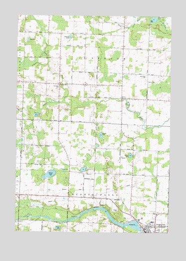
Oconto Falls North, WI USGS Topographic Map
Click on map above to begin viewing in our Map Viewer.

This topographic map contains these locations and features:
Feature Name Type Latitude Longitude GNIS ID View Map
Balcom LakeLakeN44.9081°W88.2228°1561116View Map
Beaver LakeLakeN44.9195°W88.1571°1561463View Map
Beaver Lake School (historical)SchoolN44.9230°W88.1645°1843937View Map
Company LakeLakeN44.9112°W88.1952°1563303View Map
Daly CreekStreamN44.9500°W88.2132°1563681View Map
Gray LakeLakeN44.8775°W88.2153°1565789View Map
Johnson LakeLakeN44.9876°W88.2071°1567231View Map
Kelly BrookPopulated PlaceN44.9603°W88.2159°1577674View Map
Kelly Brook CemeteryCemeteryN44.9587°W88.2160°1567389View Map
Kelly Brook School (historical)SchoolN44.9603°W88.2151°1843974View Map
Kuplic LakeLakeN44.9310°W88.1812°1567663View Map
Lily LakeLakeN44.9105°W88.2114°1568045View Map
North Branch School (historical)SchoolN44.8953°W88.1954°1843990View Map
Oak School (historical)SchoolN44.9972°W88.2245°1843992View Map
Oconto CountyCivilN44.9985°W88.2206°1581102View Map
Oconto Falls Community LibraryBuildingN44.8761°W88.1451°1843997View Map
Oconto Falls Police DepartmentBuildingN44.8804°W88.1355°2759389View Map
Oconto Falls Pond 729ReservoirN44.8807°W88.1683°1793002View Map
Oconto Falls Post OfficePost OfficeN44.8753°W88.1426°1844000View Map
Oconto Falls Volunteer Fire DepartmentBuildingN44.8805°W88.1431°2696860View Map
Pete LakeLakeN44.9858°W88.2410°1571251View Map
Pine Hill CemeteryCemeteryN44.9619°W88.1662°1571463View Map
Porcupine LakeLakeN44.9981°W88.1392°1571789View Map
Sacred Heart CemeteryCemeteryN44.9647°W88.1454°1572786View Map
Sacred Heart ChurchChurchN44.9619°W88.1434°1572790View Map
Saint Anthony SchoolSchoolN44.8771°W88.1443°1844008View Map
Saint Anthonys Roman Catholic ChurchChurchN44.8772°W88.1448°1844007View Map
Saint John ChurchChurchN44.8814°W88.2470°1573017View Map
Saint Mark CemeteryCemeteryN44.9603°W88.1949°2768256View Map
Saint Mark ChurchChurchN44.9605°W88.1945°1573237View Map
SprucePopulated PlaceN44.9525°W88.1648°1574732View Map
Spruce Elementary SchoolSchoolN44.9525°W88.1549°2713230View Map
Sunny Slope School (historical)SchoolN44.9242°W88.2115°1844025View Map
Town of Oconto FallsCivilN44.8965°W88.1899°1583853View Map
Town of SpruceCivilN44.9815°W88.1835°1584207View Map
Upper Oconto Falls WP98 DamDamN44.8767°W88.1468°1793001View Map

Note: Coordinates in the location and feature list above are referenced to NAD83 datum.


Copyright (C) 2008-2024 Ryan Niemi / Sunset Dynamics ... All Rights Reserved