TopoQuest Logo
Do you find TopoQuest useful?
Help keep TopoQuest running and adding new maps/features by donating!
Bitcoin:  19c7KJd3qBynnjoSw5npx9KScwjBe4ifkT
Litecoin:  LXs6TkuXGGXo1vDsWCkWVdjQX94eUKd6ui
Home View Maps Find Maps Find Places Resources & Links


Orlean, Virginia Topographic Map

USGS Map Title: Orlean, VA
USGS Map MRC: 38077G8
DRG (GeoTIFF) Download: o38077g8.tif


Neighboring USGS Topographic Map Quads:


  Linden, VA  
38078H1
 

  Upperville, VA  
38077H8
 

  Rectortown, VA  
38077H7
 

  Flint Hill, VA  
38078G1
 

  Orlean, VA  
38077G8
 

  Marshall, VA  
38077G7
 

  Massies Corner, VA  
38078F1
 

  Jeffersonton, VA  
38077F8
 

  Warrenton, VA  
38077F7


Map MRC Location:

N39°
W78°
N39°
W77°
H8 H7 H6 H5 H4 H3 H2 H1
G8 G7 G6 G5 G4 G3 G2 G1
F8 F7 F6 F5 F4 F3 F2 F1
E8 E7 E6 E5 E4 E3 E2 E1
D8 D7 D6 D5 D4 D3 D2 D1
C8 C7 C6 C5 C4 C3 C2 C1
B8 B7 B6 B5 B4 B3 B2 B1
A8 A7 A6 A5 A4 A3 A2 A1
N38°
W78°
N38°
W77°

Orlean, VA USGS 1:24K Topographic Map Preview:
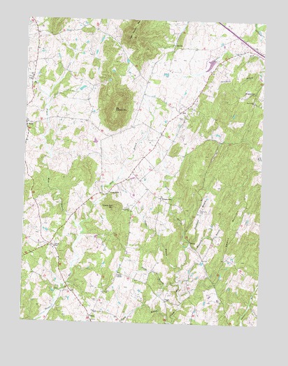
Orlean, VA USGS Topographic Map
Click on map above to begin viewing in our Map Viewer.

This topographic map contains these locations and features:
Feature Name Type Latitude Longitude GNIS ID View Map
AdaPopulated PlaceN38.8371°W77.9183°1496780View Map
Angelica BranchStreamN38.7818°W77.9119°1462477View Map
AshvillePopulated PlaceN38.8643°W77.9222°1496789View Map
Ayres-Aicp AirportAirportN38.7758°W77.9104°1480246View Map
Big Cobbler MountainSummitN38.8382°W77.9531°1496803View Map
Big LakeReservoirN38.8466°W77.9703°1489756View Map
Big Lake DamDamN38.8468°W77.9714°1489755View Map
Boot Andersons CornerLocaleN38.8709°W77.9639°1749351View Map
Cabin BranchStreamN38.7501°W77.9200°1464220View Map
Carter CemeteryCemeteryN38.8346°W77.9164°1464477View Map
Clarks CornerPopulated PlaceN38.7707°W77.9494°1496844View Map
Cobbler Springs FarmLocaleN38.8268°W77.9692°1749241View Map
CondePopulated PlaceN38.7593°W77.9239°1496855View Map
East Branch Thumb RunStreamN38.7901°W77.9697°1466090View Map
Fresta Valley Christian SchoolSchoolN38.7724°W77.9047°1749372View Map
Glendale (historical)Populated PlaceN38.8190°W77.9011°1749374View Map
Hideaway Hills DamDamN38.8284°W77.8964°1489753View Map
Hideaway Hills LakeReservoirN38.8284°W77.8987°1489754View Map
HumePopulated PlaceN38.8321°W77.9994°1496952View Map
Hume Post OfficePost OfficeN38.8310°W77.9997°1749273View Map
Hume United Methodist ChurchChurchN38.8321°W77.9969°1749275View Map
Jerrys ShopLocaleN38.7821°W77.9853°1468694View Map
Leeds CemeteryCemeteryN38.8507°W77.9969°1749388View Map
Leeds ChurchChurchN38.8504°W77.9972°1469274View Map
Little Cobbler MountainSummitN38.8679°W77.9447°1469504View Map
Marshall DistrictCivilN38.8312°W77.9352°1927389View Map
Mellott DamDamN38.8601°W77.8964°1489725View Map
Mellott PondReservoirN38.8601°W77.8964°1489726View Map
MorgantownPopulated PlaceN38.8457°W77.8789°1497024View Map
Morgantown School (historical)SchoolN38.8393°W77.8808°1749396View Map
Mount Nebo ChurchChurchN38.8415°W77.8797°1470954View Map
OrleanPopulated PlaceN38.7526°W77.9639°1496051View Map
Orlean CemeteryCemeteryN38.7593°W77.9597°1471951View Map
Orlean ChurchChurchN38.7626°W77.9558°1471952View Map
Orlean Post OfficePost OfficeN38.7523°W77.9640°1749408View Map
Orlean Volunteer Fire and Rescue Department Company 11BuildingN38.7537°W77.9647°2075402View Map
Poorhouse BranchStreamN38.7840°W77.9119°1472613View Map
Poorhouse CemeteryCemeteryN38.7965°W77.9072°1472614View Map
Rattle BranchStreamN38.7662°W77.9164°1473010View Map
Runnymeade FarmLocaleN38.8051°W77.9464°1749421View Map
Saint Andrew Episcopal ChurchChurchN38.8390°W77.9164°1749422View Map
South Run Church (historical)ChurchN38.7929°W77.9150°1749429View Map
Strothers BranchStreamN38.8529°W77.8767°1475257View Map
Swains MountainSummitN38.7884°W77.8906°1497174View Map
Tanner BranchStreamN38.7729°W77.9161°1475451View Map
Thumb Run ChurchChurchN38.7971°W77.9447°1475698View Map
Thumb Run MountainSummitN38.7976°W77.9522°1497182View Map
Thumbn Run CemeteryCemeteryN38.7971°W77.9453°1749434View Map
Vernon MillsPopulated PlaceN38.8032°W77.9561°1497189View Map
West Branch Thumb RunStreamN38.7901°W77.9697°1476473View Map
Wilsons StoreLocaleN38.8012°W77.9275°1476831View Map

Note: Coordinates in the location and feature list above are referenced to NAD83 datum.


Copyright (C) 2008-2024 Ryan Niemi / Sunset Dynamics ... All Rights Reserved