TopoQuest Logo
Do you find TopoQuest useful?
Help keep TopoQuest running and adding new maps/features by donating!
Bitcoin:  19c7KJd3qBynnjoSw5npx9KScwjBe4ifkT
Litecoin:  LXs6TkuXGGXo1vDsWCkWVdjQX94eUKd6ui
Home View Maps Find Maps Find Places Resources & Links


Otterbein, Indiana Topographic Map

USGS Map Title: Otterbein, IN
USGS Map MRC: 40087D1
DRG (GeoTIFF) Download: o40087d1.tif


Neighboring USGS Topographic Map Quads:


  Templeton, IN  
40087E2
 

  Round Grove, IN  
40087E1
 

  Brookston SW, IN  
40086E8
 

  Chatterton, IN  
40087D2
 

  Otterbein, IN  
40087D1
 

  Lafayette West, IN  
40086D8
 

  Attica, IN  
40087C2
 

  Westpoint, IN  
40087C1
 

  Romney, IN  
40086C8


Map MRC Location:

N41°
W88°
N41°
W87°
H8 H7 H6 H5 H4 H3 H2 H1
G8 G7 G6 G5 G4 G3 G2 G1
F8 F7 F6 F5 F4 F3 F2 F1
E8 E7 E6 E5 E4 E3 E2 E1
D8 D7 D6 D5 D4 D3 D2 D1
C8 C7 C6 C5 C4 C3 C2 C1
B8 B7 B6 B5 B4 B3 B2 B1
A8 A7 A6 A5 A4 A3 A2 A1
N40°
W88°
N40°
W87°

Otterbein, IN USGS 1:24K Topographic Map Preview:
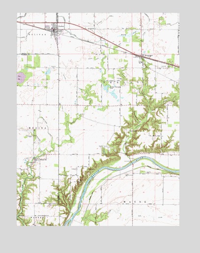
Otterbein, IN USGS Topographic Map
Click on map above to begin viewing in our Map Viewer.

This topographic map contains these locations and features:
Feature Name Type Latitude Longitude GNIS ID View Map
Armstrong ChapelChurchN40.4278°W87.1122°430262View Map
Armstrong CreekStreamN40.4173°W87.1045°430263View Map
Asbury CemeteryCemeteryN40.4216°W87.0598°430292View Map
Bloomer's GreenhouseBuildingN40.3886°W87.0461°2649876View Map
Box DitchCanalN40.4931°W87.0106°431416View Map
Colliers IslandIslandN40.3753°W87.0867°432789View Map
Cranberry MarshSwampN40.4613°W87.1245°433084View Map
Davis CemeteryCemeteryN40.4055°W87.1225°433347View Map
Edward DitchCanalN40.4725°W87.0656°434028View Map
Gephart-Mageet DitchCanalN40.4325°W87.1014°435031View Map
Goose CreekStreamN40.4417°W87.0239°435188View Map
Goose IslandIslandN40.4017°W87.0683°435199View Map
Grandville BridgeBridgeN40.4123°W87.0370°435310View Map
Granville BridgeBridgeN40.4125°W87.0445°446664View Map
Granville CemeteryCemeteryN40.4063°W87.0255°435334View Map
Green HillPopulated PlaceN40.4136°W87.1111°435401View Map
High BridgeBridgeN40.3809°W87.1242°436137View Map
Indian CreekStreamN40.4139°W87.0345°436747View Map
Lost CreekStreamN40.3798°W87.0750°438316View Map
McFarland DitchCanalN40.4961°W87.0583°438863View Map
McKinney DitchCanalN40.4564°W87.0789°438906View Map
MontmorenciPopulated PlaceN40.4742°W87.0295°439370View Map
Montmorenci Census Designated PlaceCensusN40.4705°W87.0354°2583460View Map
Mulvey PondSwampN40.4873°W87.0392°439875View Map
Old HalfwayPopulated PlaceN40.4906°W87.0658°440567View Map
OtterbeinPopulated PlaceN40.4906°W87.0964°440751View Map
Otterbein DitchCanalN40.4878°W87.0836°440758View Map
Otterbein Elementary SchoolSchoolN40.4911°W87.0978°446552View Map
Otterbein Town Police DepartmentBuildingN40.4888°W87.0947°2758193View Map
Otterbein Volunteer Fire DepartmentBuildingN40.4960°W87.1040°2626008View Map
Pond Grove CemeteryCemeteryN40.4675°W87.0967°441427View Map
Purdue Experimental FarmSchoolN40.3803°W87.1047°441650View Map
Purdue University Forest LaboratoryLocaleN40.4300°W87.0358°452388View Map
Purdue University PondReservoirN40.4521°W87.0505°452484View Map
Ross CampParkN40.4009°W87.0775°442315View Map
Saint Pauls ChurchChurchN40.4086°W87.0786°442781View Map
Shambaugh CemeteryCemeteryN40.4613°W87.0434°443273View Map
Southworth BranchStreamN40.4345°W87.0306°443900View Map
Spencer CemeteryCemeteryN40.4493°W87.0232°443939View Map
Town of OtterbeinCivilN40.4887°W87.0936°2396841View Map
Township of ShelbyCivilN40.4825°W87.0486°453847View Map

Note: Coordinates in the location and feature list above are referenced to NAD83 datum.


Copyright (C) 2008-2024 Ryan Niemi / Sunset Dynamics ... All Rights Reserved