TopoQuest Logo
Do you find TopoQuest useful?
Help keep TopoQuest running and adding new maps/features by donating!
Bitcoin:  19c7KJd3qBynnjoSw5npx9KScwjBe4ifkT
Litecoin:  LXs6TkuXGGXo1vDsWCkWVdjQX94eUKd6ui
Home View Maps Find Maps Find Places Resources & Links


Palestine, Arkansas Topographic Map

USGS Map Title: Palestine, AR
USGS Map MRC: 34090H8
DRG (GeoTIFF) Download: o34090h8.tif


Neighboring USGS Topographic Map Quads:


  Hunter East, AR  
35091A1
 

  Hawkins, AR  
35090A8
 

  Forrest City, AR  
35090A7
 

  Wheatley, AR  
34091H1
 

  Palestine, AR  
34090H8
 

  Haynes, AR  
34090H7
 

  Garrett Grove, AR  
34091G1
 

  Moro, AR  
34090G8
 

  Marianna, AR  
34090G7


Map MRC Location:

N35°
W91°
N35°
W90°
H8 H7 H6 H5 H4 H3 H2 H1
G8 G7 G6 G5 G4 G3 G2 G1
F8 F7 F6 F5 F4 F3 F2 F1
E8 E7 E6 E5 E4 E3 E2 E1
D8 D7 D6 D5 D4 D3 D2 D1
C8 C7 C6 C5 C4 C3 C2 C1
B8 B7 B6 B5 B4 B3 B2 B1
A8 A7 A6 A5 A4 A3 A2 A1
N34°
W91°
N34°
W90°

Palestine, AR USGS 1:24K Topographic Map Preview:
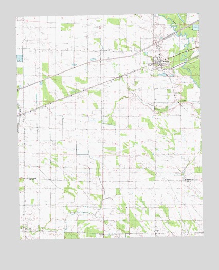
Palestine, AR USGS Topographic Map
Click on map above to begin viewing in our Map Viewer.

This topographic map contains these locations and features:
Feature Name Type Latitude Longitude GNIS ID View Map
Burns AerodromeAirportN34.9807°W90.9145°2650792View Map
Calvary Bible ChurchChurchN34.9487°W90.9807°83098View Map
City of PalestineCivilN34.9689°W90.9061°2404462View Map
Cole LakeReservoirN34.9222°W90.9562°83022View Map
GillPopulated PlaceN34.8776°W90.9076°57815View Map
Gill CemeteryCemeteryN34.8809°W90.9071°59508View Map
Gill Community Center (historical)BuildingN34.8762°W90.8815°59493View Map
Gill SchoolSchoolN34.8759°W90.8812°49414View Map
Gill SchoolSchoolN34.8782°W90.9137°49416View Map
Hopewell CemeteryCemeteryN34.8765°W90.8826°50303View Map
Interchange 233CrossingN34.9840°W90.9048°82869View Map
Mars Hill CemeteryCemeteryN34.8934°W90.9276°59507View Map
Mars Hill ChurchCemeteryN34.8926°W90.9271°51689View Map
Martin CemeteryCemeteryN34.8812°W90.9973°51704View Map
New SalemPopulated PlaceN34.8798°W90.9965°59492View Map
PalestinePopulated PlaceN34.9723°W90.9026°83241View Map
Palestine - Wheatley Elementary SchoolSchoolN34.9716°W90.9029°2039188View Map
Palestine - Wheatley Senior High SchoolSchoolN34.9695°W90.9046°2039183View Map
Palestine Fire StationBuildingN34.9758°W90.9033°2116926View Map
Palestine Police DepartmentBuildingN34.9758°W90.9025°2118546View Map
Palestine Post OfficePost OfficeN34.9705°W90.9069°2773501View Map
Ragland Memorial Presbyterian ChurchChurchN34.8782°W90.8804°78128View Map
Shiloh ChurchChurchN34.9209°W90.9073°83285View Map
Township of GoodwinCivilN34.9680°W90.9943°82859View Map
Township of PrairieCivilN34.9545°W90.9043°82865View Map
Union Grove ChurchChurchN34.9137°W90.9435°83308View Map
Union Hill CemeteryCemeteryN34.9145°W90.9243°82958View Map
Union Hill ChurchChurchN34.9148°W90.9234°83309View Map
West Union ChurchChurchN34.9362°W90.9435°83314View Map
Westley CemeteryCemeteryN34.9612°W90.9198°83315View Map

Note: Coordinates in the location and feature list above are referenced to NAD83 datum.


Copyright (C) 2008-2024 Ryan Niemi / Sunset Dynamics ... All Rights Reserved