TopoQuest Logo
Do you find TopoQuest useful?
Help keep TopoQuest running and adding new maps/features by donating!
Bitcoin:  19c7KJd3qBynnjoSw5npx9KScwjBe4ifkT
Litecoin:  LXs6TkuXGGXo1vDsWCkWVdjQX94eUKd6ui
Home View Maps Find Maps Find Places Resources & Links


Palo Alto Ranch, Arizona Topographic Map

USGS Map Title: Palo Alto Ranch, AZ
USGS Map MRC: 31111H4
DRG (GeoTIFF) Download: o31111h4.tif


Neighboring USGS Topographic Map Quads:


  Pan Tak, AZ  
32111A5
 

  San Pedro, AZ  
32111A4
 

  Three Points, AZ  
32111A3
 

  Kitt Peak, AZ  
31111H5
 

  Palo Alto Ranch, AZ  
31111H4
 

  Stevens Mountain, AZ  
31111H3
 

  Baboquivari Peak, AZ  
31111G5
 

  Fresno Wash, AZ  
31111G4
 

  Penitas Hills, AZ  
31111G3


Map MRC Location:

N32°
W112°
N32°
W111°
H8 H7 H6 H5 H4 H3 H2 H1
G8 G7 G6 G5 G4 G3 G2 G1
F8 F7 F6 F5 F4 F3 F2 F1
E8 E7 E6 E5 E4 E3 E2 E1
D8 D7 D6 D5 D4 D3 D2 D1
C8 C7 C6 C5 C4 C3 C2 C1
B8 B7 B6 B5 B4 B3 B2 B1
A8 A7 A6 A5 A4 A3 A2 A1
N31°
W112°
N31°
W111°

Palo Alto Ranch, AZ USGS 1:24K Topographic Map Preview:
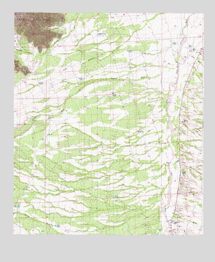
Palo Alto Ranch, AZ USGS Topographic Map
Click on map above to begin viewing in our Map Viewer.

This topographic map contains these locations and features:
Feature Name Type Latitude Longitude GNIS ID View Map
Alambre WashStreamN31.9701°W111.3920°549View Map
Altar WashStreamN31.9701°W111.3923°617View Map
Anvil RanchLocaleN31.9804°W111.3832°721View Map
Anvil TankReservoirN31.9829°W111.3956°722View Map
Ash WashStreamN31.9020°W111.3948°855View Map
Banner WashStreamN31.9520°W111.3945°1000View Map
Cactus TankReservoirN31.9600°W111.4833°2353View Map
Chico TankReservoirN31.9537°W111.4349°2813View Map
Fresnal WashStreamN31.9767°W111.3837°4857View Map
Fresno WashStreamN31.8884°W111.4012°4858View Map
Ironwood TankReservoirN31.9882°W111.4446°6271View Map
Lievres TankReservoirN31.8908°W111.4974°7001View Map
Mendoza CanyonValleyN31.9781°W111.4793°7873View Map
North TankReservoirN31.8960°W111.4338°8773View Map
Palo Alto RanchLocaleN31.8826°W111.3959°9139View Map
Rucker TankReservoirN31.9622°W111.4544°10584View Map
Saint George TankReservoirN31.9785°W111.4220°10709View Map
San Pedro TankReservoirN31.9401°W111.4773°10850View Map
Soldier WellWellN31.9095°W111.3884°11538View Map
Stevens WashStreamN31.9604°W111.3929°11832View Map
West Side WindmillLocaleN31.9334°W111.4151°13528View Map
West TankReservoirN31.8800°W111.4722°13531View Map
Williams WellWellN31.9387°W111.3876°13814View Map

Note: Coordinates in the location and feature list above are referenced to NAD83 datum.


Copyright (C) 2008-2024 Ryan Niemi / Sunset Dynamics ... All Rights Reserved