TopoQuest Logo
Do you find TopoQuest useful?
Help keep TopoQuest running and adding new maps/features by donating!
Bitcoin:  19c7KJd3qBynnjoSw5npx9KScwjBe4ifkT
Litecoin:  LXs6TkuXGGXo1vDsWCkWVdjQX94eUKd6ui
Home View Maps Find Maps Find Places Resources & Links


Pine Bluffs, Wyoming Topographic Map

USGS Map Title: Pine Bluffs, WY
USGS Map MRC: 41104B1
DRG (GeoTIFF) Download: o41104b1.tif


Neighboring USGS Topographic Map Quads:


  Albin SW, WY  
41104C2
 

  Lindbergh, WY  
41104C1
 

  North of Bushnell, NE  
41103C8
 

  Tracy, WY  
41104B2
 

  Pine Bluffs, WY  
41104B1
 

  Bushnell, NE  
41103B8
 

  Pine Bluffs SW, WY  
41104A2
 

  Pine Bluffs SE, WY  
41104A1
 

  Bushnell SW, NE  
41103A8


Map MRC Location:

N42°
W105°
N42°
W104°
H8 H7 H6 H5 H4 H3 H2 H1
G8 G7 G6 G5 G4 G3 G2 G1
F8 F7 F6 F5 F4 F3 F2 F1
E8 E7 E6 E5 E4 E3 E2 E1
D8 D7 D6 D5 D4 D3 D2 D1
C8 C7 C6 C5 C4 C3 C2 C1
B8 B7 B6 B5 B4 B3 B2 B1
A8 A7 A6 A5 A4 A3 A2 A1
N41°
W105°
N41°
W104°

Pine Bluffs, WY USGS 1:24K Topographic Map Preview:
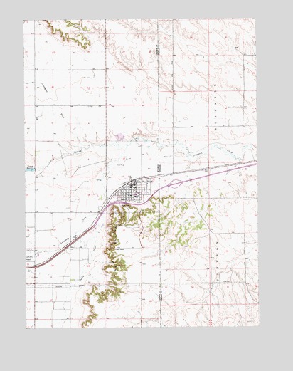
Pine Bluffs, WY USGS Topographic Map
Click on map above to begin viewing in our Map Viewer.

This topographic map contains these locations and features:
Feature Name Type Latitude Longitude GNIS ID View Map
Chivington DrawValleyN41.2001°W104.0957°1586681View Map
Interchange 1CrossingN41.1830°W104.0450°1830218View Map
Laramie County Fire District 5 Pine BluffsBuildingN41.1822°W104.0687°2673648View Map
Laramie County Sheriff's Office Eastern DistrictBuildingN41.1822°W104.0685°2752683View Map
Muddy CreekStreamN41.1769°W104.0825°1591870View Map
Pine BluffsPopulated PlaceN41.1819°W104.0691°1609139View Map
Pine Bluffs CemeteryCemeteryN41.1730°W104.0619°2774582View Map
Pine Bluffs Elementary SchoolSchoolN41.1792°W104.0659°1795551View Map
Pine Bluffs Junior and Senior High SchoolSchoolN41.1792°W104.0645°1795549View Map
Pine Bluffs Junior High SchoolSchoolN41.1819°W104.0691°1795550View Map
Pine Bluffs Police DepartmentBuildingN41.1828°W104.0680°2752639View Map
Pine Bluffs Post OfficePost OfficeN41.1810°W104.0692°2765613View Map
Spring CreekStreamN41.1986°W104.0711°1594854View Map
Town of Pine BluffsCivilN41.1803°W104.0692°2413131View Map
Whispering Pines Care HomeHospitalN41.1819°W104.0691°1794868View Map
Wisroth ReservoirReservoirN41.1892°W104.1233°1597025View Map

Note: Coordinates in the location and feature list above are referenced to NAD83 datum.


Copyright (C) 2008-2024 Ryan Niemi / Sunset Dynamics ... All Rights Reserved