TopoQuest Logo
Do you find TopoQuest useful?
Help keep TopoQuest running and adding new maps/features by donating!
Bitcoin:  19c7KJd3qBynnjoSw5npx9KScwjBe4ifkT
Litecoin:  LXs6TkuXGGXo1vDsWCkWVdjQX94eUKd6ui
Home View Maps Find Maps Find Places Resources & Links


Bethany NE, Oklahoma Topographic Map

USGS Map Title: Bethany NE, OK
USGS Map MRC: 35097F5
DRG (GeoTIFF) Download: o35097f5.tif


Neighboring USGS Topographic Map Quads:


  Cashion, OK  
35097G6
 

  Navina, OK  
35097G5
 

  Guthrie South, OK  
35097G4
 

  Piedmont, OK  
35097F6
 

  Bethany NE, OK  
35097F5
 

  Edmond, OK  
35097F4
 

  Bethany, OK  
35097E6
 

  Britton, OK  
35097E5
 

  Spencer, OK  
35097E4


Map MRC Location:

N36°
W98°
N36°
W97°
H8 H7 H6 H5 H4 H3 H2 H1
G8 G7 G6 G5 G4 G3 G2 G1
F8 F7 F6 F5 F4 F3 F2 F1
E8 E7 E6 E5 E4 E3 E2 E1
D8 D7 D6 D5 D4 D3 D2 D1
C8 C7 C6 C5 C4 C3 C2 C1
B8 B7 B6 B5 B4 B3 B2 B1
A8 A7 A6 A5 A4 A3 A2 A1
N35°
W98°
N35°
W97°

Bethany NE, OK USGS 1:24K Topographic Map Preview:
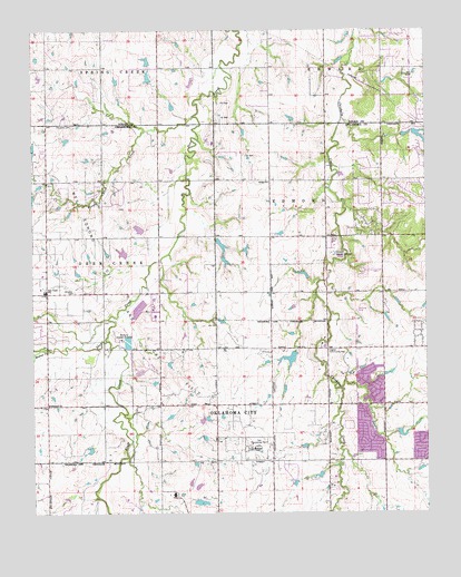
Bethany NE, OK USGS Topographic Map
Click on map above to begin viewing in our Map Viewer.

This topographic map contains these locations and features:
Feature Name Type Latitude Longitude GNIS ID View Map
5B Ranch AirportAirportN35.7281°W97.5418°1102450View Map
Angie Debo Elementary SchoolSchoolN35.6329°W97.5651°1803973View Map
Bethany Sewage DisposalLocaleN35.6701°W97.5964°1101985View Map
Bethel ChurchChurchN35.7109°W97.5495°1090050View Map
Bloody Rush CreekStreamN35.7278°W97.5731°1090257View Map
Bluff CreekStreamN35.6698°W97.6020°1090309View Map
Calvary Baptist ChurchChurchN35.6814°W97.5320°1782975View Map
Charles Haskell Elementary SchoolSchoolN35.6270°W97.5426°1803974View Map
Christner CemeteryCemeteryN35.7252°W97.6121°1091347View Map
Deer Creek Elementary SchoolSchoolN35.6372°W97.6063°1790636View Map
Deer Creek Farms DamDamN35.6917°W97.5953°1754861View Map
Deer Creek Farms LakeReservoirN35.6925°W97.5965°1754862View Map
Deer Creek Fire Protection DistrictBuildingN35.6840°W97.6032°2658620View Map
Deer Creek High SchoolSchoolN35.6833°W97.6250°1092023View Map
Deer Creek Intermediate SchoolSchoolN35.6868°W97.6221°1790635View Map
Edmond Fire Department Station 3BuildingN35.6672°W97.5049°2658495View Map
Edmond Road Baptist ChurchChurchN35.6528°W97.5006°1782989View Map
Edmond Sewage DisposalLocaleN35.6917°W97.5289°1102008View Map
Higbee Community HallLocaleN35.6670°W97.5312°1093727View Map
Holy Trinity Christian SchoolSchoolN35.6378°W97.5191°2713006View Map
Hopewell ChurchChurchN35.6531°W97.6203°1093918View Map
J-M Ranch DamDamN35.6667°W97.5420°1752327View Map
J-M Ranch LakeReservoirN35.6650°W97.5437°1752328View Map
Liberty ChurchChurchN35.6323°W97.5320°1783140View Map
Lord of Life Lutheran ChurchChurchN35.6278°W97.5317°1783141View Map
Northwest Edmond Airport (historical)AirportN35.7076°W97.5409°1102449View Map
Oakbrook Shopping CenterLocaleN35.6384°W97.5142°1777936View Map
Oklahoma City Fire Department Station 37BuildingN35.6424°W97.5490°2658661View Map
Oklahoma City Northwest DivisionCivilN35.6671°W97.5470°2584399View Map
Oknoname 083024 DamDamN35.7267°W97.5420°1752691View Map
Oknoname 083024 ReservoirReservoirN35.7270°W97.5426°1752692View Map
Oknoname 083043 DamDamN35.7417°W97.5870°1752727View Map
Oknoname 083043 ReservoirReservoirN35.7420°W97.5883°1752728View Map
Oknoname 083046 DamDamN35.7367°W97.5870°1752733View Map
Oknoname 083046 ReservoirReservoirN35.7379°W97.5882°1752734View Map
Oknoname 109019 DamDamN35.6934°W97.5920°1754863View Map
Oknoname 109019 ReservoirReservoirN35.6938°W97.5987°1754732View Map
Oknoname 16 DamDamN35.6934°W97.5570°1752329View Map
Oknoname 16 ReservoirReservoirN35.6932°W97.5574°1752330View Map
Oknoname 17 DamDamN35.6451°W97.5087°1752325View Map
Oknoname 17 ReservoirReservoirN35.6456°W97.5088°1752326View Map
Oknoname 19 DamDamN35.6934°W97.5920°1754731View Map
Prairie Vale Elementary SchoolSchoolN35.7008°W97.5486°2712813View Map
Quail Springs United Methodist ChurchChurchN35.6767°W97.5498°1809525View Map
Rose Union Elementary SchoolSchoolN35.6954°W97.6106°2712869View Map
Saint Monica Catholic ChurchChurchN35.6745°W97.5320°1783154View Map
Santa Fe High SchoolSchoolN35.6402°W97.5088°1803968View Map
Stonegate Presbyterian ChurchChurchN35.6451°W97.5237°1783155View Map
Summit Middle SchoolSchoolN35.6254°W97.5415°1803971View Map
Township of Deer CreekCivilN35.6889°W97.6100°1824751View Map
Wakefield Strip (historical)AirportN35.7251°W97.5673°1102396View Map
Walnut CreekStreamN35.6673°W97.6198°1099322View Map
Washington Irving Elementary SchoolSchoolN35.6558°W97.5331°1803975View Map
West Field Elementary SchoolSchoolN35.6505°W97.5510°2713043View Map
Whisler (historical)Populated PlaceN35.6824°W97.6218°2677947View Map
Whisler CemeteryCemeteryN35.6824°W97.6124°1099688View Map

Note: Coordinates in the location and feature list above are referenced to NAD83 datum.


Copyright (C) 2008-2024 Ryan Niemi / Sunset Dynamics ... All Rights Reserved