TopoQuest Logo
Do you find TopoQuest useful?
Help keep TopoQuest running and adding new maps/features by donating!
Bitcoin:  19c7KJd3qBynnjoSw5npx9KScwjBe4ifkT
Litecoin:  LXs6TkuXGGXo1vDsWCkWVdjQX94eUKd6ui
Home View Maps Find Maps Find Places Resources & Links


Plainsburg, California Topographic Map

USGS Map Title: Plainsburg, CA
USGS Map MRC: 37120B3
DRG (GeoTIFF) Download: o37120b3.tif


Neighboring USGS Topographic Map Quads:


  Merced, CA  
37120C4
 

  Planada, CA  
37120C3
 

  Owens Reservoir, CA  
37120C2
 

  El Nido, CA  
37120B4
 

  Plainsburg, CA  
37120B3
 

  Le Grand, CA  
37120B2
 

  Bliss Ranch, CA  
37120A4
 

  Chowchilla, CA  
37120A3
 

  Berenda, CA  
37120A2


Map MRC Location:

N38°
W121°
N38°
W120°
H8 H7 H6 H5 H4 H3 H2 H1
G8 G7 G6 G5 G4 G3 G2 G1
F8 F7 F6 F5 F4 F3 F2 F1
E8 E7 E6 E5 E4 E3 E2 E1
D8 D7 D6 D5 D4 D3 D2 D1
C8 C7 C6 C5 C4 C3 C2 C1
B8 B7 B6 B5 B4 B3 B2 B1
A8 A7 A6 A5 A4 A3 A2 A1
N37°
W121°
N37°
W120°

Plainsburg, CA USGS 1:24K Topographic Map Preview:
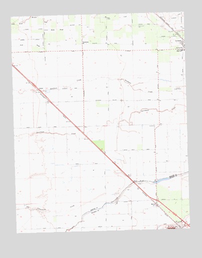
Plainsburg, CA USGS Topographic Map
Click on map above to begin viewing in our Map Viewer.

This topographic map contains these locations and features:
Feature Name Type Latitude Longitude GNIS ID View Map
AthlonePopulated PlaceN37.2080°W120.3580°1657961View Map
Chowchilla Volunteer Fire DepartmentBuildingN37.1251°W120.2605°2624629View Map
Double DJ Farms DairyLocaleN37.1369°W120.2789°2707242View Map
Helm - Turner CemeteryCemeteryN37.2421°W120.2844°225149View Map
Johnson Ranch AirportAirportN37.1902°W120.2723°1653600View Map
La Branza (historical)Populated PlaceN37.1747°W120.3177°1661988View Map
Le Grand Census Designated PlaceCensusN37.2288°W120.2540°2408590View Map
Le Grand Elementary SchoolSchoolN37.2277°W120.2518°1813103View Map
Le Grand High SchoolSchoolN37.2273°W120.2535°1813104View Map
Le Grand Post OfficePost OfficeN37.2297°W120.2504°2769444View Map
Le Grand SchoolSchoolN37.2288°W120.2527°232609View Map
Le Grand Sewage DisposalLocaleN37.2069°W120.2568°1654303View Map
Lingard LateralCanalN37.2430°W120.3727°234162View Map
Mariposa CreekStreamN37.2486°W120.3093°266975View Map
Middle SloughGutN37.2419°W120.3421°228621View Map
MinturnPopulated PlaceN37.1397°W120.2743°228811View Map
PlainsburgPopulated PlaceN37.2330°W120.3243°1659404View Map
Plainsburg Elementary SchoolSchoolN37.2333°W120.3243°1813115View Map
Russell LateralCanalN37.2363°W120.3521°232042View Map
Sierra VistaPopulated PlaceN37.1513°W120.2863°1666162View Map
Sierra Vista 681 DamDamN37.1433°W120.2760°1664013View Map

Note: Coordinates in the location and feature list above are referenced to NAD83 datum.


Copyright (C) 2008-2024 Ryan Niemi / Sunset Dynamics ... All Rights Reserved